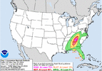
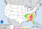
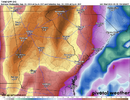
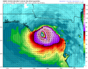
It has been moving very slowly east. There have definitely been some beneficial rains for eastern Alabama and far northwestern Georgia. It has been partly cloudy here all morning, temps have surpassed 80 in many locations already.HRRR vastly underestimating first wave of rain coming into GA as the PRE event sets up.View attachment 151781View attachment 151782
-
Hello, please take a minute to check out our awesome content, contributed by the wonderful members of our community. We hope you'll add your own thoughts and opinions by making a free account!
You are using an out of date browser. It may not display this or other websites correctly.
You should upgrade or use an alternative browser.
You should upgrade or use an alternative browser.
Tropical Major Hurricane Helene
- Thread starter SD
- Start date
- Status
- Not open for further replies.
SnowwxAtl
Member
Why you say that.. it seems like it is on par and on scheduleHRRR vastly underestimating first wave of rain coming into GA as the PRE event sets up.View attachment 151781View attachment 151782
Blue_Ridge_Escarpment
Member
12Z GFS has a 977 sitting over Dollywood. Mercy
- Joined
- Jan 23, 2021
- Messages
- 4,603
- Reaction score
- 15,199
- Location
- Lebanon Township, Durham County NC
12z GFS has Downtown Greenville NE42G72 at 5AM Friday.
iGRXY
Member
GFS has me peaking at 40 mph sustained with guts over 70mph so nearly Hurricane force. Doubt it gets that bad. I'm still expecting winds of 20-30mph with gusts in that 40-50mph range.
TerryInTucker
Member
Moderate rain now in Tucker, GA.
TerryInTucker
Member
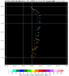
There was a little bubble of rain before that big line. It's slacking off now.Not showing up on radar as yetView attachment 151784
BufordWX
Member
How do the hurricane models (HWRF, HMON, HAFS-A, HAFS-B) handle systems once they are on land?
Georgiapeach
Member
Ugh, Georgia, the irony!!!
I’m on this forum from December to March following all the genius weather experts here, holding my breath for another March,1992 snow storm…
Tropical storm watch, really?!?
I’m on this forum from December to March following all the genius weather experts here, holding my breath for another March,1992 snow storm…
Tropical storm watch, really?!?
JimRussell
Member
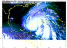
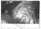
looks like she is taking in a lot of dry air at the moment
Georgiapeach
Member
Does that mean it’s weakening or falling apart?agreed, mixing some things out
View attachment 151792
newest recon pass pretty underwhelming
i'm surprised this has been an issue but so far the eyewall is broad and open and that leaves a storm vulnerable to dry air injections like this
looks like she is taking in a lot of dry air at the moment
Formation stage still, probably will see cloud temps continue to warm before convection actually erupts in the forming eyewall and begins to band around the center.
Brent
Member
agreed, mixing some things out
View attachment 151792
newest recon pass pretty underwhelming
i'm surprised this has been an issue but so far the eyewall is broad and open and that leaves a storm vulnerable to dry air injections like this
It needs to get away from the Yucatan to do much I think
iGRXY
Member
severestorm
Member
Looks like still a touch of southernly shear as well.
Unfortunately not weakening or falling apart but could delay intensificationDoes that mean it’s weakening or falling apart? I’m good with that!
Brent
Member
Unfortunately not weakening or falling apart but could delay intensification
Yeah the one saving grace here is landfall is under 36 hours away. It can still blow up very easily in that time but time is ticking
Definitely. Also TCs have difficulty burping out that dry air at times too, again could delay intensification and never know could mean weaker system at LF but way to premature to think thatYeah the one saving grace here is landfall is under 36 hours away. It can still blow up very easily in that time but time is ticking
severestorm
Member
You can see it in radar pretty easily
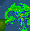
that dry air really hollowed out the northern core of the system. probably why pressure rose a touch. i didn't think it would have a lot of impact but it must have been dry air off the yucatan it is ingesting. this is a speed bump and it should begin intensifying again soon

that dry air really hollowed out the northern core of the system. probably why pressure rose a touch. i didn't think it would have a lot of impact but it must have been dry air off the yucatan it is ingesting. this is a speed bump and it should begin intensifying again soon
12Z UKMET shifted a little W vs 0Z run’s far NE GA and once again comes in stronger like typical UK trend:
TROPICAL STORM HELENE ANALYSED POSITION : 21.5N 86.2W
ATCF IDENTIFIER : AL092024
LEAD CENTRAL MAXIMUM WIND
VERIFYING TIME TIME POSITION PRESSURE (MB) SPEED (KNOTS)
-------------- ---- -------- ------------- -------------
1200UTC 25.09.2024 0 21.5N 86.2W 984 51
0000UTC 26.09.2024 12 23.1N 86.3W 979 48
1200UTC 26.09.2024 24 25.5N 85.4W 975 50
0000UTC 27.09.2024 36 29.6N 83.9W 970 55
1200UTC 27.09.2024 48 35.6N 84.0W 984 31
0000UTC 28.09.2024 60 38.7N 86.8W 989 35
1200UTC 28.09.2024 72 36.9N 89.5W 996 16
0000UTC 29.09.2024 84 36.6N 89.3W 1003 12
1200UTC 29.09.2024 96 36.4N 89.3W 1006 10
0000UTC 30.09.2024 108 CEASED TRACKING
Snow_chaser
Member
We are getting a monsoon in Paulding county. Lots of tree leaves rotating in the airThere was a little bubble of rain before that big line. It's slacking off now.
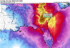
Euro projecting 70+ wind gusts for my area (68 at the tooltip, but the dark gold blob moves northward)
View attachment 151799
Not to downplay the winds in ATL, which will be strong, but I’m currently more concerned about Athens than Atlanta for the highest winds per model consensus since Athens looks to be near or E of the center. Same for @GeorgiaGirl in Augusta.
Drizzle Snizzle
Member
if that’s the consensus then why is the official forecast track near or just to the west of Atlanta ?Not to downplay the winds in ATL, which will be strong, but I’m currently more concerned about Athens than Atlanta for the highest winds per model consensus since Athens looks to be near or E of the center. Same for @GeorgiaGirl in Augusta.
if that’s the consensus then why is the official forecast track near or just to the west of Atlanta ?
I don’t know. The NHC knows more than us.
Blue_Ridge_Escarpment
Member
I believe you’re 2 counties too far south for AthensEuro projecting 70+ wind gusts for my area (68 at the tooltip, but the dark gold blob moves northward)
View attachment 151799
EastmanGAWX
Member
If this holds true, the damage in Middle Georgia will probably be worse than Michael. I'm just to the west of the "80 mph" notation, my peak gusts during Michael were around 70 mph. All of the "in house" models that are used in the Macon, GA media market project this thing to come more east than the current cone suggests.Euro projecting 70+ wind gusts for my area (68 at the tooltip, but the dark gold blob moves northward)
View attachment 151799
I would tend to agree if we still had weaker solutions to the west. However, we have consistent Cat3/Cat4 predictions west of the big bend now. I don't currently see anything in the upper levels that is going to kick this east. Again, if the ULL placement is drastically misplaced, or the ridge is weaker than predicted, then yes, the eastward component will be there.....but there just isnt anything pointing to that right now. Just my opinion thoughi disagree, i think the storm getting tangled with land interaction is what put weaker solutions on the table and supported western solutions. ensemble data showed stronger solutions favoring the eastern side of the envelope. i wouldn't be surprised to seem some eastward ticks in modeling this cycle now that that hurdle has been cleared
rusrius
Member
Interaction with the ULL will add enchantments I guess.
rusrius
Member
Tropical Storm Watches now extend thru the Central Midlands of SC.
That little dry air intrusion should slow intensification which hopefully is a good thing, in fact, you can almost see the llc exposed on vis satellite in that dry slot.
Georgiapeach
Member
My mom lives in PCB, she’s on a cruise till Sunday, I’ve been watching that area and it seems like the newest landfall paths seem to have moved closer to PCB. Am I imagining this?
- Status
- Not open for further replies.

