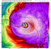
While this is still a possibility it initialized about 11mb weaker than the storms current pressure. Some times these models miss the little things like dry air intrusion. I'm not downplaying this at all but just throwing it out there as a hopeful sign
-
Hello, please take a minute to check out our awesome content, contributed by the wonderful members of our community. We hope you'll add your own thoughts and opinions by making a free account!
You are using an out of date browser. It may not display this or other websites correctly.
You should upgrade or use an alternative browser.
You should upgrade or use an alternative browser.
Tropical Major Hurricane Helene
- Thread starter SD
- Start date
- Status
- Not open for further replies.
HMON shifted back east a bit
It certainly may be overdone. After all, a CAT 5 requires a near-perfect environment to achieve CAT 5 status.While this is still a possibility it initialized about 11mb weaker than the storms current pressure. Some times these models miss the little things like dry air intrusion. I'm not downplaying this at all but just throwing it out there as a hopeful sign
What I find particularly concerning not just with the HWRF I posted, but all of the tropical models is the strengthening forecast right up until landfall. The prospect of dry air intrusion from the continent as is so common with GOM landfills seems unlikely per modeling.
Definitely east of the 6z run by the looks of it12Z Euro: even stronger with 954 landfall! tracks to just E of Macon and then to Athens
I was referencing the current dry air intrusion hopefully slowing intensification in the short term not the prospect of any as it approaches LF. Also I'll agree, we've seen to many of these strengthening right up to LF in recent years tooIt certainly may be overdone. After all, a CAT 5 requires a near-perfect environment to achieve CAT 5 status.
What I find particularly concerning not just with the HWRF I posted, but all of the tropical models is the strengthening forecast right up until landfall. The prospect of dry air intrusion from the continent as is so common with GOM landfills seems unlikely per modeling.
It's bonkers that the NHC track seems to be discounting all of the global models further eastward movement. Not even a mention in any of the discussions.12Z Euro: even stronger with 954 landfall! tracks to just E of Macon and then to Athens
If the NHC nails this track as usual, I'll never doubt them again.
Still plenty of time for it to shift back west a tick.
this may sound dumb since we just had dry air intrudeIt certainly may be overdone. After all, a CAT 5 requires a near-perfect environment to achieve CAT 5 status.
What I find particularly concerning not just with the HWRF I posted, but all of the tropical models is the strengthening forecast right up until landfall. The prospect of dry air intrusion from the continent as is so common with GOM landfills seems unlikely per modeling.
but this storm will be moving so quickly and will be coming in at such an angle that continental dry air will not matter. by the time it gets properly ingested it will be over land. i really dont think this will be an issue and i believe it will be intensifying up to landfall
Stormsfury
Member
I’d have imagine they tick east a bit at 5pm but hey who knows. You’re right though they’ve been locked in on the same areas so farIt's bonkers that the NHC track seems to be discounting all of the global models further eastward movement. Not even a mention in any of the discussions.
If the NHC nails this track as usual, I'll never doubt them again.
NCHighCountryWX
Member
- Joined
- Dec 28, 2016
- Messages
- 699
- Reaction score
- 1,918
Ryan Maue says won’t know precise inland impacts until it comes into range of the HRRR
Drizzle Snizzle
Member
When does it come into range of the HRRR ?Ryan Maue says won’t know precise inland impacts until it comes into range of the HRRR
- Joined
- Jan 5, 2017
- Messages
- 3,779
- Reaction score
- 5,989
Extreme rainfall at my house now. .26" so far. Windy outside already.
accu35
Member
This is go time now, with her dancing around and wobbles it’s a hard pinpoint where exactly landfall. So far they all been in same general area
No landfall or real degradation from the Yucatan and Cuba is pretty concerning here. There isn't a lot over the next 24 hours or so to really slow down gradual development at minimum. You can make a case that in that last 6 hours before LF the environment may get hostile enough to see weakening but by that point some level of ET may be starting so it could all be a net 0. Once inland as it starts to really interact with that upper low and undergo full ET I think the initial spin down is pretty rapid but it's going to hit a level when the spin down becomes less rapid not sure where that is on the wind side but I'd suspect high enough to make a mess across a good part of GA and parts of SC/NC/TN
South AL Wx
Member
It looks like the latest advisory has raised the potential peak storm surge:
"Carrabelle, FL to Chassahowitzka, FL...12-18 ft"
"Carrabelle, FL to Chassahowitzka, FL...12-18 ft"
BufordWX
Member
Triplephase93
Member
South AL Wx
Member
Triplephase93
Member
- Joined
- Jan 5, 2017
- Messages
- 3,779
- Reaction score
- 5,989
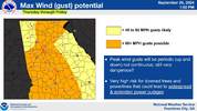
If those easterly tracks materialize, that 60+ area needs to be extended to the east a good bit.
Drizzle Snizzle
Member
They just updated this like 30 minutes ago so I'm sure they took into consideration all of the newer models as well.If those easterly tracks materialize, that 60+ area needs to be extended to the east a good bit.
- Joined
- Jan 5, 2017
- Messages
- 3,779
- Reaction score
- 5,989
Ok, but the Euro, a very good model, shows gusts of 76 mph in Augusta, 73 in Statesboro, and even 68 in Columbia, SC. It wouldn't hurt to give them a heads up that it's possible.They just updated this like 30 minutes ago so I'm sure they took into consideration all of the newer models as well.
Nerman
Member
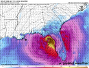
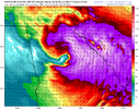
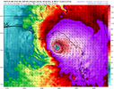
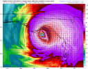
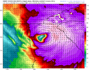
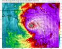
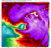
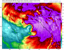
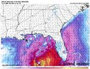
12z hurricane models shifted east a little.
Couple of them were slower by 3 hours for landfall. Images near landfall and in NE GA ...
HAFS-B
HWRF
HAFS-A
HMON
View attachment 151805View attachment 151806View attachment 151807View attachment 151808
View attachment 151803View attachment 151809View attachment 151810View attachment 151804
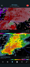
I'm a little concerned about risk of spin-up tornadoes in my area.
Several mentions to 2009 flooding in this video
Drizzle Snizzle
Member
Several mentions to 2009 flooding in this video
And the 2009 flooding happened in Late September also.
12Z EPS: mean track Gwinnett County, just E of Atlanta. More members just E of ATL vs right over or just W but a decent number are just W. So, a just W of ATL track still a reasonable possibility per 12Z EPS. Many members in high 970s to low 980s when closest to ATL.
Corrected
Corrected
Last edited:
Stop arguing about the pandemic and talk about the storm. Thanks
Drizzle Snizzle
Member
Are you still going to chase this storm in Florida ?Stop arguing about the pandemic and talk about the storm. Thanks
AL, 09, 2024092518, , BEST, 0, 220N, 864W, 75, 978, HU Up to 85 mph.
Yes. Preparing to leave now. Will drive down towards Perry florida.Are you still going to chase this storm in Florida ?
- Status
- Not open for further replies.

