-
Hello, please take a minute to check out our awesome content, contributed by the wonderful members of our community. We hope you'll add your own thoughts and opinions by making a free account!
You are using an out of date browser. It may not display this or other websites correctly.
You should upgrade or use an alternative browser.
You should upgrade or use an alternative browser.
Tropical Major Hurricane Helene
- Thread starter SD
- Start date
- Status
- Not open for further replies.
SnowwxAtl
Member
It's east of ATL too! Slightly west then the other models but joins the east of ATL trend. CMC is on its own I guess with the west trend.0Z Euro coming in significantly stronger into the Big Bend at 961 mb! It keeps getting stronger with each run.
0Z Euro coming in significantly stronger into the Big Bend at 961 mb! It keeps getting stronger with each run.

00z runs are very aggressive. Some are 920mb at landfall. Recon plane is entering the storm right now.

2am EST Recon found 986mb at the center.
Last edited:
It looks like the 0Z Euro has the center crossing Gwinnett County. The distance from landfall position to E of ATL is ~250 miles and it gets there in only 9 hours. That works out to an average of a whopping 28 mph, among the fastest on record for that area! To compare, the very fast moving Opal averaged no more than ~25 mph. Eloise of 1975, which also brought damaging winds well inland to W GA, averaged at ~29 mph.
SPC has added an enhanced risk for tornadoes on Day 2. Heads up Larry!
BufordWX
Member
SPC added 2% tornado risk from SE Alabama into the Weatern Carolinas on new day 1 outlook.
Downeastnc
Member
Timing sucks with it landfalling at or right after dark Thursday, nighttime canes are the worst.....
PRE is gradually starting to set up across AL/GA ahead of Helene. Also I noticed in their app that TWC has gotten more aggressive on the rainfall totals here. 8-12 inches from tomorrow through Thursday night. Not anything that wasn’t a likely possibility, but compared to when I checked this morning I don’t think they were forecasting even half of that. https://radar.weather.gov/?settings...jYWxTdGF0aW9ucyI6MC44LCJuYXRpb25hbCI6MC42fX0=
BufordWX
Member
Latest forecast from WPC showing swath of double digit rainfall totals.
Wow. Having trouble sleeping tonight with everything going on! Good to have you back in Georgia my manLatest forecast from WPC showing swath of double digit rainfall totals.
Biggest piece of the puzzle for the next 12 hours is can the center stay over water. Anytime spent over land could disrupt whatever beginning of a core it possesses.

Nerman
Member
That track would put Lake Lanier on the NE edge of the eye.It looks like the 0Z Euro has the center crossing Gwinnett County. The distance from landfall position to E of ATL is ~250 miles and it gets there in only 9 hours. That works out to an average of a whopping 28 mph, among the fastest on record for that area! To compare, the very fast moving Opal averaged no more than ~25 mph. Eloise of 1975, which also brought damaging winds well inland to W GA, averaged at ~29 mph.
HugeSnowStick
Member

Nerman
Member
Moving over the Yucatan

Snow_chaser
Member
The cluster looks like it has shifted west yet some more.
SnowwxAtl
Member
As a hurricane over southwestern GA at 1a Friday...just insane...wow wow wow!
The cluster looks like it has shifted west yet some more.
I’d hate to be NHC right now, on one hand the Euro which is dang hard to beat at this stage and then again you have above.
SnowwxAtl
Member
And then the 06Z ICON & GFS is still well east of the NHC track. GFS was a tid weaker with Helene than ICON.I’d hate to be NHC right now, on one hand the Euro which is dang hard to beat at this stage and then again you have above.
SnowwxAtl
Member
Comparing 0z & 06z GFS, 6z did some in a tid weaker then 0z. ICON remain close to its wallet with strength and eastward track from NHC trajectory and cone zone.
WXinCanton
Member
All the ensemble means are west like NHC track as well.I’d hate to be NHC right now, on one hand the Euro which is dang hard to beat at this stage and then again you have above.
Henry2326
Member
Quite a move west.....
.png")
TerryInTucker
Member
Becoming worse and worse for ATL metro.
Henry2326
Member
Depends on how deep that turn becomes.Becoming worse and worse for ATL metro.
What is this? NWS CAE attaches contradictory images on the same post. They call for 1.5-2 inches in the same areas where NOAA calls for 4-6 in the same post. It's clear the models are shifting west and that's why the totals are dropping and the low amounts will probably verify. But that's a very contradictory post

Henry2326
Member
06z HMON taking the west track now.
947 at landfall
952 south GA
959 middle GA
969 north GA

947 at landfall
952 south GA
959 middle GA
969 north GA
jaymackd3
Member
recon shows 981 mb
Dang won’t take much more for Upstate SC to be out of it completely. Pretty hilarious and a sign of things to come for winter.
Georgiapeach
Member
That eye is going directly over my house in Acworth, NW Ga.
ForsythSnow
Moderator
FL winds are just under hurricane strength too. Shouldn't be long before she's a 1.recon shows 981 mb
Rainforrest
Member
16-20 for the southern escarpment. That’s not good.Latest forecast from WPC showing swath of double digit rainfall totals.View attachment 151730
DCK
Member
Dang won’t take much more for Upstate SC to be out of it completely. Pretty hilarious and a sign of things to come for winter.
If we are lucky. I prefer not to get 8 inches of rain and 60 mph gusts. We will still have some impacts but I do not wish for major impacts.
HugeSnowStick
Member
This storm is going to cover a huge amount of real estate in size, anyone within about 200 miles from the center is going to feel the effects.
Henry2326
Member
06z HWRF.....practically unchanged for days now.
But brutal up the middle of the state.
Landfall at midnight and 6 hours later it's in north GA.

But brutal up the middle of the state.
Landfall at midnight and 6 hours later it's in north GA.
- Joined
- Jan 23, 2021
- Messages
- 4,604
- Reaction score
- 15,202
- Location
- Lebanon Township, Durham County NC

rburrel2
Member
The power outages in Georgia/SC are going to be awful. Most of this area hasn’t experienced a decent ice/windstorm in quite a while. 8-15 inches of rain followed by 40-60 mph gusts from Atlanta to the GSP area spells trouble. I’m buying a generator today.
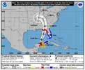
979mb with 70 mph
LOCATION...21.1N 86.2W
ABOUT 60 MI...100 KM ENE OF COZUMEL MEXICO
ABOUT 100 MI...160 KM WSW OF THE WESTERN TIP OF CUBA
MAXIMUM SUSTAINED WINDS...70 MPH...110 KM/H
PRESENT MOVEMENT...NW OR 325 DEGREES AT 9 MPH...15 KM/H
MINIMUM CENTRAL PRESSURE...979 MB...28.91 INCHES
ABOUT 60 MI...100 KM ENE OF COZUMEL MEXICO
ABOUT 100 MI...160 KM WSW OF THE WESTERN TIP OF CUBA
MAXIMUM SUSTAINED WINDS...70 MPH...110 KM/H
PRESENT MOVEMENT...NW OR 325 DEGREES AT 9 MPH...15 KM/H
MINIMUM CENTRAL PRESSURE...979 MB...28.91 INCHES
Henry2326
Member
Right on schedule with HWRF and HMON forecast at the gate.LOCATION...21.1N 86.2W
ABOUT 60 MI...100 KM ENE OF COZUMEL MEXICO
ABOUT 100 MI...160 KM WSW OF THE WESTERN TIP OF CUBA
MAXIMUM SUSTAINED WINDS...70 MPH...110 KM/H
PRESENT MOVEMENT...NW OR 325 DEGREES AT 9 MPH...15 KM/H
MINIMUM CENTRAL PRESSURE...979 MB...28.91 INCHES
- Status
- Not open for further replies.