• Hello, please take a minute to check out our awesome content, contributed by the wonderful members of our community. We hope you'll add your own thoughts and opinions by making a free account!

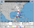
Tropical Major Hurricane Helene

Guess I'm missing how that translates if a model is going to be right on landfall pressure...
its called Analysis. We can go back on the models and see if they are correct on location, strength etc... Its how weather is understood. Doesn't mean its right but we can at least see if it initiated correctly.
 
Last edited:
I don’t think so. The 18Z suite is further east than the 12Z
The cone was too far east compared to other modeling, so the NHC will be adjusting which is why OFCI is pathed through the core of the models vs the GFS at 12Z. Suites may be east but the cone wasn't in line with the models anyway.
 
its called Analysis. We can go back on the models and see if they are correct on location, strength etc... Its how weather is understood. Doesn't mean its right but we can at least see if it initiated correctly.
I would say the analysis on whether models were correct on landfall location and strength would have to happen AFTER landfall, not tonight, when there may or may not even be a defined LLC, MLC, or ULC, let alone them being stacked. I'm glad you agree that whatever happens tonight doesn't mean a model is going to be right, like you had stated before. You have a history of getting really hyped about systems, and playing off the worst case scenario....I just want to make sure you understand that absolutely nothing about tonight will verify or validate anything in the future for this system. If it gets organized tonight, and that's a BIG IF, then all you can "analyze" is which models did better at initialization. What happens going forward is dependent upon many upper and lower level features that aren't even in play yet.
 
This is the day before landfall FYI
————————————————————

NWS Weather Prediction Center College Park MD
444 PM EDT Mon Sep 23 2024
Day 3
Valid 12Z Wed Sep 25 2024 - 12Z Thu Sep 26 2024

...THERE IS A SLIGHT RISK OF EXCESSIVE RAINFALL OVER PORTIONS OF
THE SOUTHEAST, TENNESSEE VALLEY, AND THE SOUTHERN APPALACHIANS...

20z Update:
The Slight risk over portions of AL, northern GA and southeast TN
looks in good shape. We very well could be looking at a PRE event
ahead of Helene as moisture associated with the tropical system
interacts with a front and upper jet. Overall the synoptic setup
looks quite favorable for excessive rainfall and global
deterministic model QPF is as high as 4-6" over portions of the
area. Given the convective nature of the QPF, it seems plausible
that rainfall totals could even exceed these values on a localized
basis. There is still some uncertainty on the exact location of
this higher rainfall axis. Todays model runs have shifted a bit
east, focusing more from eastern AL into northern GA and southeast
TN. The Slight risk remains a bit broad to account for this
uncertainty, but it does seem to cover the areas at greatest risk.
The ingredients in place and overall setup does suggest a MDT risk
could eventually be needed. However this depends on exactly how the
moisture streaming north ahead Helene ends up interacting with the
approaching trough/closed low and where exactly this interaction
happens. So while confidence in a flash flood risk is increasing,
think a higher end Slight risk is the best option for now.


IMG_0252.gif
 
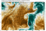
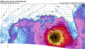
The NAM at 63 is much weaker and is northwest. 32MB weaker in fact.
And this is why getting all horned up over these mega model runs right now isn't the best idea.
I don't think anyone here is ignoring the ceiling of what this storm could be but there's an equally mediocre floor (or whatever words you want to use here). Many of these hurricane models are in the 970s low 980s roughly this time tomorrow. Might be best to wait and see what happens tonight bc right now the system doesn't look that great
 
Back
Top