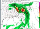
helene looks great. convection firing around center. recon in route. setting the line at 994.5 when they get there (i'm taking the under)
-
Hello, please take a minute to check out our awesome content, contributed by the wonderful members of our community. We hope you'll add your own thoughts and opinions by making a free account!
You are using an out of date browser. It may not display this or other websites correctly.
You should upgrade or use an alternative browser.
You should upgrade or use an alternative browser.
Tropical Major Hurricane Helene
- Thread starter SD
- Start date
- Status
- Not open for further replies.
ForsythSnow
Moderator
That deeper convection is blowing up to the NW of the core now so it won't be long before we see some rapid declines in pressure and structural improvements.helene looks great. convection firing around center. recon in route. setting the line at 994.5 when they get there (i'm taking the under)
mydoortotheworld
Member
Anyone know any websites with full screen vis sat views? I typically use cod but i'd like to make use of my whole monitor 
HugeSnowStick
Member
Anyone know any websites with full screen vis sat views? I typically use cod but i'd like to make use of my whole monitor

True Color Satellite Loop for Western Atlantic | Tropical Tidbits
Western Atlantic True Color Satellite Loop
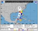
...STORM SURGE AND HURRICANE WARNINGS ISSUED FOR THE GULF COAST OF
FLORIDA...
...HELENE'S LARGE SIZE WILL LIKELY CAUSE AN EXTENSIVE AREA TO BE
AFFECTED BY THE STORM'S HAZARDS...
SUMMARY OF 500 PM EDT...2100 UTC...INFORMATION
----------------------------------------------
LOCATION...19.7N 84.7W
ABOUT 155 MI...245 KM ESE OF COZUMEL MEXICO
ABOUT 150 MI...245 KM S OF THE WESTERN TIP OF CUBA
MAXIMUM SUSTAINED WINDS...50 MPH...85 KM/H
PRESENT MOVEMENT...WNW OR 300 DEGREES AT 12 MPH...19 KM/H
MINIMUM CENTRAL PRESSURE...995 MB...29.39 INCHES
WATCHES AND WARNINGS
--------------------
CHANGES WITH THIS ADVISORY:
A Storm Surge Warning has been issued from Flamingo to Indian Pass,
Florida, including Tampa Bay and Charlotte Harbor.
A Hurricane Warning has been issued from Anclote River to Mexico
Beach, Florida.
The government of Mexico has issued a Hurricane Warning from Cabo
Catoche to Tulum.
A Tropical Storm Warning has been issued for the Middle Florida Keys
from the Seven Mile Bridge to the Channel 5 Bridge. A Tropical
Storm Warning has been issued for the Gulf coast of Florida from
Flamingo northward to Anclote River, including Tampa Bay, and west
of Mexico Beach to the Walton/Bay County Line.
A Tropical Storm Watch has been issued for the east coasts of
Florida and Georgia from the Palm Beach/Martin County Line northward
to the Savannah River, and for Lake Okeechobee.
SUMMARY OF WATCHES AND WARNINGS IN EFFECT:
A Storm Surge Warning is in effect for...
* Indian Pass southward to Flamingo
* Tampa Bay
* Charlotte Harbor
A Hurricane Warning is in effect for...
* Anclote River to Mexico Beach, Florida
* Cabo Catoche to Tulum, Mexico
A Hurricane Watch is in effect for...
* Cuban province of Pinar del Rio
* Englewood to Anclote River, including Tampa Bay
A Tropical Storm Warning is in effect for...
* Dry Tortugas
* Lower and Middle Florida Keys west of the Channel 5 Bridge
* Flamingo to Anclote River, including Tampa Bay
* Rio Lagartos to Tulum, Mexico
* Cuban provinces of Artemisa, Pinar del Rio, and the Isle of Youth
A Tropical Storm Watch is in effect for...
* Lake Okeechobee
* Palm Beach/Martin County Line northward to the Savannah River
A Storm Surge Warning means there is a danger of life-threatening
inundation, from rising water moving inland from the coastline,
during the next 36 hours in the indicated locations. For a
depiction of areas at risk, please see the National Weather
Service Storm Surge Watch/Warning Graphic, available at
hurricanes.gov. This is a life-threatening situation. Persons
located within these areas should take all necessary actions to
protect life and property from rising water and the potential for
other dangerous conditions. Promptly follow evacuation and other
instructions from local officials.
A Hurricane Warning means that hurricane conditions are expected
somewhere within the warning area. A warning is typically issued
36 hours before the anticipated first occurrence of
tropical-storm-force winds, conditions that make outside
preparations difficult or dangerous. Preparations to protect life
and property should be rushed to completion.
A Tropical Storm Warning means that tropical storm conditions are
expected somewhere within the warning area within the next 36 hours.
A Hurricane Watch means that hurricane conditions are possible
within the watch area. A watch is typically issued 48 hours
before the anticipated first occurrence of tropical-storm-force
winds, conditions that make outside preparations difficult or
dangerous.
A Tropical Storm Watch means that tropical storm conditions are
possible within the watch area.
Additional watches or warnings may be required for portions of
Florida and the southeastern United States tonight or on Wednesday.
For storm information specific to your area in the United
States, including possible inland watches and warnings, please
monitor products issued by your local National Weather Service
forecast office. For storm information specific to your area
outside of the United States, please monitor products issued by
your national meteorological service.

Last edited:
Tropical Storm Helene Discussion Number 6
NWS National Hurricane Center Miami FL AL092024
500 PM EDT Tue Sep 24 2024
Deep convection is gradually filling in within Helene's
circulation, and the well-defined center that formed earlier this
morning is now obscured by cloudiness and showers. Data from NOAA
buoy indicate that the central pressure has fallen to 995 mb, and
the initial intensity is therefore estimated to be 45 kt. NOAA and
the Air Force Reserve Hurricane Hunters will be investigating Helene
this evening to provide more information about the storm's intensity
and structure.
With the center formation this morning, Helene has taken a
short-term jog to the west-northwest (300/10 kt). The storm is
expected to turn northwestward by tonight and then northward on
Wednesday as high pressure over Florida shifts eastward, and a
deep-layer trough digs southward over the Lower Mississippi Valley.
The NHC track forecast has been shifted westward during the first
24 hours to account for the recent motion, and Helene's center
could get very close to the northeastern coast of the Yucatan
Peninsula Wednesday morning. After that time, however, the NHC
track forecast is relatively unchanged from the previous
prediction, except for being a little bit slower based on the
latest guidance. Helene is expected to accelerate while it moves
northward across the eastern Gulf of Mexico and approaches the
Florida Gulf coast.
Warm sea surface temperatures, decreasing shear, and strong
upper-level divergence are likely to foster Helene's strengthening
while it moves across the northwestern Caribbean Sea and eastern
Gulf of Mexico. The statistical-dynamical SHIPS/LGEM models, as
well as the regional hurricane models, continue to show Helene
reaching major hurricane intensity while over the eastern Gulf of
Mexico, and that continues to be shown in the NHC forecast. Helene
could maintain that level of intensity until it reaches the Gulf
coast of Florida.
Of equal importance to the forecast intensity is Helene's forecast
size. Helene's forecast radii are at the 90th percentile of
major hurricane size at similar latitudes, and therefore storm
surge, wind, and rainfall impacts will likely extend well
away from the center and outside the forecast cone, particularly on
the east side. In addition, the fast forward speed while it crosses
the coast will likely result in farther inland penetration of strong
winds over parts of the southeastern United States after landfall.
HugeSnowStick
Member
Yeah, I can’t imagine anything worse than borderline Cat 1 hurricane into the Atlanta metro area as a worse case scenario regardless of Helene being a Cat 3,4,or 5. Thinking back in recent yrs to Irma despite it being a major hurricane moving at a rapid, brisk pace by the time it got as far inland as us it was a borderline 75mph Cat 1 hurricane at worst before weakening to a TS.Cat 2 in atlanta is a pipe dream and probably physically impossible. I hope nobody is hoping that. however i'm still pretty bullish on the strenght; and if it continues to get its ducks in a row with the structure and establishing a cdo this will make a run at a 4
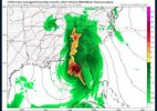
The Great Flood of ‘09 was the first thing I thought of looking at this map. Only on a more widespread scale. This is gonna be very devastating for N/Central Ga and Atl metro if this verifies before Helene makes her way northward to add insult to injury.18z 3K NAM rain totals. This is all BEFORE the system makes landfall so this is solely from the PRE
Models are locking in on a significant rainfall event in North Georgia View attachment 151651
HugeSnowStick
Member
Not out of the realm of possibilities to see 20 inch reports.Yeah, I can’t imagine anything worse than borderline Cat 1 hurricane into the Atlanta metro area as a worse case scenario regardless of Helene being a Cat 3,4,or 5. Thinking back in recent yrs to Irma despite it being a major hurricane moving at a rapid, brisk pace by the time it got as far inland as us it was a borderline 75mph Cat 1 hurricane at worst before weakening to a TS.
The Great Flood of ‘09 was the first thing I thought of looking at this map. Only on a more widespread scale. This is gonna be very devastating for N/Central Ga and Atl metro if this verifies before Helene makes her way northward to add insult to injury.
NoSnowATL
Member
SlightShift west a little from the previous map.
SnowwxAtl
Member
I noticed that tooSlightShift west a little from the previous map.
Stormsfury
Member
Noticed they shifted a little west with the 12z hurricane models. However, convective tugging is dragging our LLC more northward currently. Will have to see if this trend continues now that towers are blowing up around the center.
SnowwxAtl
Member
Drizzle Snizzle
Member
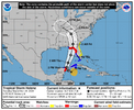
Isn’t that way east of the official forecast track ?
SnowwxAtl
Member
If what I can see, yes it is. That is why I posted it. Waiting on the GFSIsn’t that way east of the official forecast track ?
It's within the cone of uncertainty, just to the far eastern sideIf what I can see, yes it is. That is why I posted it. Waiting on the GFS
SnowwxAtl
Member
Exactly...waiting on the GF...just interested on why NHC moved it slightly back west again.It's within the cone of uncertainty, just to the far eastern side
Ron Burgundy
Member
Icon has consistently been the eastern outlier of the model suitesIsn’t that way east of the official forecast track ?
Drizzle Snizzle
Member
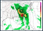
I find it interesting that the heaviest rain is to the west of the center in South GA and North FL18z National Blend of Models Precip Totals
View attachment 151662
Timing as well
itryatmanysportsespgolf70
Member
I know it's probably unlikely to happen, but the 12z and 18z nam has Helene under 888mb before landfall!!
Based on satellite, the shear is gone. IF the recent convection over the COC doesn't wane with DMIN this evening I'd bet on RI overnight.
Not wishing ill on the Cancun area, but it would be helpful if the storm tangles with that landmass before heading to the US coast.
994 Mb with a north wind @23 knots at NDBC buoy now. That's 10Mb lower than the late AM recon data.
Not wishing ill on the Cancun area, but it would be helpful if the storm tangles with that landmass before heading to the US coast.
994 Mb with a north wind @23 knots at NDBC buoy now. That's 10Mb lower than the late AM recon data.
Also it's still 977mb passing east of Atlanta. That would be close to a record low I would imagine
SnowwxAtl
Member
It seems like it will be making landfall later at 0z Friday instead of Thursday evening based off the GFSAlso it's still 977mb passing east of Atlanta. That would be close to a record low I would imagine
JHS
Member
This GFS run is the scariest yet for upstate SC. 60mph gusts were bad enough, but this is showing 80mph for us now.
accu35
Member
I can see far west as maybe PCB and that’s itMost of those are too far west.
Snow_chaser
Member
They may be, but they’ve been pretty consistent with showing that. Maybe splits the state of Georgia before going NW?Most of those are too far west.
Drizzle Snizzle
Member
Yet another model showing the center east of the current forecast track. They may have to shift the track further east. ICON and GFS are both east.18Z with sustained tropical storm force winds far inland to the east of the center.
View attachment 151666
I'd prefer dealing with this system during the daylight hours, rather than passing through while everyone is sleepingIt seems like it will be making landfall later at 0z Friday instead of Thursday evening based off the GFS
LovingGulfLows
Member
- Joined
- Jan 5, 2017
- Messages
- 1,499
- Reaction score
- 4,100
It seems like it will be making landfall later at 0z Friday instead of Thursday evening based off the GFS
0z Friday would be 8pm Thursday so it's still pretty much in the evening.
- Status
- Not open for further replies.

