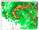
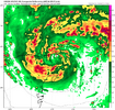
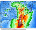
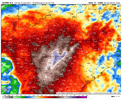
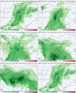
I took a closer look at this and sped the satellite up and I'm now pretty sure this is not just a little eddy but the main llc. Currently some convection going up right on the centerHave a feeling it'll rotate back around. The overall circulation envelope is massive. Seeing multiple small Eddies just whipping around her right now.
-
Hello, please take a minute to check out our awesome content, contributed by the wonderful members of our community. We hope you'll add your own thoughts and opinions by making a free account!
You are using an out of date browser. It may not display this or other websites correctly.
You should upgrade or use an alternative browser.
You should upgrade or use an alternative browser.
Tropical Major Hurricane Helene
- Thread starter SD
- Start date
- Status
- Not open for further replies.
12Z UKMET: E shift and a bit stronger vs 0Z bringing it into Apalachee Bay (instead of near Apalachicola) Thu night; goes to a little E of ATL vs near ATL on 0Z
TROPICAL STORM 09L ANALYSED POSITION : 19.5N 83.5W
ATCF IDENTIFIER : AL092024
LEAD CENTRAL MAXIMUM WIND
VERIFYING TIME TIME POSITION PRESSURE (MB) SPEED (KNOTS)
-------------- ---- -------- ------------- -------------
1200UTC 24.09.2024 0 19.5N 83.5W 1003 37
0000UTC 25.09.2024 12 20.0N 85.3W 998 37
1200UTC 25.09.2024 24 21.1N 86.0W 993 40
0000UTC 26.09.2024 36 22.5N 86.3W 989 40
1200UTC 26.09.2024 48 24.7N 85.5W 987 48
0000UTC 27.09.2024 60 28.4N 84.4W 983 51
1200UTC 27.09.2024 72 33.3N 83.3W 986 41
0000UTC 28.09.2024 84 38.1N 84.1W 995 31
1200UTC 28.09.2024 96 37.5N 90.7W 1000 17
0000UTC 29.09.2024 108 36.4N 91.4W 1003 13
1200UTC 29.09.2024 120 35.3N 92.4W 1007 12
0000UTC 30.09.2024 132 CEASED TRACKING
Henry2326
Member
.
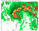
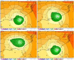
HAFS-A does too.HAFS-B now takes Helene into the NE Yucatan. And parks it there for 12 hours.
View attachment 151635

Stormsfury
Member
What was also wild, the 06z HWRF did a small cyclonic loop early in that particular run. It's crazy how messy Helene's evolution has become .I took a closer look at this and sped the satellite up and I'm now pretty sure this is not just a little eddy but the main llc. Currently some convection going up right on the center
Henry2326
Member
this is a drum webb was beating but john likely messed with the guidance a lot. surprise! here is a major landfalling in mexico. the unexpected burst in outflow likely threw the regime off some in the wcarWhat was also wild, the 06z HWRF did a small cyclonic loop early in that particular run. It's crazy how messy Helene's evolution has become .
New Dr. Levi video out.
Those HAFS models need to be trashed. A 150kt Cat 5 to not even a hurricane in one run.
BufordWX
Member
Looking on Pivitol, 12z UKMET also shows a tremendous amount of rain across North GA. Seems like many of the models are uping rainfall totals across the state.12Z UKMET: E shift and a bit stronger vs 0Z bringing it into Apalachee Bay (instead of near Apalachicola) Thu night; goes to a little E of ATL vs near ATL on 0Z
TROPICAL STORM 09L ANALYSED POSITION : 19.5N 83.5W
ATCF IDENTIFIER : AL092024
LEAD CENTRAL MAXIMUM WIND
VERIFYING TIME TIME POSITION PRESSURE (MB) SPEED (KNOTS)
-------------- ---- -------- ------------- -------------
1200UTC 24.09.2024 0 19.5N 83.5W 1003 37
0000UTC 25.09.2024 12 20.0N 85.3W 998 37
1200UTC 25.09.2024 24 21.1N 86.0W 993 40
0000UTC 26.09.2024 36 22.5N 86.3W 989 40
1200UTC 26.09.2024 48 24.7N 85.5W 987 48
0000UTC 27.09.2024 60 28.4N 84.4W 983 51
1200UTC 27.09.2024 72 33.3N 83.3W 986 41
0000UTC 28.09.2024 84 38.1N 84.1W 995 31
1200UTC 28.09.2024 96 37.5N 90.7W 1000 17
0000UTC 29.09.2024 108 36.4N 91.4W 1003 13
1200UTC 29.09.2024 120 35.3N 92.4W 1007 12
0000UTC 30.09.2024 132 CEASED TRACKING
Stormsfury
Member
John's emergence has been something else like what Otis did recently in the same region. Definitely helped an upper low over the Yucatan disrupt Helene's initiation. Now we have the possibility of Helene visiting the NE tip of the Yucatan to boot on the 12z hurricane models.this is a drum webb was beating but john likely messed with the guidance a lot. surprise! here is a major landfalling in mexico. the unexpected burst in outflow likely threw the regime off some in the wcar
Question after is will the strong upper different pattern help Helene in the Eastern GOM?
The thing that will be fun to watch(If it happens) is how much does the hit on the Yucatán slow down the speed of Helene. Could make for some interesting track adjustments later on.
I think they're struggling to figure out what to do with the center. With 2 or 3 possible locations out there, hard to pinpoint. I think they will do better in 24 hours after she's started getting her actual act together. She's just rehearsing right now.Those HAFS models need to be trashed. A 150kt Cat 5 to not even a hurricane in one run.
i think there's only one center for now, i don't think the naked swirl would be as prominent if there were multiple. however, i am unsure if any model is incorporating the orbit the llc made around the full gyre- it was shooting SW this morning and now it is stationary. it will be useful to compare where the LLC is at 2 (18z) compared to where most models have it at that timeI think they're struggling to figure out what to do with the center. With 2 or 3 possible locations out there, hard to pinpoint. I think they will do better in 24 hours after she's started getting her actual act together. She's just rehearsing right now.
lexxnchloe
Member
I will go with the GFS, seems reasonable with around a 970mb landfall
I think they're struggling to figure out what to do with the center. With 2 or 3 possible locations out there, hard to pinpoint. I think they will do better in 24 hours after she's started getting her actual act together. She's just rehearsing right now.
This is probably true, that said the HWRF and HMON have never had this problem. The HAFS models have also been wonky with pressure vs reflectivity/wind field as well.
lightning field, and are we seeing a more clearly defined center:


It gets to Atl just 8 hours later and thus only weakens to 981 you just showed, which would be flirting with all-time record low SLP there!
TerryInTucker
Member
This looks like a different storm from a few hours ago.lightning field, and are we seeing a more clearly defined center:

Got it a few minutes ago fromThis looks like a different storm from a few hours ago.
Levi's feed shows the same:
The current forecast track from the NWS is worrisome for interests in the Appalachian Mountains who could be in line for some major flooding. We have seen in the past how flooding affects that region with soil conditions and peaks and valleys enhancing runoff and powerful torrents of water where flooding occurs.
HugeSnowStick
Member
I see an eye?
That tight swirl is near 19.4, 84.6W fwiw.
JimRussell
Member
sure looks like she's about to explode from satellite presentation...I am just a weenie tho
HugeSnowStick
Member
Nothing wrong with being a weenie, yes, it is about ready to pop.sure looks like she's about to explode from satellite presentation...I am just a weenie tho
Makeitsnow
Member
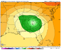
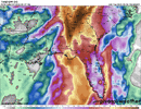
Although still significantl gusts over inland aress it would be great if we can keep it from not gettjng any stronger than that. Although winds might be less of an issue the rain totals from the euro have ticked up some and matched the rest of the 12z runs for ga/western Carolinas.Euro has a heavy duty predecessor rain event (PRE) over much of North Georgia. Before the system moves in
View attachment 151645
lizajane
Member
Wouldn't the Applachian Mountains weaken this storm? I know the ones in Cuba can.
Although still significantl gusts over inland aress it would be great if we can keep it from not gettjng any stronger than that. Although winds might be less of an issue the rain totals from the euro have ticked up some and matched the rest of the 12z runs for ga/western Carolinas.
If ATL were to actually get down to close to an all-time record low SLP 981 mb like the 12Z Euro shows, I’d be quite surprised if there also weren’t major wind issues in much of N GA. Could be like Opal.
I can't recall a similar satellite presentation to Helene since the apparent low-level center ejected from the main convection this morning.
The 'swirl' seems to have found itself dead in the center of the broad circulation with convection still removed from the center on all sides while appearing to slowly fill in what would become a CDO. Fascinating.
The 'swirl' seems to have found itself dead in the center of the broad circulation with convection still removed from the center on all sides while appearing to slowly fill in what would become a CDO. Fascinating.
Time to load up on gas and get the chainsaws sharpened.If ATL were to actually get down to close to an all-time record low SLP 981 mb like the 12Z Euro shows, I’d be quite surprised if there also weren’t major wind issues in much of N GA. Could be like Opal.
Snow_chaser
Member
I know the east side is the worst, but if this thing passes within a county or 2 to the east, it could still get pretty nasty?If ATL were to actually get down to close to an all-time record low SLP 981 mb like the 12Z Euro shows, I’d be quite surprised if there also weren’t major wind issues in much of N GA. Could be like Opal.
Makeitsnow
Member
Totally Agree. It will be bad enough as a cat 2.... but if we see a cat 3 or higher we really are in for a whooping. It's been quite scary seeing some of these extremely high 850 to 925mb winds outputs well inland.If ATL were to actually get down to close to an all-time record low SLP 981 mb like the 12Z Euro shows, I’d be quite surprised if there also weren’t major wind issues in much of N GA. Could be like Opal.
Totally Agree. It will be bad enough as a cat 2.... but if we see a cat 3 or higher we really are in for a whooping. It's been quite scary seeing some of these extremely high 850 to 925mb winds outputs well inland.
Big storm + fast motion = strong winds well inland. I am against this thing ever getting organized at all. Too bad it won't just sit over the Yucatan and die off.
- Status
- Not open for further replies.

