Grit posted this on amx: euro ensembles looks alot like 6z gfs and NHC. Crazy path, but atleast consensus. So tired of tracking this thing, ready for it to do what its gonna do and move on.

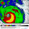
That is one impressive looking sim radar snapshot.Massive
Sent from my SM-G920V using Tapatalk
Im seeing that as well. Lot of warming last 60-90 minutes north and northwest portions of the COD. Seems to be some dry air going by the upper and mid level water vapor viewsHad a few minutes there where the convective appearance seemed for the first time so far to be A+. But thankfully, we're back down to a degraded and lopsided storm. -70C tops are to the SE, with the -60 ring barely hanging on in the NW quad. Perhaps an artifact of Florence moving too fast, a la Gordon in the GOM? Watching closely (1min GOES-16 link in case you don't already have one or are looking for a new one: https://weather.us/satellite/692-w-301-n/top-alert-superhd-1min.html#play2)

Don’t worry. In about 10 minutes it will start to look foolish again!Definitely becoming better organized and symmetric.
Had a few minutes there where the convective appearance seemed for the first time so far to be A+. But thankfully, we're back down to a degraded and lopsided storm. -70C tops are to the SE, with the -60 ring barely hanging on in the NW quad. Perhaps an artifact of Florence moving too fast, a la Gordon in the GOM? Watching closely (1min GOES-16 link in case you don't already have one or are looking for a new one: https://weather.us/satellite/692-w-301-n/top-alert-superhd-1min.html#play2)
Y’all, I am still having trouble believing that this thing will perfectly track the SE coastline SW from Wilmington to Charleston and come ashore near the GA/SC line and move WSW int GA. I’m sorry but that’s absurd. I think it may yet go through upper SC.
Y’all, I am still having trouble believing that this thing will perfectly track the SE coastline SW from Wilmington to Charleston and come ashore near the GA/SC line and move WSW int GA. I’m sorry but that’s absurd. I think it may yet go through upper SC.

Will be interesting to see just how far north it gets today and tonight, noticed this tidbit from the Rah AFD....
06Z/special release upr air data over the sern US this morning indicates a developing mid-upr level ridge there is already 10-20 meters stronger than even 00Z, 6hr model forecasts.
Sent from my SM-G920V using Tapatalk
That's a great question I would think it would there would be some stalling before it turn left but I'm really not the one to answer that hahaSeems to be the theme these days. Would this bend the track west sooner or just stall her sooner?
Sent from my iPhone using Tapatalk
Don't we often see strong ridging highs back off a bit in the last 48 hours? Seems like that's always the case with our NW trend with winter systems. I know that this is a different setup and invest 95L has really been pumping the high, but I wouldn't be surprised to see the ridge lift or weaken a bit over the next few runs.

Don't we often see strong ridging highs back off a bit in the last 48 hours? Seems like that's always the case with our NW trend with winter systems. I know that this is a different setup and invest 95L has really been pumping the high, but I wouldn't be surprised to see the ridge lift or weaken a bit over the next few runs.
Y’all, I am still having trouble believing that this thing will perfectly track the SE coastline SW from Wilmington to Charleston and come ashore near the GA/SC line and move WSW int GA. I’m sorry but that’s absurd. I think it may yet go through upper SC.
Something of note I've been tracking since yesterday is the EPS and Euro have been consistently verifying too far SW even 12 hours out from a forecast cycle and the UK ensembles haven't even been close. The 6z GFS and NAM did come in a touch north, the 12z runs will be key to watch and see if we get any additional shifts like that. One thing I'm watching closely is the RGEM. It's not a tropical model but it did exceptionally well a few weeks ago with that tropical storm in the gulf and the further east track that it ended up taking.
We should know by now that any big event here, either winter storms or hurricanes, always changes 48 hours out.

Completely agree. If that actually happens I'd be completely shocked. Much more likely is for it to stall and drift west IMO. It seems like everybody's glued to the models, but they forget in another 2 cycles the models will all change again. Nhc track is on the northern end of model consensus. That tells you how they feel as well.


On a global scale, things are not changing significantly. We obsess over the mesoscale meteorology because it effects us and large populated areas. Small changes can cause havoc for us personally, but the world keeps turning.We should know by now that any big event here, either winter storms or hurricanes, always changes 48 hours out.
Well as of now, the ridge is already stronger than modeled, per RAH.
Yeah, it usually ends up not as big as it looked at first. Good thing with hurricanes, but not with snow.Raleigh has been fortunate to avoid stuff like this since Fran, well the worst of it.
I'm going to sound like the NHC now but don't focus on just the center point and let your guard down just because the center is not passing over your house. Her wind field about a hundred and fifty miles east and is expanding and there could still be numerous power outages well inland, again I remember Hurricane Irene people in Roanoke Rapids were without power for almost 10 days. The center of Irene about a hundred and fifty miles east and an 85 mile per hour hurricane.
Sent from my SM-G920V using Tapatalk
Very good point. We keep seeing records in the Atlantic broken and new paths for storm all the time. People tend to think analogs and initial forecasts are set in stone and have the same influence as one put out 4 days ago. Yes, it's important to note trends, but use the trends to make better forecasts, not get stuck on the same idea even if it dramatically changes.Just because you or anyone else here haven't seen anything like this before doesn't make it any less legitimate meteorologically
Well obviously Irene kept moving northward but it parallel to coast and we were on the weakest side of that storm, just shows you different storms have different issues, that had an expanding wind field and a slow mover. I've seen storm scrape the Outer Banks I never got as much as a breezeI think the angle of approach made it worse.
Sent from my iPhone using Tapatalk
By the way I'm not suggesting anything remotely like that with this storm, just a reminder don't be surprised that the power flickers a couple of hundred miles away from the center hahaI think the angle of approach made it worse.
Sent from my iPhone using Tapatalk
Don't we often see strong ridging highs back off a bit in the last 48 hours? Seems like that's always the case with our NW trend with winter systems. I know that this is a different setup and invest 95L has really been pumping the high, but I wouldn't be surprised to see the ridge lift or weaken a bit over the next few runs.