RollTide18
Member
This back and forth with the models is frustrating.


Sliding, crawling west @72
We'll have to see what the EPS says, if it comes back north at least we'll have agreement for once lol.


And now heading for Charleston..... good grief
edit: I stand corrected looks like she's bypassing Charleston, heck maybe headed for Ga

Assuming this was to play out exactly as the model predicts, would this remain hurricane status while sitting stalled off of the coast? What effect does this have strength wise?
Has this thing made any type of landfall.?. I can’t tell.
Sent from my iPhone using Tapatalk
The frustrating thing is the models are all over the place with what happens with Flo once she gets here. They have been pretty consistent on Flo coming somewhere between the NC/SC border and Morehead City, but they have showed her going inland to the NC mountains, inland over Raleigh like Fran, inland to SC, and just sitting and spinning at the coast. And that has all been in the last two days.
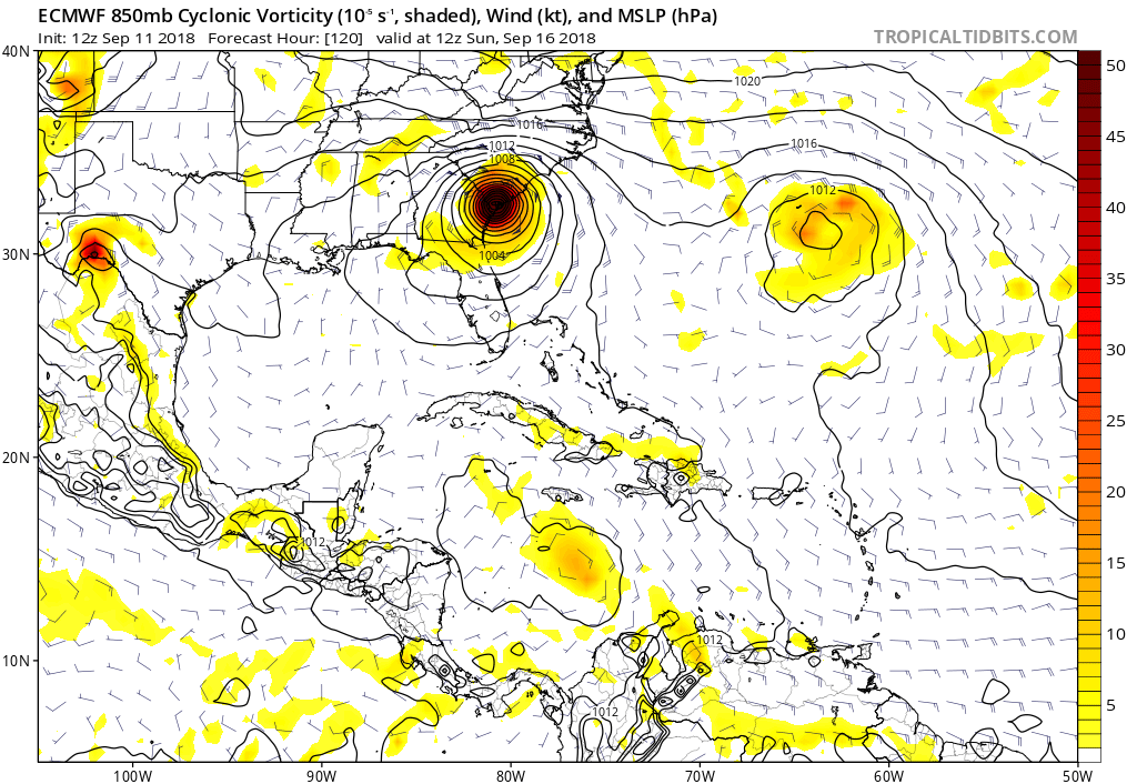
The other models aren't far from producing this solution if the ridge over the SE US and midwest is stronger.Now Euro is all alone. Landfall in Charleston. This is crazy.
My goodness, at 120 she's on the SC/GA line. This run basically scrapes the entire coast from Morehead City, NC down to GA.
Part of me says we are in the clear because almost all models stall now as it approaches the coast (except the Ukmet) but on the other hand the Euro shifted a good bit north prior to the stall and if it stalls later oh boy.Good news for us, a nuisance event for the triangle though. Bad news for places south/east of us.
Good news for us, a nuisance event for the triangle though. Bad news for places south/east of us.