• Hello, please take a minute to check out our awesome content, contributed by the wonderful members of our community. We hope you'll add your own thoughts and opinions by making a free account!

Tropical Major Hurricane Florence

Something I have not seen mentioned is the threat of tornadoes with Flo coming in. Is that a possibility?

Yes. SPC has a marginal risk out for coastal areas on Thursday currently, and that could be upgraded and expanded as we get closer:

day3otlk_0730.gif

...THERE IS A MARGINAL RISK OF SEVERE THUNDERSTORMS COASTAL NORTH
CAROLINA...VIRGINIA TIDEWATER...AND SOUTHERN DELMARVA...

...SUMMARY...
A tornado or two may occur from the North Carolina coast into the
Virginia Tidewater as Hurricane Florence approaches.

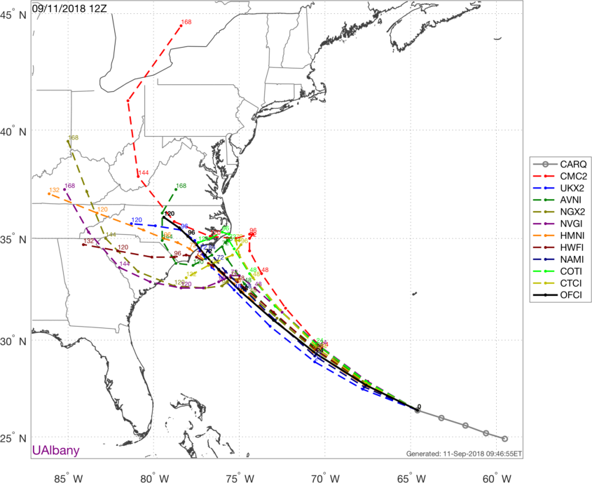
...Carolinas/Hurricane Florence...
Guidance is a fairly good agreement that the center of Florence will
be 150-180 miles south-southeast of HSE at the beginning of the Day
3 period (12Z Thursday). It is during this period (i.e. between 12Z
Thursday and 12Z Friday) when some models depict Florence slowing
its forward motion in response to a weakness in the flow aloft. Some
of the guidance actually slows the storm enough to keep it offshore
while others bring the storm farther inland before significantly
slowing it. As such, there is uncertainty on whether or not the
front-right quadrant will make it onshore before 12Z Friday. This
uncertainty limits including higher probabilities in this outlook.
If confidence that the right-front quadrant (and its associated
favorable wind profiles and higher theta-e) comes ashore increases
in subsequent outlooks, Slight-Risk-equivalent probabilities will
likely be needed.
 
12z NAM stalls near the OBX and shifts the 5H field north a touch allowing this extra N component before the stall.
namconus_mslp_wind_seus_47.png
 
Allan Huffman has landfall still between Cape Fear and Cape Lookout, but move the inland track further south.

 
Further west track inland though. Major flooding from the Triangle to the Triad with that look.

Looks like NHC is hitting the flash flood potential a little harder on this advisory, adding the word "catastrophic":

2. Life-threatening, catastrophic flash flooding and significant
river flooding
is possible over portions of the Carolinas and
Mid-Atlantic states from late this week into early next week, as
Florence is expected to slow down as it approaches the coast and
moves inland.
 
Landfall is about 6 hours later on the new advisory, really taking into account the slowing motion as it approaches the coast.....
 
I'm not sure this thing is even going to make it into the Carolinas before it spins way down.
Let's hope you are correct.... I was thinking if the ots does not occur and we must endure the floods please at least maybe she will stall long enough to weaken considerably before coming inland so some folks will not have to deal with the double disaster.

Btw ICON has her basically over the Pamlico Sound over 48 hours.
 
Substantial SW shift on the GFS through hour 42.
 
Western flank of the Atlantic ridge much stronger, looks like headed right down the NHC track... welcome to the party GFS better late than never I guess
 
Not surprising the GFS is way SW, the cloud radiative scheme in the model is primitive & leads to spurious expansion of the wind field leading to excessive beta drift, and it's becoming evident that the EPS/Euro isn't overdoing the ridge (especially over the SE US) given 95L's presence in the Gulf of Mexico.
 
It's notable that the GFS finally caught up with what the Euro and FV3 have been showing for a few days now. The new FV3 certainly seems superior to the old GFS in this regard at least.
 
Back
Top