Claycochaser
Member
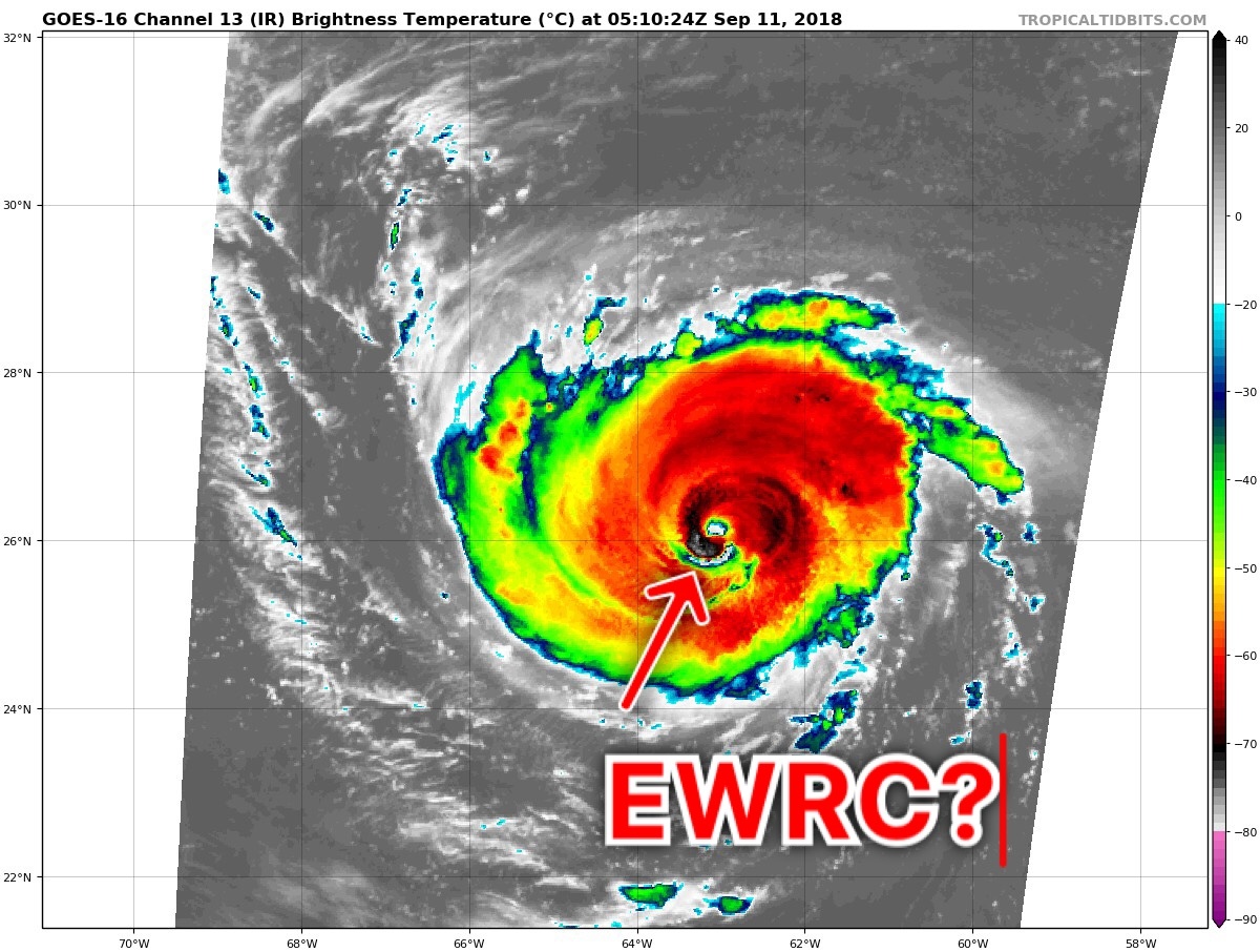
Sorry to interrupt the play-by-play...but does anyone else notice that she's in the process of cancelling her EWRC and exploding? Taking on a classic annular look as well.
Yes. Every model tonight has a stouter ridge for sure.I have notice a trend with the 00z models a Stronger Ridge opposed to the weaking earlier models had it doing..
Yes, it is looking much stronger now.Sorry to interrupt the play-by-play...but does anyone else notice that she's in the process of cancelling her EWRC and exploding? Taking on a classic annular look as well.
Did Ukmet shift south or west at all on the 0z?

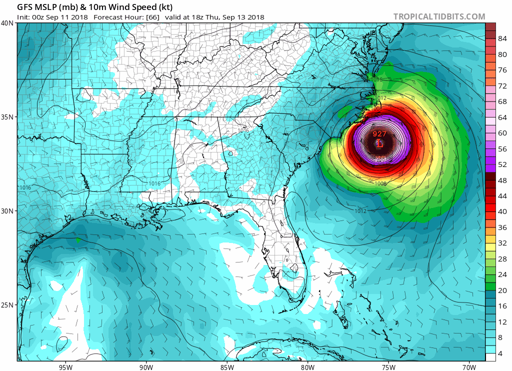
Yea, FV3 has landfall SW from it's 18Z location.so far as far as I can tell all of the 0z models are SW


The Ukmet definitely shift further south abd west wonder if the starting to line up a landfall closer to SC abd NC border

I tell ya. With every frame she is looking more and more like an annular hurricane.Yep, but the fun part is how long before the old eye gives up the ghost? That can take a while.
.png")

Euro stalled near Myrtle Beach at 96
drifts from Wilmington to Myrtle Beach Friday
EuRO and GFS are almost identical performing a stall and
and still stalled there at 120
Euro stalled near Myrtle Beach at 96
drifts from Wilmington to Myrtle Beach Friday
and still stalled there at 120
headed for Atlanta at 144... now the Euro is being weird...
With the double barrel ridge could storm stall further south like toward the south carolina coast?The 00z upper soundings seem to be sensing on a lockdown double barrel ridge. The one in the ATL and the one expected to develop over the OV/NE. I haven't been able to shake this weird feeling...but it looks like the idea of a stall, head west slowly idea is in play now with virtually all the guidance showing this scenario in some sense.
With the double barrel ridge could storm stall further south like toward the south carolina coast?
What do you mean by barrel of stream?It could very well be in play still. However, before the stall, the storm is expected to pick up a barrel of stream beforehand so, it's more wait and see. Just when it couldn't get any more complicated.