Could be good if it gets strong sooner. May bring about a favorable window for an ERC as it approaches the coast. Seen that happen many times.Solid Cat 4..... poop
-
Hello, please take a minute to check out our awesome content, contributed by the wonderful members of our community. We hope you'll add your own thoughts and opinions by making a free account!
You are using an out of date browser. It may not display this or other websites correctly.
You should upgrade or use an alternative browser.
You should upgrade or use an alternative browser.
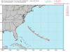
Tropical Major Hurricane Florence
- Thread starter ForsythSnow
- Start date
snowlover91
Member
Florence is having a RI this morning.
Yep the NHC did a good job forecasting the RI potential too, kudos to them!
Stormsfury
Member
945mb pressure.
Looks like flight level 135kts!

Looks like flight level 135kts!
If it’s that far off on intensity’s, the North track it keeps showing, could be way off too!? How did the initial position on this run, compared to actually??And the GFS initialized at 971 and doesn't have it below 945mb until hr 30...
Yeah sadly everyone is saddled with the logic if GFS is this far off you can pretty much sense that it gives credance to the more southernly trackAnd the GFS initialized at 971 and doesn't have it below 945mb until hr 30...
It looks like the GFS assumes a NW track right now. That's not reality right now. I don't know if that means anything or not, though.
GFS may not make landfall at all in this run.
Kylo
Member
It looks like the GFS assumes a NW track right now. That's not reality right now. I don't know if that means anything or not, though.
Could the GFS be right, it's hundreds of miles NE of Euro at day 3.
Showmeyourtds
Member
GFS might be ots
Goofy gon’ Goof....jus’ saying. In this case though, I think we’d like to call in that favor.
Kylo
Member
UK landfall between ILM and Morehead City.

GFS slowing Flo way down @72 off the coast...
If the GFS turns out to be wrong, it's hard to understand how it could get more wrong as we get closer to 0 hour.Could the GFS be right, it's hundreds of miles NE of Euro at day 3.
LovingGulfLows
Member
- Joined
- Jan 5, 2017
- Messages
- 1,499
- Reaction score
- 4,100
This storm is very close to taking on the classic buzzsaw shape that you typically get with strong Cat 4 and Cat 5 hurricanes.
That's a shift back south... could be a good middle of the road track though
See Southern snowstormsIf the GFS turns out to be wrong, it's hard to understand how it could get more wrong as we get closer to 0 hour.
B
Brick Tamland
Guest
Pray the GFS is on to something. Maybe the stronger Flo gets, the better chance it turns out to sea.
Goofus going nuts, down to 927 @84 still sitting off the OBX
and we must be overloading TT website, it's very slow
and we must be overloading TT website, it's very slow
Haha ridiculousGoofus going nuts, down to 927 @84 still sitting off the OBX
GFS is starting to stall off the outer banks at 90 hours and is down to 921 mb.
I’m at work right now, but from what I can tell the GFS better hope this turns north west fairly quickly if it’s gonna make its track because of the short term right now it’s moving almost to West
W
WeatherLC
Guest
Nhc just updated. Officially a cat 4
Kylo
Member
If the GFS turns out to be wrong, it's hard to understand how it could get more wrong as we get closer to 0 hour.
Well one of these models, Euro or GFS, is going to be really wrong. And if it's the GFS and a Cat 5 Florence ends up plowing into SE NC it's going to be tough to defend it.
South AL Wx
Member
Goofus going nuts, down to 927 @84 still sitting off the OBX
and we must be overloading TT website, it's very slow
And down to 919 at hour 90.
packfan98
Moderator
And with the slow forward movement at that point, you can throw the intensities in the trash due to upwelling. The glaring issue is that the GFS is uncoupled from the ocean is another reason to get rid of it. It's lagging way behind other modeling in many ways.Goofus going nuts, down to 927 @84 still sitting off the OBX
Brent
Member

12:00 PM AST Mon Sep 10
Location: 25.0°N 60.2°W
Moving: W at 13 mph
Min pressure: 946 mb
Max sustained: 130 mph
Location: 25.0°N 60.2°W
Moving: W at 13 mph
Min pressure: 946 mb
Max sustained: 130 mph
Let's hope the GFS is right but the GFS initialized too weak.
GFS is out to lunch no two ways about it.... the Ukmet trended back south. I will not be surprised to see the Euro come north just a smidge and converge on the SC/NC border as landfall point
Let's see what the Euro says. Plus we're a couple days from landfall and things can still change.
So
it’s almost doubled forward speed and it’s still due West?? Hmmm12:00 PM AST Mon Sep 10
Location: 25.0°N 60.2°W
Moving: W at 13 mph
Min pressure: 946 mb
Max sustained: 130 mph
Slightly earlier then expected intensification to a Cat 4 and that track bonking the expectations. I remember just last year Hurricane Irma was a beast with a mind of her own. Way to earlier to rule out all parts of the East Coast because Irma went from a Upper Eastern FL/SC/NC storm to a Miami storm to a Western Florida and up the panhandle storm in 5-6 days
https://www.nhc.noaa.gov/archive/2017/IRMA_graphics.php?product=5day_cone_with_line_and_wind
https://www.nhc.noaa.gov/archive/2017/IRMA_graphics.php?product=5day_cone_with_line_and_wind
snowlover91
Member
GFS is horrible. I would use a blend of Euro, HWRF, UK and FV3 for Florence. What the Euro shows will be interesting.
And it really isn’t, which is concerningPer the 12z so far its showing that Hurricane Florence should be moving Northwest now.
Brent
Member
yeah if the GFS is gonna be right she can't be moving along 25 N anymore
W
WeatherLC
Guest
Looks like Fayetteville is still a good spot for me unless the euro goes south again
Showmeyourtds
Member
This hag has done a helluva job coughing up all that dry air she had late last night...man, talk about RI
Could be a wobble but last frame there is a slight northward component.... I don't think we can deny it's continued westward movement is concerning for areas further south but I also think we may be putting a little too much emphasis on the current motion, really any definitive NW movement should come later as it rounds the developing high to it's north
Stormsfury
Member
This hag has done a helluva job coughing up all that dry air she had late last night...man, talk about RI
Essentially a 46 mb drop since 5pm yesterday
Webberweather53
Meteorologist
Florence going for Florence, SC would be so fittingLooks like Fayetteville is still a good spot for me unless the euro goes south again