W
WeatherLC
Guest
I think the story here is going to be the flood in North Carolina. Those rainfall totals almost rival Harvey....
Movement?
6Z HWRF almost a carbon copy of 0Z Euro. No bueno.
Due west. Note the 249 N (24.9 N). It's in line with the previous advisory while the longitude has increased.Movement?
Movement?
Typically the government will tell people when it gets within 4 or 3 days, then they will do zones starting with the highest chance for highest impact. As for inland, they never will call evacuations there unless you live in a flood-prone area.
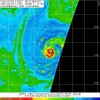
As for the storm at the moment, microwave imagery looks bad. The eye appears to be shrinking and heavy convection building up.
I usually don't put as much faith into the GFS/GEFS/Fv3 camp vs the EPS in cases like this where we have a strong tropical cyclone riding the edge of a rapidly building subtropical high that'll only be reinforced by Florence's upper level outflow thru -PV deposition. I've seen this movie play out so many times and know better than to ride the underdispersive & poleward biased GFS/GEFS suites. Fv3 seems to be doing better in this respect w/ more realistic intensity & track but I'll still take the Euro/EPS over it.
Typically the government will tell people when it gets within 4 or 3 days, then they will do zones starting with the highest chance for highest impact. As for inland, they never will call evacuations there unless you live in a flood-prone area.
As for the storm at the moment, microwave imagery looks bad. The eye appears to be shrinking and heavy convection building up.
Sometimes the inner eyewall chokes off the outer wall sometimes?
It's notable to me that the UK is in the GFS camp. Usually the UK has a bit of a south/west bias to it and the majority of it's ensembles are now centered on NC. Usually the UK and Euro are pretty close with track but seeing them diverge last night was a bit unusual. Of course the UK has been horrible with Florence so far too but still something to keep an eye on. I actually think the FV3 has the best balance and may be close to what transpires.
Being in the GFS camp at this stage in the game isn't exactly a good thing in a setup like this, the UKMET has been all over the place & anything but reliable with this storm, the European hasn't deviated much overall from a landfall in southern NC or central-northern SC, I'm still taking the EPS here.
That has to be the most obnoxious map I have ever seen someone ever put out. Most people can make better maps than that, and I'm sure he used his mouse do draw all of that, not to mention that he threw a pound of his personal "I like the worst possible scenario!" bias in there to make it look like Isaac is going to screw us later too and make Florence go into a huge loop to cover more ground than any model suggests.View attachment 6106 View attachment 6106 Wilkes works for JB now!?

I like the FV3 personally, it's been pretty consistent and is in good alignment with the NHC track as well. I feel the Euro/EPS is a bit too far south but it should be interesting to see how it all plays out.
I think the Fv3 is still second rate to the Euro/EPS, the 6z HWRF also agrees with them btw...
Was it on?Did the live update mechanism get turned off? Someone may have posted about it and I missed it. It's not working for me right now.
It was yesterday.Was it on?
Sent from my SM-G955U using Tapatalk
Yes I was going to try to turn it back on myself. But don’t have that kind of power. LolWas it on?
Sent from my SM-G955U using Tapatalk
It’s on now . It turns its self off early in the AM
Not sure about the western colleges but some inland one's are closing, my daughter is at Campbell University right there in Shane's backyard and they were told today they are going home tomorrow.I know UNC-Wilmington has canceled class for the week and told the students to go home. I am wondering if the colleges in the mountains like App State, UNC-Ashville, and Western Carolina are going to do the same.

Thank you!It’s on now . It turns its self off early in the AM
I recently relocated to the greater Columbia SC area from South LA (I have had my fair share of hurricanes). If Florence were to make a landfall in SC what kind of wind could be expected that far inland? About 100 miles or so. I have heard several people reference Hugo as a comparison. Anyone experience that storm in the Midlands of SC?
Yeah it's slight I know but it's been just north of due west..
Wobbling along 25N
Look how the clouds to the north are pushing down. Ridge city for sure
Wobbling along 25N
Chris wasn’t it suppose to be alreadying moving WNW or NW by this time??Look how the clouds to the north are pushing down. Ridge city for sure
B Rad P., the G.OA.T, says tracks are shifting North!????Look how the clouds to the north are pushing down. Ridge city for sure
