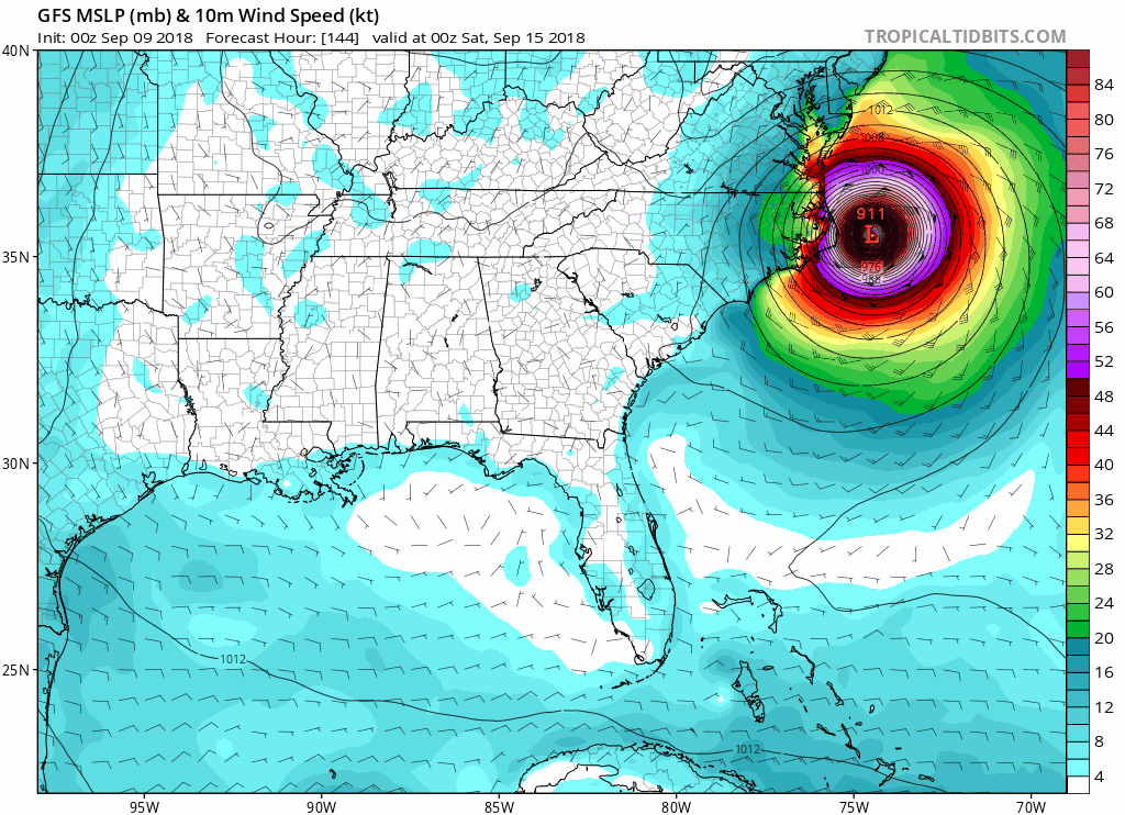
At least we are still 5 days out? There aren't a lot of ways to polish this turd. The euro track couldn't get much worse for the I40 corridor from ILM to RDU. 111 just to my east and to the S of rain cold.
I don't find a lot of comfort in anything on the models this morning. The OTS window that was cracked at 0z seemed to have been closed a little at 6z. The 0z eps being south is great for my personal interests but does no favors to the carolinas.
I'm not sure the variables are showing themself right now that would prevent a major hurricane from hitting the Carolina coast line. I feel like these north to south adjustments are within the standard deviation of model error at the lead time we are. But again it's still 5 days out
Sent from my SM-G955U using Tapatalk