pcbjr
Member
Regrettably ...Let start with this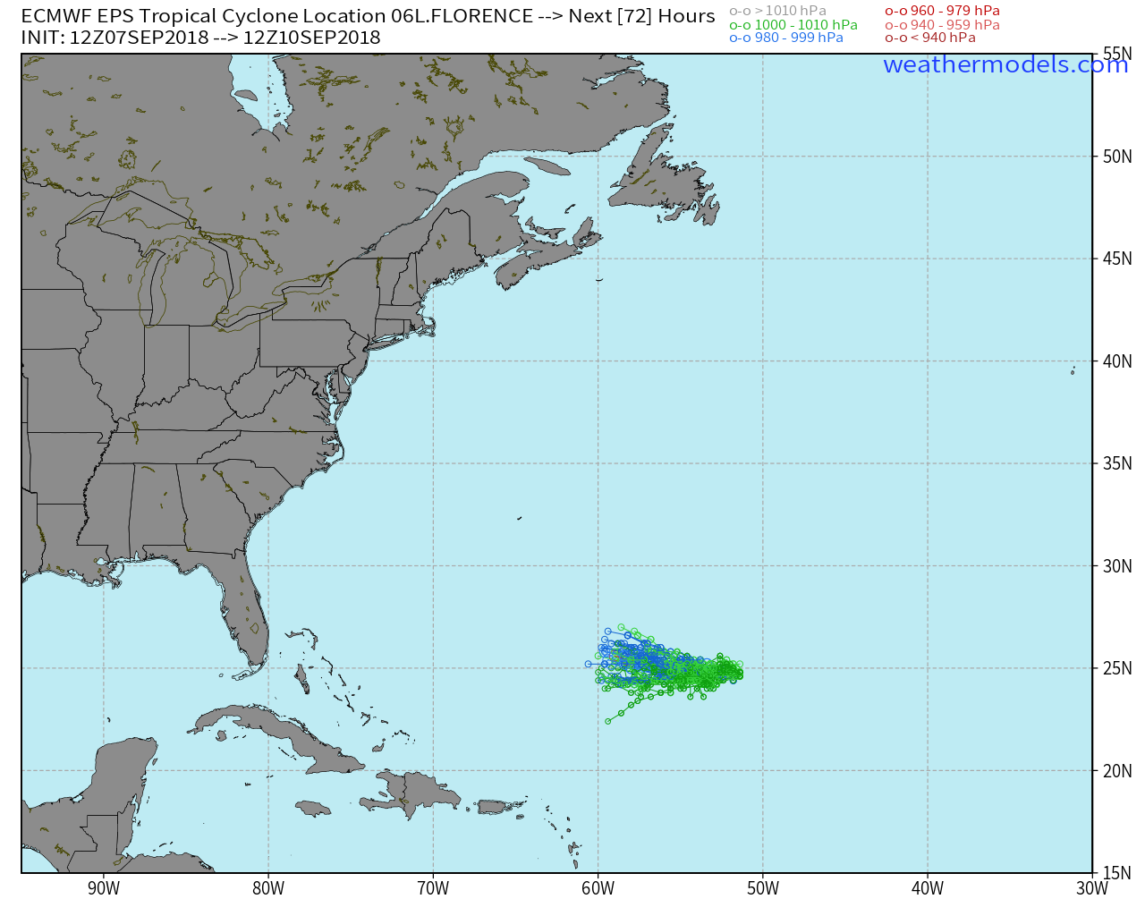
Regrettably ...Let start with this
Not sure about that, even if it got strong quick I think the escape route is all but out the window.... for us if it gets stronger quicker it could spell trouble. Anyway with that said looks like most of the Euro ens members are stronger sooner then the op runYeah, it doesn't look like many of the EPS members are going to recurve on this run. The intensity over the next 60 hours will tell the tale. We should be rooting for it to get stronger more quickly...seems weird to say...
.png")

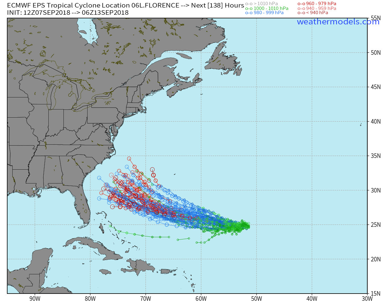
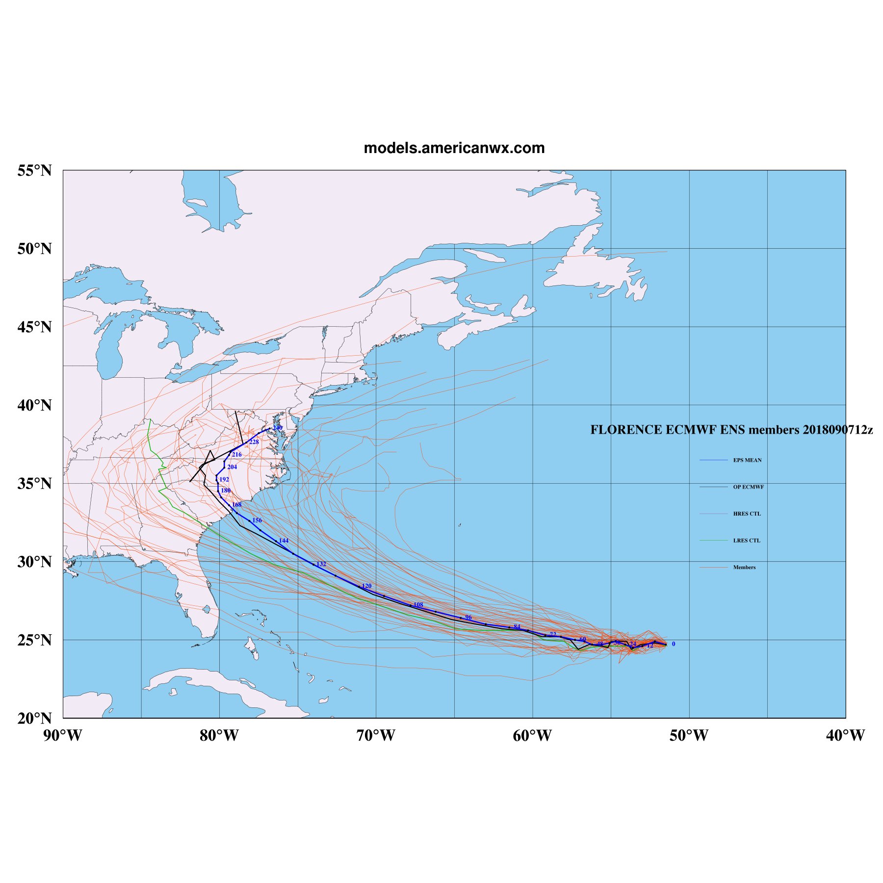
EPS cone narrows it appears. Not pretty seeing 1 - 3 OTS solutions. Many head further south too.
Webb,this 12z EPS run is ugly, there are some that blow Florence into a beefy major hurricane and still plow it into north-central Florida,
Yeah, unfortunately if that ridge becomes a record breaker in itself as you've been mentioning, there may be no way a cat 4 can even push it much. I see 2 camps, one a S GA / FL, and another being the NC / Scrape the coast ones. It becomes obvious around the 70W mark.Oh man this 12z EPS run is ugly, there are some that blow Florence into a beefy major hurricane and still plow it into north-central Florida, intensity will certainly help push it north some but it doesn't explain everything, especially if the ridge just gets stronger.
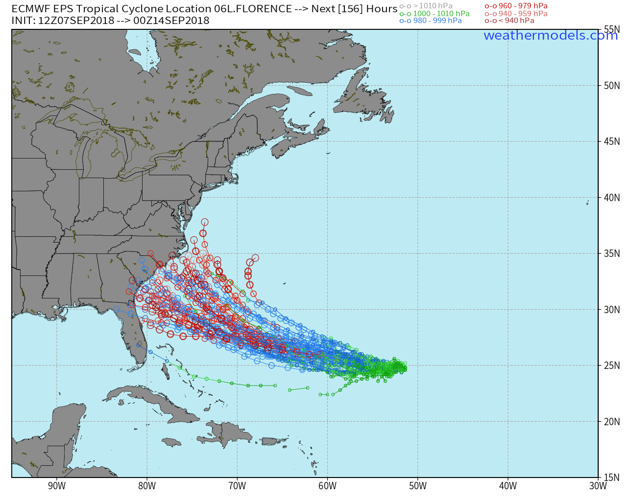
And if you go up the middle of all of them it looks like it hits right at the SC/NC border.
How fun, one member goes straight though here. NOT. It's those Savannah landfalls that plow straight though Macon that worry me. Many Phil would agree are worrying to his area as well. Unfortunately, the further south members may be stronger in the end due to more water time.
Yeah worrisome to say the least....How fun, one member goes straight though here. NOT. It's those Savannah landfalls that plow straight though Macon that worry me. Many Phil would agree are worrying to his area as well. Unfortunately, the further south members may be stronger in the end due to more water time.
It's the correct run on my screen. Try clearing your cache??? I'm not even sure what that is, but that's what others say when this happens to me.That’s yesterday’s 12z run
Sent from my iPhone using Tapatalk
")
will be interesting to see if this continues the south trend and ends up in our area.EPS cone narrows it appears. Not pretty seeing 1 - 3 OTS solutions. Many head further south too.
This is one part of weather I don't do for a hobby or fun ... dadgum right I'm watching ... but also listening to myself ... it is 6 plus days out ...How fun, one member goes straight though here. NOT. It's those Savannah landfalls that plow straight though Macon that worry me. Many Phil would agree are worrying to his area as well. Unfortunately, the further south members may be stronger in the end due to more water time.
Seriously worrisome
Sent from my SM-G920V using Tapatalk
Seriously worrisome
Sent from my SM-G920V using Tapatalk
Here's a good one with the mean. Too bad it goes over my house!
Yes. Could be quite the surge. And then it could stall inland. Double trouble!We've said it already, but that joker is hauling toward the coast line.
How fun, one member goes straight though here. NOT. It's those Savannah landfalls that plow straight though Macon that worry me. Many Phil would agree are worrying to his area as well. Unfortunately, the further south members may be stronger in the end due to more water time.
It's honestly still quite a bit of spread (as expected this far out), just now we are moving away from the total recurve scenario.
Old run as indicated by the 00 at the end of the date at the top Init.


Here's a good one with the mean. Too bad it goes over my house!
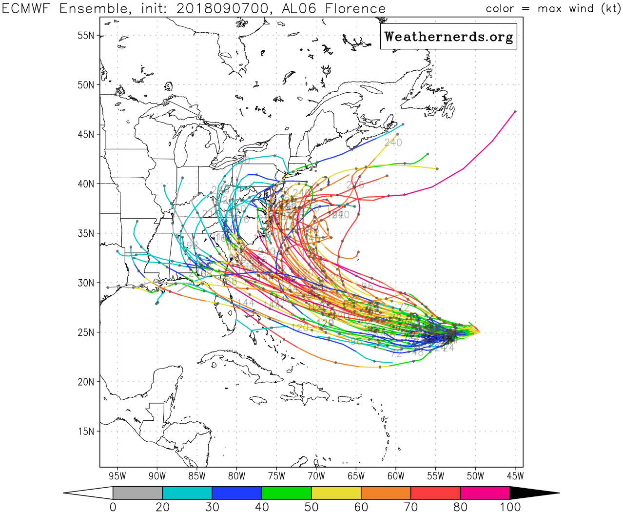
Larry,Per Ryan's 12Z EPS tracks, many of them hit the SE as cat 2s with several even as 3s. Scary stuff. The worst run yet, even worse than the really bad 0Z with very few misses.