pcbjr
Member
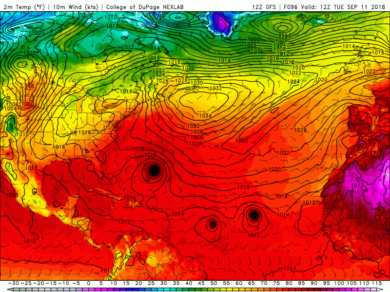
No and looks like ...Am I crazy or did Florence just go southwest on the Satellite loop?

No and looks like ...Am I crazy or did Florence just go southwest on the Satellite loop?
Well it might actually end well for those of us in NC if it keeps right on trending further South and West but that would in turn be bad for those of us South of NC.Little by little the GFS shifting the orientation of that High, I'm afraid this is not going to end well
Sent from my SM-G920V using Tapatalk
Agreed... but I'm speaking of CONUS and the SE specifically and right now I'm not seeing any escape route. No doubt it may end up further south as you mentioned thoughWell it might actually end well for those of us in NC if it keeps right on trending further South and West but that would in turn be bad for those of us South of NC.

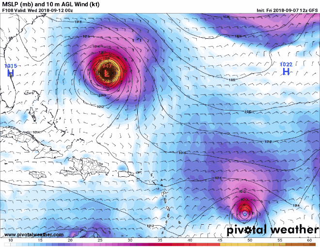
View attachment 5915 Yikes!!!!!
It's a concerning trend for our backyardsbetween 96-120 GFS has Florence accelerating also, just as the Euro.... this is problematic

Yep! Increased foreward speed x cat 3/4 strength = devastation further inland!It's a concerning trend for our backyards
Sent from my SM-G955U using Tapatalk


between 96-120 GFS has Florence accelerating also, just as the Euro.... this is problematic
Honestly wouldn’t be surprised to see it head south of here, giving our area minimal impacts, when all is said and done. The ridge means business and I’m not sure the models are done catching up to how strong it is likely to be.It's a concerning trend for our backyards
Sent from my SM-G955U using Tapatalk
Yep, that’s a good point. Quite complicated and fun to watch how it plays out. Unfortunately, it’s looking more likely that it’s not going to be fun for somebody in about a week’s time.Completely agree. The counter is how quickly Florence restrengthens. This is turning into a serious situation where a powerful Cat 3 to 4 hurricane is going to barrel well inland -- versus just scraping the coast -- and wreak a lot of havoc somewhere I fear.
.png")
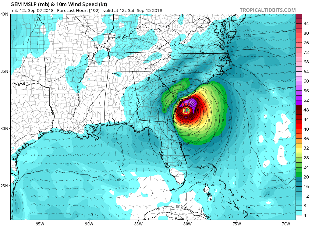
Irma wasn't very nice last year so I don't look forward to any repeats given that there will be less land to cover to get here if it goes for the GA coast. I worry for you NC folks in Raleigh if it heads there given it could have cat 1 strength on its north side if it goes inland near Myrtle Beach.I think the ensemble guidance today will probably continue the shift away from the out to sea scenario. It is becoming very unlikely at this point IMO. I feel like the most likely landfall zone -- while anywhere from northern FL to the northern Outer Banks of NC are in play -- is probably Savannah, GA to Morehead City, NC right now but this definitely could be one of those hurricanes where major impacts are felt hundreds of miles inland.
Spoken almost as if you were a true Floridian ...I'll probably make a run to the store today to just get a few extra groceries (esp water and canned goods) before the seemingly inevitable mad dash probably occurs within the next few days as many probably begin to panic. The memories of storms like Hugo, Fran, et al still resonate with many in the Carolinas and I don't want to be price gouged or w/o necessary goods to survive if the power goes out. Never hurts to be safe rather than sorry & prepare early & often...