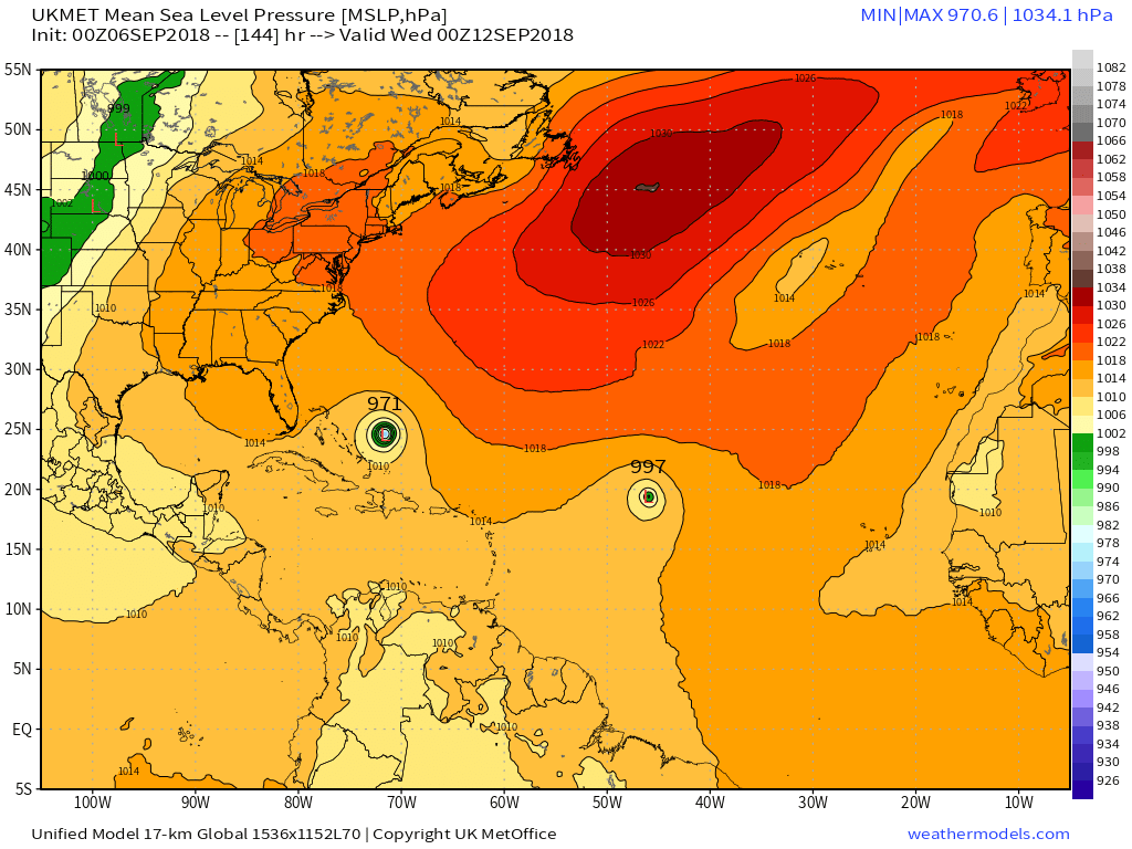
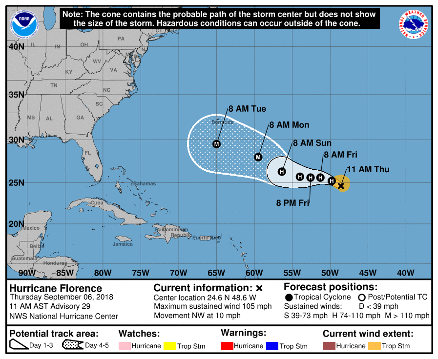
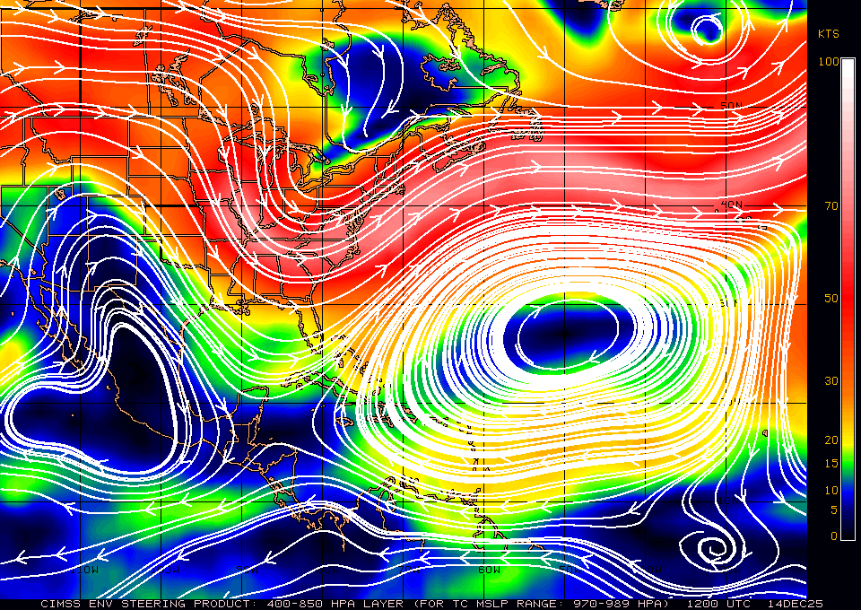
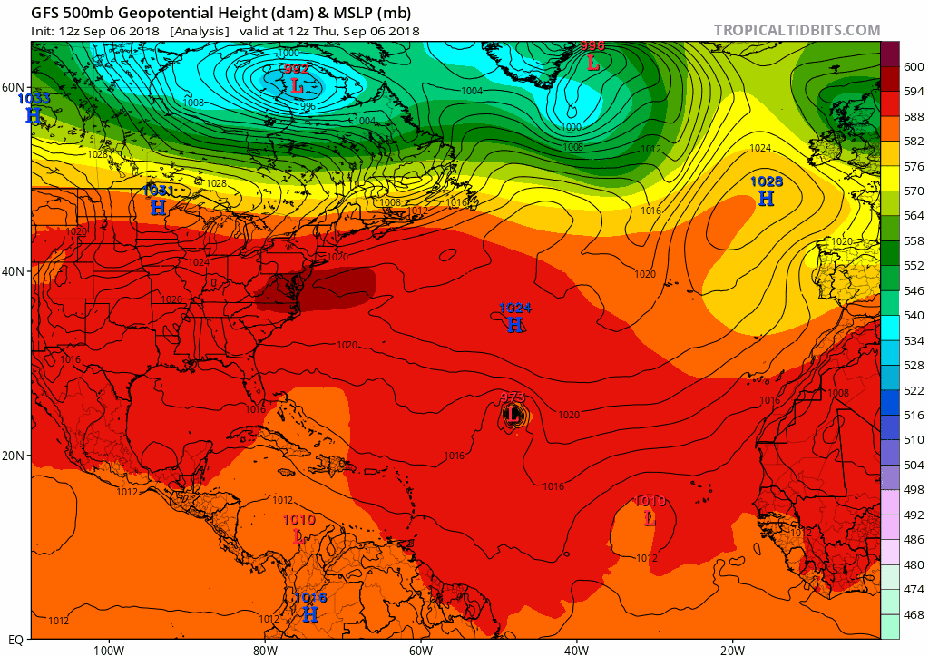
Florence is currently under ~30 KT of westerly-southwesterly shear according to both the CIMSS and the GFS vortex averaged skew Ts at initialization and most of this shear is in the mid-levels. You can also see that as Florence's rossby penetration depth becomes shallower due to weakening & asymmetrization of the storm's warm core, a larger proportion of the total integrated steering flow will be comprised of east-southeasterly flow at/below 600 hPa, hence the expected turn to the W or WNW in the next day or two. The evolution of the s/w trough associated w/ Gordon's remnants near the lower MS valley will be crucial to monitor going forward because in order to get stronger flow reversal under the building ridge to its north, a prolonged NW track like Hugo, Isabel, et al vs a broader recurvature, this feature usually needs to be present and in relatively close proximity to the storm. This remnant upper level trough being over the Gulf coast for example while our storm is offshore the SE US is often sufficiently close in instances like this.
View attachment 5870