• Hello, please take a minute to check out our awesome content, contributed by the wonderful members of our community. We hope you'll add your own thoughts and opinions by making a free account!

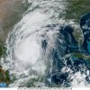
Tropical Major Hurricane Delta

Climo of early Oct storms, especially in La Nina, also suggests tracks as far west as the TX/LA border are quite believable. So, for now I’m going with LA west of New Orleans since it has good model support.

So we know the gfs has a bias of weakening ridges too soon. Does this apply during this time of year as well. I would think that bias would be amplified by the highs getting stronger as we head in on the cooler months?

Like I said I'm not buying into a climo type of east correction just yet.
 
HDelta has four major variables around its position later this week. The two major one are a ULL over Florida as depicted here on W2 and the midwest trough. If Delta becomes stronger which is forecasted on all models it will slow down. This would allow more timing for the MW trough to dig deeper into the gulf coast causing Delta to move further northeast. The ULL over Florida will prevent it from moving to far east leaving Mid LA to Mississippi in the potential landfall area. New Orleans in my observations will take a direct hit. It was lucky the past two times.

eefa118ec1e86b2dea57eb3e4b1e7fe4.jpg


Sent from my iPhone using Tapatalk
 
Climo of early Oct storms, especially in La Nina, also suggests tracks as far west as the TX/LA border are quite believable. So, for now I’m going with LA west of New Orleans since it has good model support.
Is that the good model support in the Victoria secret edition? I’ll hang up and take the answer. ?
 
I know Gamma is gone but there is still a diffuse circulation with some convective blowup, almost looks like Delta is being pulled that direction to gobble up the remains. You can see that on the 12z ICON too which gets pretty far west before the N turn
 
Eye is also now 5 NM wide. Absolutely insane.
109
URNT12 KWBC 061438
VORTEX DATA MESSAGE AL262020
A. 06/14:12:17Z
B. 18.12 deg N 082.56 deg W
C. 700 MB 2746 m
D. 957 mb
E. 110 deg 25 kt
F. CLOSED
G. C5
H. 102 kt
I. 134 deg 8 nm 14:10:30Z
J. 229 deg 90 kt
K. 134 deg 8 nm 14:10:19Z
L. 102 kt
M. 315 deg 3 nm 14:13:01Z
N. 051 deg 109 kt
O. 315 deg 6 nm 14:13:43Z
P. 12 C / 3065 m
Q. 19 C / 2728 m
R. 15 C / NA
S. 1245 / 7
T. 0.01 / 2 nm
U. NOAA2 0426A DELTA OB 26
MAX FL WIND 109 KT 315 / 6 NM 14:13:43Z
 
So is NHC predicting a major hit for someone on the gulf coast I see they have it at 125 before that inland plot .. Weiss we had one more position intensity update point before landfall
 
Wow, went from a cat 1 to a cat 4 in less than 24 hours. Hope the Gulf Coast is ready, specially Louisiana. Big difference from it being forecasted as a cat 2 just yesterday when it makes landfall. This season looks like it's going out with a bang.
 
Back
Top