Shaggy
Member
Little faster too which is also problematicGfs doesnt budge at 12z. Seems to be zeroing in on the central coast and correct me if I'm wrong but it was at 971mb at 6z and stronger down in low 960s at 12z.
Little faster too which is also problematic
Less chance to weaken. Shaping up to be a potentially major strike for them.
Typically a stronger hurricane would want to pull more northward quicker which would argue for a more East track. However that’s not what we’re seeing in the models this morning. I do wonder if it’s being pulled a little more to the west due to the remnant low from Gamma. Either way from the models I’m looking at this morning no matter when the turn NE actually occurs, it looks to be fairly sharp turn.Would a stronger hurricane mean a more westerly track ?
Plus more time to pull northeastCooler water eastern gulf and warmer waters west gulf is the reason models are predicting a powerful storm because of Delta moving in that direction. The problem is if it slows a bit in the western gulf, it will have nothing but warm water until landfall coming from the sw to the ne.

Less chance to weaken. Shaping up to be a potentially major strike for them.
Agreed, that's how, IMHO this could get ugly inland for many areas.Moving NE as well at a good clip would also mitigate shear.
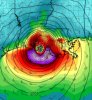
132 kt FL still a 4 mile wide eye!View attachment 49855
Geez.And the 12Z UKMET now joins the further west party. Also, it is very strong at landfall I’m Central LA at 948 mb! ?
HURRICANE DELTA ANALYSED POSITION : 18.0N 82.3W
ATCF IDENTIFIER : AL262020
LEAD CENTRAL MAXIMUM WIND
VERIFYING TIME TIME POSITION PRESSURE (MB) SPEED (KNOTS)
-------------- ---- -------- ------------- -------------
1200UTC 06.10.2020 0 18.0N 82.3W 977 61
0000UTC 07.10.2020 12 19.2N 84.8W 968 66
1200UTC 07.10.2020 24 21.2N 87.4W 972 60
0000UTC 08.10.2020 36 22.5N 90.3W 964 64
1200UTC 08.10.2020 48 23.8N 92.3W 964 65
0000UTC 09.10.2020 60 25.2N 93.1W 956 71
1200UTC 09.10.2020 72 27.0N 93.2W 946 75
0000UTC 10.10.2020 84 29.5N 92.2W 948 78
1200UTC 10.10.2020 96 32.0N 91.4W 984 33
0000UTC 11.10.2020 108 33.3N 90.0W 994 24
1200UTC 11.10.2020 120 34.9N 87.7W 999 22
0000UTC 12.10.2020 132 38.1N 84.6W 999 30
1200UTC 12.10.2020 144 41.0N 82.1W 999 35
Really thought that it would start to weaken as it approached the coast.... Maybe not
I agree it does show a Northerly component. Levi also mentioned if Delta doesn't entwine with Gamma due to Gamma sw movement than expect a east trend in the future.I do see recon showing a little more Northerly component (to the WNW movement) *shorter term movement* Biggest thing is can this avoid a landfall over the Yucatan.
That's because the water are very warm in the western gulfReally thought that it would start to weaken as it approached the coast.... Maybe not
Next frame is actually 964 at landfall so some minor weakening, also shows some monster rain totals NE Ga/upstate SC, WNC thinks to some serious upslopingReally thought that it would start to weaken as it approached the coast.... Maybe not
Yeah was just looking at this. Big time totals, some foot plus areas along the southern escarpment of NC.Next frame is actually 964 at landfall so some minor weakening, also shows some monster rain totals NE Ga/upstate SC, WNC thinks to some serious upsloping
Yeah.. the angle of approach, interaction with the wedge front and cold front sets up a perfect upslope for those areas..Yeah was just looking at this. Big time totals, some foot plus areas along the southern escarpment of NC.
Can we just take a second and gawk at the 100 mph gain this thing has made in 30 hours?RI continues
SUMMARY OF 200 PM EDT...1800 UTC...INFORMATION
----------------------------------------------
LOCATION...18.5N 83.5W
ABOUT 260 MI...420 KM ESE OF COZUMEL MEXICO
MAXIMUM SUSTAINED WINDS...140 MPH...220 KM/H
PRESENT MOVEMENT...WNW OR 300 DEGREES AT 16 MPH...26 KM/H
MINIMUM CENTRAL PRESSURE...956 MB...28.23 INCHES
.png")
Who did Louisiana piss off


Has to do with the RI and size of the eye. It's visible on IR to some degree but because it was a TS around 24 hours ago and its eye is now only 4 miles wide, it's hard to clear with the pressure it has is my guess.CAT 4 approaching CAT 5 and we still don’t have a cleared out eye? Hmmmm I haven’t seen a storm with no cleared out eye that is this strong .. very interesting .. would assume she has to pop one out here soon we can’t go CAT 5 with NO clear eye right?