• Hello, please take a minute to check out our awesome content, contributed by the wonderful members of our community. We hope you'll add your own thoughts and opinions by making a free account!

Wintry Machine Learning Mauler 1/30-2/1

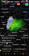
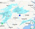
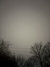
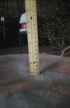
Got a little bit coming down now in NW Winston Salem.... seeing it on top of the grill cover

Sent from my Pixel 10 Pro XL using Tapatalk
Yeah, I've seen some very light flurries falling; but no real flakes. It's definitely hanging on the edge.
I hate to call this the official start but I guess a gaggle of flurries counts as that.
So I'll go make a drink to celebrate.
 
I fear I'm just about 7-10 miles too SE of this band hitting northern most Durham country right now :\
Yeah nothing here in NE CH. I am afraid I’m going to be too far south for this and too far north for the best stuff tomorrow!
 
Yeah nothing here in NE CH. I am afraid I’m going to be too far south for this and too far north for the best stuff tomorrow!
Yet again, a potential for shared CH/Durham misfortunes together. Let’s hope for a solid performance tomorrow though!!

It’s just crazy making to see mpings less than 15 miles north and west of me the past couple hours. Oof.
 
If the coastal low bombs before the ULL passes our latitude, it usually means the surface low is tapping maximum upper-level support early. Right?
 
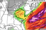
For my folks along I-95 from Florence to Rocky Mount and points east, hang this on the wall:


After 00Z Sunday is when the heaviest snow and most notable impacts
are expected as the low offshore deepens rapidly. This will pivot
winds to more N/NE across the region, and as a deformation axis
pivots west of the surface low and the cold conveyor sets up across
the Atlantic and into the eastern Carolinas, more intense ascent
and greater moisture should result in extreme (for this region)
snow rates. Cross-sections indicate a broad region of favorable
conditions for CSI, or even CI (thundersnow), and the HREF snow-
rate probabilities peak above 50% for 1"/hr suggesting at least a
potential for 2"/hr within a pivoting band somewhere in eastern NC
or SC, and this is additionally supported by the WPC prototype
snowband tool. These heavy snow rates will be accompanied by
strong winds that may gust 35-50 mph, higher at the coast and in
the mountains, suggesting near blizzard conditions in many areas.
While uncertainty remains into how dry air in the mid- level may
impact snow amounts on the broad scale, locally very significant
snowfall accumulations are likely, especially within these bands,
during D2. By Sunday afternoon the low will pull away bringing an
end to the snowfall and leaving just cold windy conditions in its

wake.
 
Coming down pretty hard in Gatlinburg
 
For my folks along I-95 from Florence to Rocky Mount and points east, hang this on the wall:


After 00Z Sunday is when the heaviest snow and most notable impacts
are expected as the low offshore deepens rapidly. This will pivot
winds to more N/NE across the region, and as a deformation axis
pivots west of the surface low and the cold conveyor sets up across
the Atlantic and into the eastern Carolinas, more intense ascent
and greater moisture should result in extreme (for this region)
snow rates. Cross-sections indicate a broad region of favorable
conditions for CSI, or even CI (thundersnow), and the HREF snow-
rate probabilities peak above 50% for 1"/hr suggesting at least a
potential for 2"/hr within a pivoting band somewhere in eastern NC
or SC, and this is additionally supported by the WPC prototype
snowband tool. These heavy snow rates will be accompanied by
strong winds that may gust 35-50 mph, higher at the coast and in
the mountains, suggesting near blizzard conditions in many areas.
While uncertainty remains into how dry air in the mid- level may
impact snow amounts on the broad scale, locally very significant
snowfall accumulations are likely, especially within these bands,
during D2. By Sunday afternoon the low will pull away bringing an
end to the snowfall and leaving just cold windy conditions in its

wake.
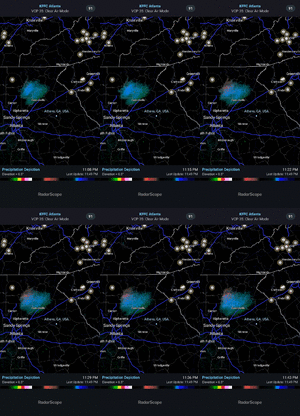
Where was this from
 
At
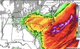
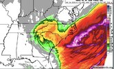
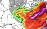
This is what ChatGPT rendered. We hug.


Bottom line for NC/SC​

An earlier-than-modeled 500-mb cutoff over southern IL favors:

  • Earlier coastal development
  • Colder inland solution
  • Higher chance of front-end snow or sleet in NC
  • Sharper gradients and localized surprises
dont use chat gpt it only tells you what you want to hear not the truth. heres what it gave me.

Why an earlier 500-mb cutoff over southern IL can hurt Carolinas snow

1. It often steals your downstream lift
2. Tends to slow or deform the system
3. Warm nose risk increases
4. You lose the “clean Miller A transfer” look


For NC/SC:

  • Earlier-than-modeled 500-mb cutoff over southern IL = more risk
  • Biggest threats: weaker lift, warmer profiles, mixed precip
  • Best snow setups usually want the cutoff later, farther east, or closer to the coast
 
At

dont use chat gpt it only tells you what you want to hear not the truth. heres what it gave me.

Why an earlier 500-mb cutoff over southern IL can hurt Carolinas snow

1. It often steals your downstream lift
2. Tends to slow or deform the system
3. Warm nose risk increases
4. You lose the “clean Miller A transfer” look


For NC/SC:

  • Earlier-than-modeled 500-mb cutoff over southern IL = more risk
  • Biggest threats: weaker lift, warmer profiles, mixed precip
  • Best snow setups usually want the cutoff later, farther east, or closer to the coast

I agree with you but this is the Machine Learning Mauler thread, so please be careful not to piss off our AI overlords
 
Last one I'll post then gotta crash for the night. It just doesn't even sound real. Hurricane force wind warnings and snow out to 100NM offshore. At 34°N off the coast of NC/SC.

ANZ833-311445
Cape Hatteras to Cape Fear to 100 NM Offshore.
945 PM EST Fri Jan 30 2026

HURRICANE FORCE WIND WARNING

TONIGHT
NE winds 15 to 20 kt, increasing to 25 to 35 kt. Seas 4 to 6 ft, building to 8 to 12 ft. Chance of rain.

SAT
E to NE winds 30 to 40 kt, becoming N. Seas 10 to 17 ft. Chance of rain with vsby 1 nm or less.

SAT NIGHT
N winds 45 to 55 kt, increasing to 55 to 65 kt. Seas 14 to 23 ft, building to 16 to 31 ft. Numerous showers with vsby 1 nm or less.

SUN

NW winds 50 to 65 kt, diminishing to 35 to 50 kt. Seas 15 to 30 ft. Scattered showers and snow showers with vsby 1 nm or less.
 
Back
Top