-
Hello, please take a minute to check out our awesome content, contributed by the wonderful members of our community. We hope you'll add your own thoughts and opinions by making a free account!
You are using an out of date browser. It may not display this or other websites correctly.
You should upgrade or use an alternative browser.
You should upgrade or use an alternative browser.
Wintry Machine Learning Mauler 1/30-2/1
- Thread starter SD
- Start date
It is breezy. Flurries drifting down for the first real flakes of 25-26
The radar is beginning to perk up over N. Georgia. I'm warming up the floodlight.
The 500MB ULL is near Nashville heade SE based on satellite.
The 500MB ULL is near Nashville heade SE based on satellite.
Webberweather53
Meteorologist
Bigedd09
Member
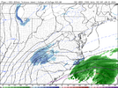
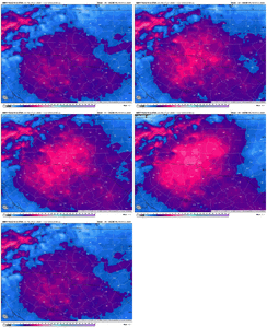
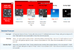
Parallel NBM forecast snowfall total trend over Charlotte
Starting to progressively look more like my forecast of 6-12” which could even be a tad conservative near Charlotte
View attachment 192305
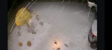
It’s already started snowing and snowing decently in huntersville been for about 45 mins or so. Everything already covered. Feels like this is a bonus. Many Mets said this would most likely be virga
Sent from my iPhone using Tapatalk
- Joined
- Jan 2, 2017
- Messages
- 1,566
- Reaction score
- 4,279
Oddly enough..not a flake here. Not good
Waynesville, NC has attained 4" of snow already, about 3 hours ahead of the 01z HRRR's schedule
SnowDeac
Member
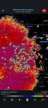
Just woke up to light snow in South Park. Any reason for areas south and east of the metro to be concerned by the current radar orientation? Looks to be set up further north (as usual) of model guidance to my untrained eye.
No, all models crush us esp later today, this is all a bonusJust woke up to light snow in South Park. Any reason for areas south and east of the metro to be concerned by the current radar orientation? Looks to be set up further north (as usual) of model guidance to my untrained eye.
Driveway white and light dusting on grass, picking up now!
rburrel2
Member
It's coming. Radar will go boom at 7am.Oddly enough..not a flake here. Not good
iGRXY
Member
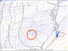
Mine says that too now. I noticed the 3K holding the snow a little laterThis is what we train all year for. Hope it pans out for everyone
View attachment 192307
iGRXY
Member
It’s absolutely puking snow here
You've been around here wx-watching long enough to know we get those little convergence bands of clouds off the Black Mtns around here when the wind is oriented correctly. I think that could keep snow around this vicinity longer. Not to mention downslope convergence before the front just clears it out entirelyMine says that too now. I noticed the 3K holding the snow a little later
Showmeyourtds
Member
Bone dry here in Cherokee Co GA. Radar looks weak. Not sure how we get any WSW criteria snow here at this point
Forevertothee
Member
Flurries have begun in Clinton.
WarEagle22
Member
Not far from you, didn’t take long for the yard, driveway, and roads to cover quick.Pouring snow here. Ground white in less than 30 minutes.
Bigedd09
Member
Just getting started. Good luck everyone

Sent from my iPhone using Tapatalk

Sent from my iPhone using Tapatalk
Fascinating …the science
Sent from my iPhone using Tapatalk
Sent from my iPhone using Tapatalk
WSOC saying clt metro looking at double digits now, really honing in on the heavy bands the cams are showing
- Joined
- Jan 2, 2017
- Messages
- 1,566
- Reaction score
- 4,279
Flurries finally..way behind here.
wow
Member
Light snow starting, temp is 29
All the gaps from the previous ice storm thaw filled in. Ground white. Moderate snow Fort Mill, Sc
Sent from my iPhone using Tapatalk
Sent from my iPhone using Tapatalk
Snow, blowing everywhere here.
FFC seems pretty locked in on snow for the metro. When I went to bed the WSW called for up two inches. The latest update issued an hour ago says 1 to 3.Bone dry here in Cherokee Co GA. Radar looks weak. Not sure how we get any WSW criteria snow here at this point
Shadow of the Apps
Member
First flakes are starting to fall here.
a_gilmore88
Member
Woke up to beautiful flakes and a covered driveway in Landis. Let’s rage. 

Snow is falling and possibly closing in on perhaps somewhere round about an inch maybe here in the new sink zone with temps running at a balmy 25 F.
It's nice to not worry about the number one thing in my list of things to worry about - temperatures.
It's nice to not worry about the number one thing in my list of things to worry about - temperatures.
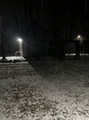
When does it ever?HRRR is not initializing correctly based on current radar. Moderate Snow (big flakes) falling in Randleman. Dusting already. 4:35AM
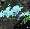
View attachment 192302View attachment 192303
Guys it’s ripping here, ground white and radar is just starting to blossom
wow
Member
TigerSnow
Member
Are we a little early in the Charlotte area? I thought they originally said 6-7 am or so? Maybe we can reel this one in.
bud006
Member
It’s snowing! Flakes visible outside at my house. 29.5°.
Here we go y’all!
—30—
Here we go y’all!
—30—
Over in Bostic (Rutherford) same. 1/4" so far.Moderate snow in Rutherfordton and the ground getting covered. Hopefully a good sign for today. Hard living in the southern Lee but when it’s good it’s usually a good sign for others.
View attachment 192308
ga_ben
Member
Light snow just started in Acworth even though no returns showing on Radarscope.

