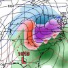
Just a couple reasons why I think a winter storm is honestly more likely than not, even east of the apps.
1. The models are flipping more than a gymnastics team at a regional tournament. You get completely different looks almost every run now. First the TPV was going to be too far west, then it was too slow moving east, then it was too weak once it started speeding up, then it randomly wants to stop in the Great Lakes and not move for 2 days. they just don't know what to do with it at this point.
2. A 1050 HP looks likely at this point with substantial cold both to our north and northwest.
The Snow pack over the northeast and midatlantic is massive and models are not going to be good at picking up on that even in a normal wedge without this massive blast of arctic air.
3. The globals have tried to flex the SER all winter in the medium range and everytime it starts getting beat down once we get into the 3-4 day range and things come in colder. We have had 2 or 3 events this year where the air mass was exceptionally marginal but still ended with a 32/33 degree rain instead of the 36-39 degree rain like they showed. Including last weekend's events that had way more cold air the closer we got to the event. That's the theme of this winter.
4. Globals do not handle normal CAD well at all. They underestimate the level of cold air at the surface, the try to erode it too fast, they try to drive LP directly into it. Now a 1040 HP sitting in the Northeast with a snow pack just screams colder than modeled.
5. Finally these models, including the Euro, are already underestimating just how cold the air mass truly is by being off as much as 10-20 degrees at initialization back over the midwest and central US.
Point of this post is to show you that right now we have the coldest air in the North America sitting just to our north, with a snow pack, models flip flopping every run, and a consistent trend of getting colder the closer we get to events. That tells me that a winter storm both in the western southeast and in the CAD areas is a lot more likely than what the models are showing on their individual runs.


