NBAcentel
Member
honestly depends...GFS is right its a Western and maybe some NC areas. EURO has the best shot if moisture was further north. (for all of us)Is the Sunday storm for the entire Southeast or Western SE or NC?


Snowvol reporting in from northwest middle tn.Haven't heard anyone say this in a minute but guest sign up lol, we have a wild week ahead of us and we could always use more posters from different locales.
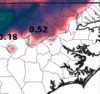
Classic NW of the triangle setup.
Classic NW of the triangle setup.
Is Orange and Durham counties not part of the triangle?
Sent from my iPhone using Tapatalk
I'm confused lol, freezing temps are really far east here, close to the inner coastal plain. The triangle looks to be solidly in playClassic NW of the triangle setup.
Yep no way. Would have to be ice or sleet IF the big high is there with those dp's. The ice would last a long time too if the temps started out at 22 despite ZR being a warming process. It would drop down to 15-17 before slowly going back up and the favored CAD areas probably would not get close to freezing until the event was over.Yeah I saw that and just thinking, not gonna sweat the details this far out.... all I need to know is a monster HP in the NE with single digit to zero DPs. No way we rain with that setup
FFC sounds as confused as we do, lol:
“Models diverge for Saturday night and Sunday with the approach of
another wave. The ECMWF is showing a rapidly moving wave pushing
east of the forecast area early Sunday...while the GFS has a closed
low over GA. We could either have a significant precipitation event
or little to nothing. Given the below freezing temperatures forecast
for Saturday night...have tried to compromise for now with low pops
across the area and some light snow possible for the far north.”
The Euro's pulling the damming high fairly steadily east... And warming things up rapidly locally in Lower SC....
Frames before that...the temps are stoutly cold, stoutly wedged... With 925mb at -5C... How rapidly it breaks the wedge down is suspect given trends the last two storm systems here have seen more evaporational cooling than forecast even in the warm sector... Early suspicions and red flags brought up... First, the Baja Bogdown (well slower than you'd expect plus timing of moisture usually is hours faster...)...
The resiliency of a reinforced QPF wedge just normally doesn't magically disappear... we're not talking about a bowl of Lucky Charms here
That's scary. Is there any way to avoid an ice storm in the SE at this point? I hope for snow, dry, sleet, or rain (in that order). We definitely don't need more rain. Maybe the low can stay suppressed and give more sleet and snow than freezing rain for most of us?Lol that SE Canada vortex position on the EPS is just like December 2002, different Look out west tho
For rain, a SE Canada vortex that departs quicker (would just mostly be cold rain)That's scary. Is there any way to avoid an ice storm in the SE at this point? I hope for snow, dry, sleet, or rain (in that order). We definitely don't need more rain. Maybe the low can stay suppressed and give more sleet and snow than freezing rain for most of us?


Thats less snow than earlier. In reality with the way things work out there is no snow in NC.

Lol the chances in Wilmington are definitely lower then CAD areas back westThats less snow than earlier. In reality with the way things work out there is no snow in NC.


This event is coming out of nowhereAhh sheet, this one is trending colder View attachment 72796View attachment 72797View attachment 72798


That’s the way we want it if it’s zr. Keep the heavy ZR just north of us and then let the real cold air slide south east after the precip clears the area. Then hopefully pop a snow storm over the weekend And score big!EURO keeps frozen North and West of Memphis again this run. Close but not close enough.


Poop!
I think it can keep going. Decent HP placement but I think what's an awesome element here is the snowpack up top. The storm before this one will help out even more with the snowpack, that will do wonders in enhancing the cold air. I think this trends all the way to CLT.Wonder how much further south we can trend this