• Hello, please take a minute to check out our awesome content, contributed by the wonderful members of our community. We hope you'll add your own thoughts and opinions by making a free account!

Pattern June 2022

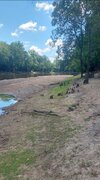
Thanks to my waterhose garden is going great. Need rain to learn my address again. Headed to Hoden beach annual trip in 1 week and garden will be at mother nature mercy. Amazed at those pioneers, farmers from yester year, espeacilly with no food lion or farmers market around.
 
Only 86 here today. Actually shot some hoops with the boy and didn’t sweat all that much. Looks like a storm is about to blow up over us again now.

Edit: pouring again.
So how much rain have you had the past couple of day?
 
If Dallas sees another 100°F high today (will be a nail biter depending on the timing of the cold front and cloud cover/precip during thr afternoon), it would be the 4th highest number on record for June, only behind 1953, 1980 and 2011.
 
That said, headed into July, there are signs that they'll be stronger blocking, which if that ends up being the case should mean a less intense and more transient death ridge.

If one's conxerned about worsening drought conditions and how high temps could get headed into the climatologically warmest part of the year, I'd think it'd be much preferred to have a truly hot/dry pattern blow its load in June (when it's still pretty wet) vs. July/August.
 
Last edited:
The Neuse rive is way down. At a nature park doing some magnet fishing but the water was all gone. Floating dock was grounded. The water line is usually at the big trees.
 

Attachments

  • Screenshot_20220626-113921_Gallery.jpg
    Screenshot_20220626-113921_Gallery.jpg
    1.7 MB · Views: 35
  • Screenshot_20220626-113852_Messages.jpg
    Screenshot_20220626-113852_Messages.jpg
    1.4 MB · Views: 35
I know how some of you NC people feel. It's dry here in the NRV, and the storms just keep missing us. We really need a big pattern change to get the Gulf into play to change out fortunes.
 
If Dallas sees another 100°F high today (will be a nail biter depending on the timing of the cold front and cloud cover/precip during thr afternoon), it would be the 4th highest number on record for June, only behind 1953, 1980 and 2011.

Officially 100°F at DFW as of 3pm.
 
GFS op looks wet next 10 days, GEFS not so much, Euro op looks relatively dry while the eps looks wet. Shows how borderline it is around here, we could easily put a dent in the drought or just as easily head into severe category
 
Thunderstorm has blown up just to my SW. Getting some rumbles from it, but got nothing more than sprinkles as it was developing overhead before moving SW.
 
GFS op looks wet next 10 days, GEFS not so much, Euro op looks relatively dry while the eps looks wet. Shows how borderline it is around here, we could easily put a dent in the drought or just as easily head into severe category
I don’t typically get too focused on forecast totals on models this time of the year unless we’re dealing with a tropical system. With how much of our rainfall right now comes from afternoon storms, I focus on if we’re in a pattern that can produce numerous storms and it appears we have that type of pattern over the next 10 days or so
 
Back
Top