Already 100°F at 1pm, day #7 for DFW.
-
Hello, please take a minute to check out our awesome content, contributed by the wonderful members of our community. We hope you'll add your own thoughts and opinions by making a free account!
You are using an out of date browser. It may not display this or other websites correctly.
You should upgrade or use an alternative browser.
You should upgrade or use an alternative browser.
Pattern June 2022
- Thread starter SD
- Start date
accu35
Member
I’m over this heat, next week looks much more normal also with rain chances thank God.
Oh my (6).png")
I find this more appealing than it showing 24" of snow in December.
You and me both. If the front early next week slows down and washes out we are sitting pretty for a decent shot a storms most of next week into the July 4th weekend with dews near above 70 for most of the week. If it's strong enough to pass through its more of the same low dews and near 90I find this more appealing than it showing 24" of snow in December.
Downeastnc
Member
You and me both. If the front early next week slows down and washes out we are sitting pretty for a decent shot a storms most of next week into the July 4th weekend with dews near above 70 for most of the week. If it's strong enough to pass through its more of the same low dews and near 90
Meh it will be the latter, we have not seen a dry stretch like this around here in probably 6-8 years......
Eps moved toward the op after 0 support at 0z so that's a good thing. Now hopefully some other models start slowing the front downMeh it will be the latter, we have not seen a dry stretch like this around here in probably 6-8 years......
BHS1975
Member
At least dews aren't bad.Already 100°F at 1pm, day #7 for DFW.
Brent
Member
Disgusting 
Early preview here. I saw the anvil leaving Atlanta and was praying the whole time it would be over the casa. 1” and still pouring.You and me both. If the front early next week slows down and washes out we are sitting pretty for a decent shot a storms most of next week into the July 4th weekend with dews near above 70 for most of the week. If it's strong enough to pass through its more of the same low dews and near 90

Last edited by a moderator:
Ain’t seen it like this in a while
Last edited by a moderator:
Today's high at DFW is 103°F, tying for the hottest day of the year to-date.
Hate. But that's awesome congratsAin’t seen it like this in a while
2.22”. Just camped out for over an hour.Hate. But that's awesome congrats
It’s not the GFS, we toss and cut totals by 7/8 thsI find this more appealing than it showing 24" of snow in December.
Rosie
Member
Jealous ?2.22”. Just camped out for over an hour.
StormStalker
Member
It's 95 but with a heat index of 94. Is that considered a wind chill..lol. Lower humidity ftw.
Shaggy
Member
Keep dreaming
BHS1975
Member
We haven't seen a good training pattern in a long time.2.22”. Just camped out for over an hour.
Downeastnc
Member
This is just horrible lol.....PGV currently at 16.16 for the year....there is a decent fire out in Hyde county....


 www.wral.com
Massive Hyde County fire reduced to 615 acres, at 25 percent containment :: WRAL.com
More than a thousand acres of land in Hyde County are still burning today, five days after the Ferebee Road fire began.
www.wral.com
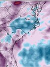
Let's play "find the urban heat island at Midnight"


The million dollar question is whether DFW will slip below 70*F for a nighttime low Monday or Tuesday, assuming no precipitation.
It might be close, and would be the first time since 6/4.
It might be close, and would be the first time since 6/4.
12am observations:


Looks like 0z euro back to pushing front through, stalls out along coast.Eps moved toward the op after 0 support at 0z so that's a good thing. Now hopefully some other models start slowing the front down
Yet another record high minimum this morning of 82*F at DFW (previous record was 80*F in 2009).
Mr good newsLooks like 0z euro back to pushing front through, stalls out along coast.
Looks like we might finally start getting into a much more classic wetter pattern as we get to the tail end of next week into the July 4th weekend and beyond. Bermuda ridge sfc pattern with a ridge to the west and a disturbed NW flow should bring realistic rain chances
BHS1975
Member
GFS still holding out on the inland stall.Mr good news
BHS1975
Member
Front looks to wash out anyway.
It's actually very close on all models to not making a full clean passage until late Wednesday. How much organized outflow we get Monday into Tuesday will probably make the difference since the front will be apt to jump into the ofb and slide through. That said if the trailing wave is strong enough it might help hold it up at least back to i40GFS still holding out on the inland stall.
Brent
Member
Headed for the hottest day of the year before it's 20 degrees cooler tomorrow afternoon 
iGRXY
Member
75 and clouds all day. Had a solid 45 minute rain that finished about 30 minutes ago. This is so much more enjoyable vs the last 2 weeks. And solid rain chances the next few days and beyond it looks like.
Shaggy
Member
It giveth and then taketh. Believe it because we suck at weather in NC outside of Roxboro.Looks like we might finally start getting into a much more classic wetter pattern as we get to the tail end of next week into the July 4th weekend and beyond. Bermuda ridge sfc pattern with a ridge to the west and a disturbed NW flow should bring realistic rain chances
Attachments
100°F at DFW as of 3pm, making this the 8th day of the year.
Only 86 here today. Actually shot some hoops with the boy and didn’t sweat all that much. Looks like a storm is about to blow up over us again now.
Edit: pouring again.
Edit: pouring again.
Last edited:
If nothing else you remind me daily that as bad as summer can be here, it's 10x better than there.100°F at DFW as of 3pm, making this the 8th day of the year.
GFS looks good! These rain totals in iowa for last nights storm complex! Some people got 6-7” over a few hours! 

Today's high at DFW was 101°F.
BHS1975
Member
RDU averages only one 100 degree day a year and we had ours already lol.If nothing else you remind me daily that as bad as summer can be here, it's 10x better than there.
Brent
Member
If nothing else you remind me daily that as bad as summer can be here, it's 10x better than there.
We hit 101 today but it was only our second 100+ day.. still better than Dallas ? where they've apparently had more 100+ days than last year already
And we get a break... 80s the next 4 days(Dallas will still be hot tomorrow). I can't wait. Just for the record our LOW this morning was 82. We may be lucky to see 82 tomorrow and Monday
Even beyond that it's nothing crazy. Nothing close to 100 til after the 4th it appears