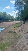
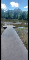
Thanks to my waterhose garden is going great. Need rain to learn my address again. Headed to Hoden beach annual trip in 1 week and garden will be at mother nature mercy. Amazed at those pioneers, farmers from yester year, espeacilly with no food lion or farmers market around.
-
Hello, please take a minute to check out our awesome content, contributed by the wonderful members of our community. We hope you'll add your own thoughts and opinions by making a free account!
You are using an out of date browser. It may not display this or other websites correctly.
You should upgrade or use an alternative browser.
You should upgrade or use an alternative browser.
Pattern June 2022
- Thread starter SD
- Start date
So how much rain have you had the past couple of day?Only 86 here today. Actually shot some hoops with the boy and didn’t sweat all that much. Looks like a storm is about to blow up over us again now.
Edit: pouring again.
Iceagewhereartthou
Member
I mean CAE has already had 5 days at 100 or more this month, with a high of 103. That place is just brutal. ?If nothing else you remind me daily that as bad as summer can be here, it's 10x better than there.
J1C1111
Member
Yes it is. Way to hot for me down there. It's hot enough up here for me.I mean CAE has already had 5 days at 100 or more this month, with a high of 103. That place is just brutal. ?
If Dallas sees another 100°F high today (will be a nail biter depending on the timing of the cold front and cloud cover/precip during thr afternoon), it would be the 4th highest number on record for June, only behind 1953, 1980 and 2011.
That said, headed into July, there are signs that they'll be stronger blocking, which if that ends up being the case should mean a less intense and more transient death ridge.
If one's conxerned about worsening drought conditions and how high temps could get headed into the climatologically warmest part of the year, I'd think it'd be much preferred to have a truly hot/dry pattern blow its load in June (when it's still pretty wet) vs. July/August.
If one's conxerned about worsening drought conditions and how high temps could get headed into the climatologically warmest part of the year, I'd think it'd be much preferred to have a truly hot/dry pattern blow its load in June (when it's still pretty wet) vs. July/August.
Last edited:
Close to 2.5”. The daily change in my yard and garden is amazing.So how much rain have you had the past couple of day?
We got a nice soaker Friday night up here at camp outside of Rosman. This week looks excellent temp wise
Brent
Member
Down to 75 here. We havent even had a low this low in awhile ?
Rosie
Member
Only .98 so far this month??Close to 2.5”. The daily change in my yard and garden is amazing.
Shaggy
Member
SWVAwxfan
Member
I know how some of you NC people feel. It's dry here in the NRV, and the storms just keep missing us. We really need a big pattern change to get the Gulf into play to change out fortunes.
If Dallas sees another 100°F high today (will be a nail biter depending on the timing of the cold front and cloud cover/precip during thr afternoon), it would be the 4th highest number on record for June, only behind 1953, 1980 and 2011.
Officially 100°F at DFW as of 3pm.
Brent
Member
84 and sunny here. Low humidity and a breeze. I could live with this all summer
Officially 100°F at DFW as of 3pm.
Today's high was 101°F.
iGRXY
Member
2 solid rain events today. Showers finally letting up after a solid couple hours of rainfall. Hopefully we can keep this going
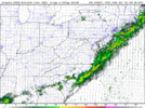
GFS op looks wet next 10 days, GEFS not so much, Euro op looks relatively dry while the eps looks wet. Shows how borderline it is around here, we could easily put a dent in the drought or just as easily head into severe category
Thunderstorm has blown up just to my SW. Getting some rumbles from it, but got nothing more than sprinkles as it was developing overhead before moving SW.
I don’t typically get too focused on forecast totals on models this time of the year unless we’re dealing with a tropical system. With how much of our rainfall right now comes from afternoon storms, I focus on if we’re in a pattern that can produce numerous storms and it appears we have that type of pattern over the next 10 days or soGFS op looks wet next 10 days, GEFS not so much, Euro op looks relatively dry while the eps looks wet. Shows how borderline it is around here, we could easily put a dent in the drought or just as easily head into severe category
Brent
Member
The 4th of July is next week and my patio and windows are open crazy
Downeastnc
Member
Forecast is very bullish for lots of storms around here anytime after 2:00 pm.
LickWx
Member
Idk, we don’t usually do good on the days the forecast is bullish ?Forecast is very bullish for lots of storms around here anytime after 2:00 pm.
smast16
Member
This will verify, Rain hole over Forysth.
0.88" for the month, picked up a whopping 0.07" yesterday. If i miss on storms tonight it's all but written i'll be under 1" for the month.
Twice last week saw a deer walking around in the yards, out in the open, around 2pm. Send rain.
smast16
Member
The problem we face now in NC is if we get a big gully washer it'll just run off. Our Packed clay soils are notorious for becoming Hydrophobic when dry.
LickWx
Member
They also hold what water is in them real well if I’m not mistaken . You and Shane should move in together . Your crap luck with Shane’s and you’ll create the worlds driest location.The problem we face now in NC is if we get a big gully washer it'll just run off. Our Packed clay soils are notorious for becoming Hydrophobic when dry.
smast16
Member
That is correct. They will hold water really well when saturated, but I didn't think discussing that was useful as we have obviously exhausted the moisture available in the top 4-6 inches of soil based on the grasses...They also hold what water is in them real well if I’m not mistaken . You and Shane should move in together . Your crap luck with Shane’s and you’ll create the worlds driest location.
On most years you could add @RainlessSnowless & Grumpy but he's got rain this month.
smast16
Member
Rosie
Member
It is raining?????
smast16
Member
smast16
Member
Come on man you know the rules, always say it will never rain, crank up the sprinklers, wash the car, fire up the grill. Only then it might actually rain.
- Joined
- Jan 5, 2017
- Messages
- 3,769
- Reaction score
- 5,966
Rain! Finally! .11 so far.
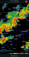
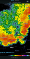
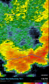
Looks like a pretty healthy line of storms coming this way.
Orange county scanner saying possible funnel cloud near Buckhorn road. Near Ems Station 4
Rain! Finally! .11 so far.
Not here. I can't tell you how many 60-70% supposed chances we've had this year with nothing. Glad you're getting some, I did get a little yesterday. I'm still under four inches since May.
I think what they were looking at just passed over me. Was a lowered section of coulds in front of the main precip, but didn't see any rotation.Orange county scanner saying possible funnel cloud near Buckhorn road. Near Ems Station 4
Heavy rain here at the office in north Raleigh.
Looks like round two is incoming.
Big storm rolling through southern Greenville county now. She’s throwing down

