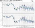
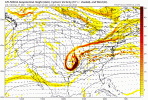
This is a beautiful sight to behold on the 12Z EURO. I'd love to see where this would go past 10 days.


I’ve been excited about it just to get stoned by the warm crowd who just says every run is dumpster fire even when it’s not even remotely ? I just stop responding and I’ll be excited in my own world lolHey just saying all I've seen for the past 30 days are day 13, 14, 15, 16 red maps with oof, crickets and golf emojis weird that when it looks decent it's quiet
Lookong forward to seeing this potential evolve. Just hope it doesnt ride up through TN-eastern KY.I’ve been excited about it just to get stoned by the warm crowd who just says every run is dumpster fire even when it’s not even remotely ? I just stop responding and I’ll be excited in my own world lol
It'd be touchy, wave coming down into the lakes might help suppress out front and a new arctic boundary is drifting east as the low was getting going in the gulf. The jet was pretty far left though. If the wave in the lakes were even 24 hours faster we likely see a lower amp version and go snow/ice across a good part of the board. All in all day 16 but nice to see winter still existsSurprised you think it will turn that late. Id be happy if WNC cashed in.
Another Lee side shut out...very believableIf this ends up being another metwannabe special I’m gonna flip View attachment 99533
Been looking at this image for 5 straight weeks now.This is a beautiful sight to behold on the 12Z EURO. I'd love to see where this would go past 10 days.

trough near the Aleutians looks different then the past 5 weeksBeen looking at this image for 5 straight weeks now.
EPS looks like it’s trying to western ridgeCan't say I'm a giant fan of the eps mean but the control flipping about 50 degrees cooler across the central US vs 0z tells me there's a ton to iron out post D7
You made me look and I see it later in the run and the jet is starting to retract too which should allow for more pac ridging. Sometimes though I feel like the way the gfs and gefs drive this pattern is a better way for sustained cool to cold and the eps mean has some fail points.EPS looks like it’s trying to western ridge
Yellows and oranges over the SE look the sametrough near the Aleutians looks different then the past 5 weeks

Euro and Canadian have shown something similar but not today so who knowsIs there anything to this on the GFS or should I just pay it no mind?
Is there anything to this on the GFS or should I just pay it no mind?
Happened last year around the same time for areas around ATL lolAnytime I see anafrontal snow I laugh like Henry from Goodfellas.
It ain’t happening.
Sent from my iPhone using Tapatalk
Happened last year around the same time for areas around ATL lol
Pics or it didn't happenJust saw the eps plumes
View attachment 99557
Here is the wxbell version it's not very helpfulPics or it didn't happen


It hasnt happened yet, that's why its a forecast.Pics or it didn't happen
Need a weak secondary low to form up and track over Fla. Then we are money, if the cold gets in. And it times right...and the haints don't get it, and a butterfly in Peru doesn't sneeze, and more of us have been good rather than bad, and we all wish real hard, but yeah, there's a chance for some flurries, or a mega storm. It's a mystery of life ....if, if, ifIs there anything to this on the GFS or should I just pay it no mind?
One thing I have noticed about living in the shadow of the Apps. for 57 years, is that the cold must get in here first to have a good winter storm. Sure, I have seen changeovers here before, but they rarely amount to much. Betting on a changeover from rain to accumulating snow in the Foothills/Piedmont is a fools errand. Down-sloping will dry it up 95% of the time.Monster anal frontView attachment 99575
Oh for sureOne thing I have noticed about living in the shadow of the Apps. for 57 years, is that the cold must get in here first to have a good winter storm. Sure, I have seen changeovers here before, but they rarely amount to much. Betting on a changeover from rain to accumulating snow in the Foothills/Piedmont is a fools errand. Down-sloping will dry it up 95% of the time.
I've seen a many disappointing 1600ft snows especially when I worked in north cove at Baxter. So unless a low trys to pop on the tail its a no go.One thing I have noticed about living in the shadow of the Apps. for 57 years, is that the cold must get in here first to have a good winter storm. Sure, I have seen changeovers here before, but they rarely amount to much. Betting on a changeover from rain to accumulating snow in the Foothills/Piedmont is a fools errand. Down-sloping will dry it up 95% of the time.

