-
Hello, please take a minute to check out our awesome content, contributed by the wonderful members of our community. We hope you'll add your own thoughts and opinions by making a free account!
You are using an out of date browser. It may not display this or other websites correctly.
You should upgrade or use an alternative browser.
You should upgrade or use an alternative browser.
Pattern Januworry
- Thread starter SD
- Start date
Brent
Member
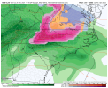
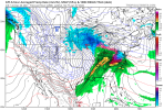
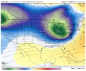
Musing while waiting for the GFS to shake up things. A forecast like this for Atlanta is on my bucket list.


Dewpoint Dan
Member
An inch of ice and up to 20" of snow in the same storm. Not sure any city in the SE has ever experienced that kind of storm.Musing while waiting for the GFS to shake up things. A forecast like this for Atlanta is on my bucket list.

In recorded history, probably not. But, given the right circumstances, it could happen.An inch of ice and up to 20" of snow in the same storm. Not sure any city in the SE has ever experienced that kind of storm.
Dewpoint Dan
Member
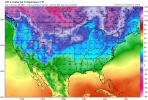
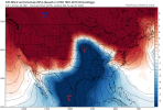
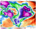
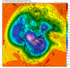
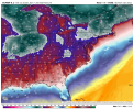
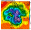
I think wall to wall literally means the entire country. South Florida says hello ?Nice Wall to Wall U.S. cold. View attachment 99247
We have. It’s just a broad warning covering valleys/mtns. It’s unlikely the same spot gets 20” snow and 1” ice it’s accounting for different elevations of the same general area. Western NC has seen heavy snow events with parts of the county getting heavy ice and lesser snow accums.An inch of ice and up to 20" of snow in the same storm. Not sure any city in the SE has ever experienced that kind of storm.
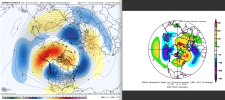
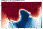
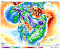
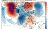
We’ve got to crawl before we can walk. I’m liking the evolution at 500mb up around AK bridging through the Arctic. Shakeup seems to be underway. I don’t know how much more Seattle snow I can take..if this doesn’t dump big time cold into the US idk what willNice Wall to Wall U.S. cold. View attachment 99247
We don’t count South Florida. Only time the have had flurries down there was in January 1977.I think wall to wall literally means the entire country. South Florida says hello ?
I’ve always wondered if we could look back over the past 500-1,000 years what the record snowfall is for locations in the SE. would be wild if there was a monster storm in the 1300s that dropped 30” from CLT to RDUIn recorded history, probably not. But, given the right circumstances, it could happen.
Man I just want to see this evolution up top coupled with Aleutian low/+PNA..definitely see those lower heights sliding into position off the west coast while this is happening. How transient will it be? Who tf knows.
Could be a faucet dripper ?
Could be a faucet dripper ?
NBAcentel
Member
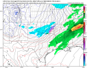
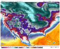
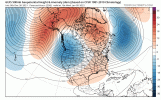
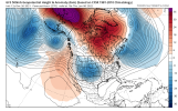
It’s fantasy, but with that look above and the monster Aleutian low forming would lead to this.We’ve got to crawl before we can walk. I’m liking the evolution at 500mb up around AK bridging through the Arctic. Shakeup seems to be underway. I don’t know how much more Seattle snow I can take..if this doesn’t dump big time cold into the US idk what will View attachment 99248
Dewpoint Dan
Member
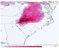
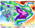
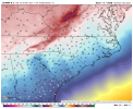
Can the Carolinas ever get a winter storm without a wedge in place ? That's kind of cheating. ?I doubt it but you love to see a wedge signature inside 300hr lolView attachment 99253
NBAcentel
Member
If we could get a high pressure to drop into MN or WI instead of western MT, we would probably get a snowstorm. Should have some moisture available to tap down south with that look.It’s fantasy, but with that look above and the monster Aleutian low forming would lead to this.
View attachment 99252
I like the baby steps toward the +PNA there.If we could get a high pressure to drop into MN or WI instead of western MT, we would probably get a snowstorm. Should have some moisture available to tap down south with that look.
Sort of need it. Some places in Climo favored spots in the northern and eastern portions of NC can score with the initial cold push. Mountains make make it hard for those in the shadow of them. But most of us need it locked in place for a “good” snow.Can the Carolinas ever get a winter storm without a wedge in place ? That's kind of cheating. ?
cd2play
Member
It's never going to snow again.
NBAcentel
Member
It’s going to get better. Getting in a better climatology time for us and plus getting a better pattern in about 10 days.It's never going to snow again.
NBAcentel
Member
Snowman63
Member
cd2play
Member
Gives TN Ana front snow
Ron Burgundy
Member
Hell, that gives Dothan anafrontal snow.Gives TN Ana front snow
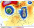
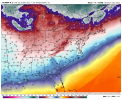
I rain!?1059 dropping down in early January should help ? View attachment 99257
Don’t count this idea out. We have already had a couple Ana Fronts already this year. (Even through it was rain).Gives TN Ana front snow
Trends this weekend toward a much colder January overall vs December have been amazingly good on the globals and the CFS! If this is another headfake, I’m giving up lol. Last Saturday’s headfake caved on Sunday. This time, it isn’t just not caving today, it is intensifying. Guidance is even showing signs especially on the EPS toward a more neutral PNA by late week 2 with an Aleutian trough/+PNA quite possible around the 2 week point or soon after. One thing I suspect is helping a lot is a much improved GEFS AO forecast, which as of just a few days ago was heading to neutral:
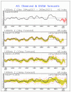
The NAO forecast even looks slightly better with neutral rather than slight positive late.
So, -AO with a new +PNA and soon after maybe a phase 8-1-2 MJO possibly low amplitude? Thats all promising for it not being a headfake.

The NAO forecast even looks slightly better with neutral rather than slight positive late.
So, -AO with a new +PNA and soon after maybe a phase 8-1-2 MJO possibly low amplitude? Thats all promising for it not being a headfake.
The PNA has slowly been trending less negative over the past couple of days, so hopefully no more headfakes!Trends this weekend toward a much colder January overall vs December have been amazingly good on the globals and the CFS! If this is another headfake, I’m giving up lol. Last Saturday’s headfake caved on Sunday. This time, it isn’t just not caving today, it is intensifying. Guidance is even showing signs especially on the EPS toward a more neutral PNA by late week 2 with an Aleutian trough/+PNA quite possible around the 2 week point or soon after. One thing I suspect is helping a lot is a much improved GEFS AO forecast, which as of just a few days ago was heading to neutral:
View attachment 99269
The NAO forecast even looks slightly better with neutral rather than slight positive late.
So, -AO with a new +PNA and soon after maybe a phase 8-1-2 MJO possibly low amplitude? Thats all promising for it not being a headfake.
NBAcentel
Member
NBAcentel
Member
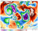
Wow, Euro with a massive abrupt pattern change. If it verified, it would be some Midwest type stuff. Severe weather to back side snow. 70s for highs one day to 40s or lower for highs the next.
Stephenb888
Member
Relax guys. The artic air will come in January. And it’s not gonna be just a cold shot here or there it’s gonna be legit. The pattern is going to change rapidly and catch some off guard. You will start to see it reflect in the models this coming weekend. Be patient.
Nobody wanted to listen.Wow, Euro with a massive abrupt pattern change. If it verified, it would be some Midwest type stuff. Severe weather to back side snow. 70s for highs one day to 40s or lower for highs the next.

