-
Hello, please take a minute to check out our awesome content, contributed by the wonderful members of our community. We hope you'll add your own thoughts and opinions by making a free account!
You are using an out of date browser. It may not display this or other websites correctly.
You should upgrade or use an alternative browser.
You should upgrade or use an alternative browser.
Pattern Januworry
- Thread starter SD
- Start date
- Joined
- Jan 2, 2017
- Messages
- 1,566
- Reaction score
- 4,279
Reel it in Fro! I'll be up close to Charlotte for January and February but home on weekends. Would like an i85 special to drive in...not but I really doLol that confluence on the GFS has us with <0 850s for days, it would be a perfect opportunity to throw a southern stream wave into that
Not this again. With Februay usually being known as a warm month for the SE during La Nina seasons, we can't afford to kick the can down the road much. Thankfuly this just one GFS op run. I wait until we get into the 0z model runs before I starting freaking out or seeing this as a possible trend.
Actually, it still looks cold for 1/3-7, regardless. That by itself makes it a good run to me as that wasn’t the case just a few days ago. So, I’ve decided I shouldn’t toss after all.
Mr. Golf
Member
Actually, it still looks cold for 1/3-7, regardless. That by itself makes it a good run to me as that wasn’t the case just a few days ago. So, I’ve decided I shouldn’t toss after all.
Remember Larry ensembles is what we focus on in the long term in particular
I guess it comes down to if it's a brief cold shot then torch or a real pattern change. The next few days will tell us that.Actually, it still looks cold for 1/3-7, regardless. That by itself makes it a good run to me as that wasn’t the case just a few days ago. So, I’ve decided I shouldn’t toss after all.
bigstick10
Member
Can we nuke the SER????
cd2play
Member
It would do no good, because then another one would just pop up.Can we nuke the SER????
It’s cold tho!That run almost entirely sucked. Not enough lipstick to put on that pig.
Start here:
View attachment 99311
End here:
View attachment 99312
And the in-between panels weren't much better.
Mr. Golf
Member
FWIW, the 18zgefs was much different than 18zgfs
Last edited:
the cold wave hasn’t even been sampled yet ?That run almost entirely sucked. Not enough lipstick to put on that pig.
Start here:
View attachment 99311
End here:
View attachment 99312
And the in-between panels weren't much better.
NBAcentel
Member
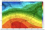
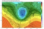
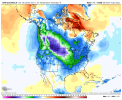
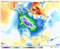
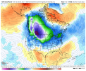
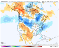
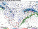
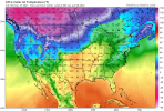
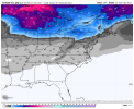
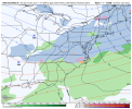
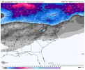
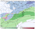
Nice. Looks like Montana and the Dakota are in for a nice wintry period. Looks like the SE might get near average or a ittle below. At least we have a lot of winter left and the model may not be handling things correctly.Yeah the gefs was actually better then it’s 12z run View attachment 99314View attachment 99315View attachment 99316View attachment 99317
Who decided that? Can temperatures really be that accurate that far out? I'm actually curious lol.Ordinarily we would have a lot of winter left but hasn't it been decided that February will be warm ? If so we only have a month left.
Stormlover
Member

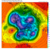
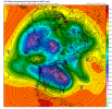
Pushing that ridge back...
Stormlover
Member
No they can't. Not sure who he claims decided that. Only God knows, and because something shows that, or someone claimed that, doesn't mean it was "decided"Who decided that? Can temperatures really be that accurate that far out? I'm actually curious lol.
Mr. Golf
Member
The cpc forecasts on the weekend are computer generated with no forecaster input. Guess we all knew that ?. Or did we??
Pushing that ridge back...
Stormlover
Member
Yeah, what's your point? Sure, humans may adjust them some, but that's the trend.The cpc forecasts on the weekend are computer generated with no forecaster input. Guess we all knew that ?. Or did we??
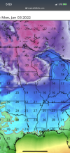
Final map.


StormWatch
Member
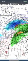
0z GFS tried with the system on the 2nd/3rd. The trough would need to dig down a bit more for something more significant. It's still a frontal system with an embedded low. Not that bad though for it to be in the time frame it's in. Still lots of time for positive changes (or negative) for winter storm development.


Stephenb888
Member
Any chance this can improve to give upstate Sc a chance or not really since it’s an anal front?0z GFS tried with the system on the 2nd/3rd. The trough would need to dig down a bit more for something more significant. It's still a frontal system with an embedded low. Not that bad though for it to be in the time frame it's in. Still lots of time for positive changes (or negative) for winter storm development.
CMC continues to show it.


It tries to develop a low on the front. Like a hybrid. Miller B setup I guess you could say.
StormWatch
Member
It does have the chance to improve. By the 0z run, the upper level vorticity is being strung out (sheard) by a fast flow in addition to higher heights building behind the trough to the west which isn't good, cause it would cause the system to push out quickly. Right now, it's looking best for snow along and west of the mountains of the Southeast. But, some snow could make it east of the mountains if the vorticity doesn't get sheard out even more by the mountains.Any chance this can improve to give upstate Sc a chance or not really since it’s an anal front?


It’s actually not too bad there is a ridge but there’s also much mor which pressure systems trying to mingle with our weather .. CAD magnetLater in the 0Z GEFS it doesn’t look so good. Not this crap again. And the 0Z GFS stinks too.
It’s actually not too bad there is a ridge but there’s also much mor which pressure systems trying to mingle with our weather .. CAD magnet
I’m not talking about CAD. I’m talking about the H5 pattern. It looks ugly.
Ya I was gonna comment but figured just leave it alone tonight. lol. Goes right back to current pattern.Later in the 0Z GEFS it doesn’t look so good. Not this crap again. And the 0Z GFS stinks too.
Things can change let’s worry about this anal front before we have to worry about thatI’m not talking about CAD. I’m talking about the H5 pattern. It looks ugly.
The CMC still solidly moved the ridge out of the Aleutians to the north of Alaska by day ten much as the earlier GFS runs have been doing. So it's far from settled. Euro will be interesting, to say the least.I’m not talking about CAD. I’m talking about the H5 pattern. It looks ugly.

The CMC still solidly moved the ridge out of the Aleutians to the north of Alaska by day ten much as the earlier GFS runs have been doing. So it's far from settled. Euro will be interesting, to say the least.

Unfortunately, the 0Z EPS was a bit warmer on most days in the SE vs the 12Z EPS though not terribly warmer. Hopefully the GEFS and EPS will reverse back colder by 12Z. If this ends up to be another headfake………….never mind. I’ll try to stay positive.
Last edited:
NBAcentel
Member
NBAcentel
Member
D
Deleted member 1449
Guest
I want to be the first to point out how grossly warm the soil temps will be after days-on-end in the 70s.
NBAcentel
Member
I’m just wanting to see snowflakes fall.I want to be the first to point out how grossly warm the soil temps will be after days-on-end in the 70s.

