• Hello, please take a minute to check out our awesome content, contributed by the wonderful members of our community. We hope you'll add your own thoughts and opinions by making a free account!

Pattern Januworry

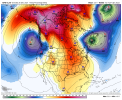
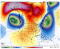
I read years back (forgot where) that the mid-winter thaw was a real thing. Dominant patterns would relax for a period before taking back over to close the winter. If you were having a cold winter the thaw would represent a warmer pattern. But the opposite was also part of the equation. If you were having a warm winter (with say a dominant -PNA) this would flip (or relax) to the opposite value giving you a cold period. I believe the "Carolina Crusher" year was a overall warm year with one flip to cold in late January into early February. With the way these models look this is what I'm hoping for now.
 
Last edited:
A -NAO is not a snow pattern. You can copy and paste text describing indexes, but that doesn't tell you about a pattern that is good for snow. A winter storm pattern is more than an index. The data you described above says that there is a positive correlation to a -NAO and particularly within an El Nino. I'm not going to dare ask you why that is the case, but the El Nino case is not applicable this year. Just let me know when you look at a map and see a snowy pattern and we'll talk about it then.

Well, that's what I am talking about when I say the overall global pattern in general doesn't produce as often now as it has in the past when we do have the factors that are talked about in this study. Not sure why you have to be a jerk about it anyway. You're coming off as pompous and condescending.
 
The end of the 12Z EPS will probably not be liked as much by SE cold desirers as compared to the 0Z EPS ending. More SER on 12Z late.
 
Well, that's what I am talking about when I say the overall global pattern in general doesn't produce as often now as it has in the past when we do have the factors that are talked about in this study. Not sure why you have to be a jerk about it anyway. You're coming off as pompous and condescending.
What I'm trying to say is that a -NAO in and of itself isn't a snowy pattern. We haven't had very many winters with a -NAO anyway. The conclusions you're drawing are not well founded. You can't really say that a good pattern doesn't produce snow anymore until we actually get a good pattern, or lots of them, and they don't produce. What I'm trying to tell you is that we have not had very many actual good winter weather producing patterns. We may get one component in our favor here or there, but it takes more than a -NAO to get a snowy pattern. Just show me when you see one. Until then, there's not much point in arguing about abstracts.
 
  • Like
Reactions: SD
I

I’m honestly not a firm believer in MJO. If there’s a +PNA I personally don’t think the MJO matters
Well, the real essential question is, what causes that +PNA? I think that tropical forcing is much more significant than many people realize. While the MJO is not the only indicator, there are a lot of factors that you really have to have an eye for to predict. That's why I rely so heavily on people like Webber & HM.
 
I

I’m honestly not a firm believer in MJO. If there’s a +PNA I personally don’t think the MJO matters

I still think the very warm Maritime Continent is a problem as widespread convection continues there making the MJO act like it is still in the MC. This is somewhat correlated to a stubborn SER in the means. See BAMWx recent videos that @NCHighCountryWX has been posting. You can sure hear the intense frustration in the tone of the videos as they note the long delays in the MJO movement.

Fwiw though and as I’ve posted, history back to 1975 strongly suggests that it is a matter of when and not if as regards the move toward phase 8. Now it may take another 3 weeks lol as there have been several cases when it seemingly gets stuck in phase 7 and it may go inside left side of COD then, but history says it won’t stay in 7 and then back up to MC phases. We’ll see!
 
Last edited:
Easy to see why things are failing. Tropical forcing is holding on for dear life around the maritime continent thru day 11 View attachment 98728

That's what's been killing us year after year. Only thing we got is we actually have cold air building up in the source region this year which wouldn't need as much of a favorable pattern to produce.


Sent from my iPhone using Tapatalk
 
I still think the very warm Maritime Continent is a problem as widespread convection continues there making the MJO act like it is still in the MC. This is somewhat correlated to a stubborn SER in the means. See BAMWx recent videos that @NCHighCountryWX has been posting. You can sure hear the intense frustration in the tone of the videos as they note the long delays in the MJO movement.

Fwiw though and as I’ve posted, history back to 1975 strongly suggests that it is a matter of when and not if as regards the move toward phase 8. Now it may take another 3 weeks lol as there have been several cases when it seemingly gets stuck in phase 7 and it may go inside left side of COD then, but history says it won’t stay in 7 and then back up to MC phases. We’ll see!
If it backs into o 6, then we’re just not supposed to have cold and snow this year.
 
Is there anyway to relax the -pna to allow the big cold to head se? I'm personally not a big fan of laniña to be honest
 
Back
Top