-
Hello, please take a minute to check out our awesome content, contributed by the wonderful members of our community. We hope you'll add your own thoughts and opinions by making a free account!
You are using an out of date browser. It may not display this or other websites correctly.
You should upgrade or use an alternative browser.
You should upgrade or use an alternative browser.
Pattern Januworry
- Thread starter SD
- Start date
Cad Wedge NC
Member
Maybe a "back of the pants" blow out.
Webberweather53
Meteorologist
Do you still think that we will still see a pattern flip in early January
I personally am under the impression early-mid January is our only real shot here. Don't have much faith in February during La Nina, esp when it looks like subseasonal forcing may strongly favor warmth (even more so than now)
Still think blocking will help us in the end the -NAO will come thru for cold rain CAD partiesI personally am under the impression early-mid January is our only real shot here. Don't have much faith in February during La Nina, esp when it looks like subseasonal forcing may strongly favor warmth (even more so than now)
I personally am under the impression early-mid January is our only real shot here. Don't have much faith in February during La Nina, esp when it looks like subseasonal forcing may strongly favor warmth (even more so than now)
Regarding that EPS trend toward a stronger -NAO that you were showing on Thursday in animation for what was then week 2, has that continued to hold?
@Myfrotho704_ I'm bored with this game and want to discuss weather. What do you see in this that would lead to a shake up? Nicky didn't agree with my analysis of the map but wouldn't answer when I asked him how it would shake up. lol Just curious what you see that I don't taking this verbatim?Not mad eventually this would get shaked up with that look View attachment 98490
Webberweather53
Meteorologist
Regarding that EPS trend toward a stronger -NAO that you were showing on Thursday in animation for what was then week 2, has that continued to hold?
It's trending more towards the Baffin Bay but it's not doing us any good other than tempering a would be record-breaking torch pattern.
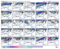
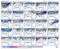
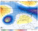
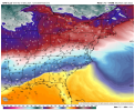
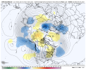
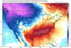
Although the 12Z EPS was clearly warmer than 0Z as Webb showed, the 360 hour map, itself, isn’t a bad look to me as regards the potential evolution to a much better pattern in early January:
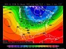
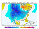
Of course, I realize that having to look at ends of runs for hope is getting old and we need to see more forward progress to resume like it was doing nicely before. We probably need the MJO to finally get to phase 8.


Of course, I realize that having to look at ends of runs for hope is getting old and we need to see more forward progress to resume like it was doing nicely before. We probably need the MJO to finally get to phase 8.
pcbjr
Member
+PNA ... IMHO ... and now going back into the cone of silence, Maxwell ...Although the 12Z EPS was clearly warmer than 0Z as Webb showed, the 360 hour map, itself, isn’t a bad look to me as regards the potential evolution to a much better pattern in early January:
View attachment 98502View attachment 98503
Of course, I realize that having to look at ends of runs for hope is getting old and we need to see more forward progress to resume like it was doing nicely before. We probably need the MJO to finally get to phase 8.
NBAcentel
Member
There would probably be a attempt at a ridge bridge from the -NAO and AK ridge which would initially try to slide the TPV east, and if that failed (probably would have) we would have to wait for another series of -PNA due to that energy diving down north of AK, all we need is the ridge to get close to the western US and that would be enough for a conus trough@Myfrotho704_ I'm bored with this game and want to discuss weather. What do you see in this that would lead to a shake up? Nicky didn't agree with my analysis of the map but wouldn't answer when I asked him how it would shake up. lol Just curious what you see that I don't taking this verbatim?
Now you may have a point there. I think a conus trough is more likely than a +PNA east coast trough at this point. At least for awhile. A ridge bridge would be ok. If we went that route though I wouldn't want to lose the blocking over Greenland. If we lost the NAO we'd essentially be looking at a strong -AO and Aluetian ridge. A strong-AO is good to see but it only guarantees the Arctic is dumped somewhere but the other indices have a say where it goes. In that case the Aleutian ridge would definitely dump it on the west. Anyway that's enough analyzing an op model at range lol on to 18ZThere would probably be a attempt at a ridge bridge from the -NAO and AK ridge which would initially try to slide the TPV east, and if that failed (probably would have) we would have to wait for another series of -PNA due to that energy diving down north of AK, all we need is the ridge to get close to the western US and that would be enough for a conus trough
It’s a step down process, that western trough will step dawn and get there by April!Not mad eventually this would get shaked up with that look
Mr. Golf
Member
Webber, I saw your diagram of phase 7 in January of enso. That would be a pretty good look if it occurs. How does that work out with a +AAM as well? Continued blocking?
Mr. Golf
Member
Also, why isnt the cold being sped up in modeling? Or what do we need to see take place for it to happen? Instead of the chasing unicorns again scenario lol
I for one hope it's still stuck in phase 7 come January and then slowly creep through 8 in mid Jan. Because you're right, phase 7 is excellent in Jan and phase 8 is right there with it. That's where the hope comes in for January. The -NAO alone isn't going to do it this time with that Pac ridge in place. But exactly how the MJO breaks that ridge down is for Webber to explain. He explained on the previous page we need to get the Pac jet to undercut it and force it north. But how or if the MJO can actually do that I do not know.Webber, I saw your diagram of phase 7 in January of enso. That would be a pretty good look if it occurs. How does that work out with a +AAM as well? Continued blocking?
Mr. Golf
Member
I for one hope it's still stuck in phase 7 come January and then slowly creep through 8 in mid Jan. Because you're right, phase 7 is excellent in Jan and phase 8 is right there with it. That's where the hope comes in for January. The -NAO alone isn't going to do it this time with that Pac ridge in place. But exactly how the MJO breaks that ridge down is for Webber to explain.
The simple point is if the models keep delaying the cold, its probably not going to happen. I guess phase 7 would be good if its there in January
NBAcentel
Member
I’m getting concerned about the NA blocking trend and GOA ridge trend, not worried but a little concernedNow you may have a point there. I think a conus trough is more likely than a +PNA east coast trough at this point. At least for awhile. A ridge bridge would be ok. If we went that route though I wouldn't want to lose the blocking over Greenland. If we lost the NAO we'd essentially be looking at a strong -AO and Aluetian ridge. A strong-AO is good to see but it only guarantees the Arctic is dumped somewhere but the other indices have a say where it goes. In that case the Aleutian ridge would definitely dump it on the west. Anyway that's enough analyzing an op model at range lol on to 18Z
Yeah like I said yesterday both of those blocks at the same time is rare and one usually destroys the other. And I'm hoping it's not the -NAO that goes. But I'm not real sure if that applies here since that's not really a -EPO ridge.I’m getting concerned about the NA blocking trend and GOA ridge trend, not worried but a little concerned
It's probably going back to phase 6.The simple point is if the models keep delaying the cold, its probably not going to happen. I guess phase 7 would be good if its there in January
Gonna take a roque , lightening catch in a bottle this year.
Im booking tee times starting wed. Cant beat em,join em. Think thats how it goes
Im booking tee times starting wed. Cant beat em,join em. Think thats how it goes
NoSnowATL
Member
Can’t ask for much more than that
NoSnowATL
Member
That’s the definition of perfection.Can’t ask for much more than that
L
Logan Is An Idiot 02
Guest
We need a positive PNA
NoSnowATL
Member
I just look for temps below 32. Then hope for moisture. With both I get snow 100% of the time.We need a positive PNA
NoSnowATL
Member
NBAcentel
Member
Although not great, finally the gfs has stronger -NAO blocking after it being weaker for 3 runs in a row and the pacific is slightly better
D
Deleted member 609
Guest
Freezing rain and sleet would like to have a word with youI just look for temps below 32. Then hope for moisture. With both I get snow 100% of the time.
NoSnowATL
Member
My guess is that we rides the 7/8 line into COD. Wishfull thinking yes but that’s my Christmas wish. Just have to be patient the next 10-14 days.Although not great, finally the gfs has stronger -NAO blocking after it being weaker for 3 runs in a row and the pacific is slightly better
NoSnowATL
Member
I’ll take that as well.Freezing rain and sleet would like to have a word with you
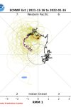
I'd like it to get solidly into 8 then ride the line between 8 and 1 into the COD in mid to late January. The later we get to the COD the later we can emerge in 4, 5 and 6.My guess is that we rides the 7/8 line into COD. Wishfull thinking yes but that’s my Christmas wish. Just have to be patient the next 10-14 days.
NBAcentel
Member
NBAcentel
Member
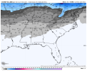
Decent gfs run with some good trends. Let's see if the gefs and 0z runs can keep it upMight get a fantasy storm View attachment 98510
NBAcentel
Member
I don’t think the -NAO breaks down as fast as the gfs shows
You're right. And it never does. But that's not really going to be our issue.I don’t think the -NAO breaks down as fast as the gfs shows
Yep our problem is still there throughout the run. It did move it a little more north and east but it's still positively tilted and dropping energy down the west coast. But that's just getting into Jan when phase 7 becomes favorable and should be close to 8 by then. There's way more than the MJO at work as you say often, but it's going to have to save the day for us the way it looks at the moment.You're right. And it never does. But that's not really going to be our issue.
NBAcentel
Member
Yeah doesn’t help that we’ve trended to a shallow GOA ridge at allYep our problem is still there throughout the run. It did move it a little more north and east but it's still positively tilted and dropping energy down the west coast. But that's just getting into Jan when phase 7 becomes favorable and should be close to 8 by then. There's way more than the MJO at work as you say often, but it's going to have to save the day for us the way it looks at the moment.
L

