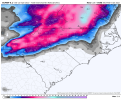
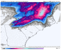
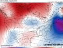
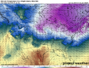
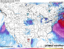
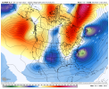
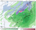
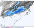
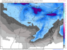
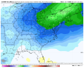
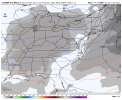
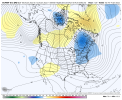
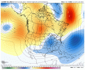
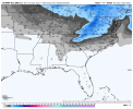
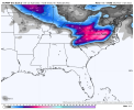
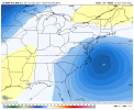
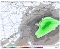
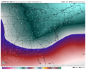
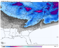
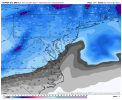
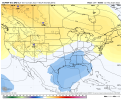
The key now does the EPS continue to support this trend .. it’s close so we should be able to see snow members continue to grow or at least maintain from last night
-
Hello, please take a minute to check out our awesome content, contributed by the wonderful members of our community. We hope you'll add your own thoughts and opinions by making a free account!
You are using an out of date browser. It may not display this or other websites correctly.
You should upgrade or use an alternative browser.
You should upgrade or use an alternative browser.
Pattern Januworry
- Thread starter SD
- Start date
Blue_Ridge_Escarpment
Member
Cary_Snow95
Member
In the past I've seen it multiple times where the triangle misses out on the first storm and gets hit with the second storm. Feb 2014 comes to mind
UKMet also looked decent for the first system that the Euro had (dropping down from the NW)


2018 all over againWake County gradient….check
Mecklenburg County gradient….check.
All systems a go!
View attachment 102954
NBAcentel
Member
NBAcentel
Member
Wow you beat me to it !!! hahaUKMet also looked decent for the first system that the Euro had (dropping down from the NW)

whatalife
Moderator
At hour 240 on the euro another system was coming in. That's three potential winter systems on 12 EURO starting at hour 150ish.


D
Deleted member 609
Guest
This looks colder than euro I think? Seems like freezing line stays south of euro.UKMet also looked decent for the first system that the Euro had (dropping down from the NW)

Cary_Snow95
Member
Maybe I missed it but did anyone have images of second system? Last I saw was hour 216. Wasn't sure if anything transpired once precip shield reached the carolinas
NBAcentel
Member
At hour 240 on the euro another system was coming in. That's three potential winter systems on 12 EURO starting at hour 150ish.
amazing euro model run, 3 ull's one after another. Need that first one to go beast mode to help us
3 waves and ridging punching up into Greenland. Did everybody go to church today or something?

Blue_Ridge_Escarpment
Member
I did my part!3 waves and ridging punching up into Greenland. Did everybody go to church today or something?

NBAcentel
Member
Blue_Ridge_Escarpment
Member
Definitely a storm signal. Love to see it.
LukeBarrette
im north of 90% of people on here so yeah
Meteorology Student
Member
2024 Supporter
2017-2023 Supporter
I went to the early service ?3 waves and ridging punching up into Greenland. Did everybody go to church today or something?

NBAcentel
Member
D
Deleted member 609
Guest
The individual maps out yet?What a satisfying trendView attachment 102970
NBAcentel
Member
NBAcentel
Member
NopeThe individual maps out yet?
NBAcentel
Member
Euro shows lots of subtropical jet stream activity with these storms as well, gonna need to trend even better because given the STJ influence, storms are more likely to come in amped/over perform/NW trend in the short term
I did, but apparently the Lord didn't honor my request to keep the red Ls from tracking through the coastal plain.3 waves and ridging punching up into Greenland. Did everybody go to church today or something?

Blue_Ridge_Escarpment
Member
Euro control looks really good as well!
Way to reel it[×3] in Myfrotho704!
Blueridge can you post control map? TIA
Blueridge can you post control map? TIA
Blue_Ridge_Escarpment
Member
NBAcentel
Member
ATLwxfan
Member
Gonna be one of those situations where far north ATL suburbs look to score but I-20 and I-85 will enjoy chilly rain. I mean it’s climo I suppose.
Sent from my iPhone using Tapatalk
Sent from my iPhone using Tapatalk
What is nice is that this has lots of time to trend better. If that energy just goes another 50-100 miles south and/or the CAD is a little stronger, there will be a lot of happy posters here. I assume from the EPS mean there are a number of those solutions on the table
This is very true. One thing though that I like is that we see this coming together at a time when there is a healthy snow pack from the Ohio Valley into the mid-Atlantic and Northeast. This set up almost reminds me of the 1/29-30/2010 stormEuro shows lots of subtropical jet stream activity with these storms as well, gonna need to trend even better because given the STJ influence, storms are more likely to come in amped/over perform/NW trend in the short term
Clem282340
Member
Do you have a closer view where we can see the county’s
Blue_Ridge_Escarpment
Member
Unfortunately it only shows that for mid AtlanticDo you have a closer view where we can see the county’s
Actually as modeled, the E and NE burbs and N&E from there are in the game. Wudge. Gainsville, Tacoa, etc. I'm on the fringe.Gonna be one of those situations where far north ATL suburbs look to score but I-20 and I-85 will enjoy chilly rain. I mean it’s climo I suppose.
Sent from my iPhone using Tapatalk
What did we do to deserve such trends!? My heavens! Give me Miller B or give me DEATH! That eps run should ultimately help out the system coming behind it
If we continue to see this type of stuff on the rest of the days models.. dare I say a thread to be made?
NBAcentel
Member

