NBAcentel
Member
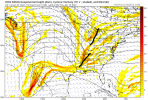
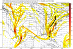
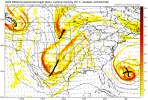
I mean lacking ever so slightly I’m saying if this is amplified at all or the rates were heavier this would easily be wet snow .. it’s easier to get over BL temps at 35 then at 40ICON really tries but cold air is lacking View attachment 102433View attachment 102434View attachment 102435
Def providing rates are equal. Weve already had our seasonal allotment of wet snow. Its big dawg time.I mean lacking ever so slightly I’m saying if this is amplified at all or the rates were heavier this would easily be wet snow .. it’s easier to get over BL temps at 35 then at 40
Certainly potential with that icon look thoI mean lacking ever so slightly I’m saying if this is amplified at all or the rates were heavier this would easily be wet snow .. it’s easier to get over BL temps at 35 then at 40
Looks good for the NW piedmont foothills Mtns. I'd like to see other model agreement but interesting for sure.Certainly potential with that icon look tho
Pixie dust!!!If I’m doing the math right in my head, that’s a 50:1 ratio. That is pure powder.
The interesting thing is, this is one of those brief cool shots. It's not overwhelmingly cold, as you show, but it's possibly cold enough, at least for some locations. And it could trend even better.ICON really tries but cold air is lacking View attachment 102433View attachment 102434View attachment 102435


Absolutely… at the very least we are in a pattern that something can come together quickly to give us a chance simply because we have a normal January airmassThe interesting thing is, this is one of those brief cool shots. It's not overwhelmingly cold, as you show, but it's possibly cold enough, at least for some locations. And it could trend even better.
At 138, like you showed, there is a lot of vorticity. You have two kind of messy waves approaching the eastern seaboard. They actually remain apart as the move through our area but then consolidate by the end of the run.
View attachment 102442
At 150, they are getting together...you can see the base of the trough start to take on a neutral tilt. This is when the light precip occurs. Not enough dynamic cooling to support snow, but it's close.
View attachment 102443
By 180, the system has consolidated, and you have a two contour upper low off the SE coast. And we have a similar situation inbound (except my guess is that the process would happen too soon for us if the model kept going).
View attachment 102444
Suppose the initial system got its act together 24 hours or so sooner? I haven't checked layers, but assuming we don't have a warm nose, that's probably a heavy wet snow event for more than a few folks.
It goes back to what I was saying earlier. You don't need big weenie 300 hour snowstorms. You need mid-January cold air and the puzzle pieces on the table. Sometimes the puzzle gets put together.
Belize? Guatemala?Where’s a gulf low when you need it?View attachment 102445
January 2018 was pretty cold. The snow was so powdery you couldn't do anything with it.2014 was the last “cold” snow in ATL I think.
Sent from my iPhone using Tapatalk
January 2018 was pretty cold. The snow was so powdery you couldn't do anything with it.
I hear you fro, it has really been almost impossible to get the cold to materialize, especially east of the mtns the past couple of years. We know what happened last Feb and so far this year there has been a lot of cold around the country but it still hasn't come east of the Apps, with the only real exception being the snow in VA last week.Yep, I’m literally not even trying to be a heat miser or whatever I’m getting the rep of, I’m just showing a trend I don’t like, I legitimately want it to snow so bad and it’s frustrating seeing things delay in every possible way, like this week/early next week looked so much better back then until the pacific jet went to Far East and extended to Far East which is still good for cold, but sucks for snow, and now this issue, here’s to hoping that really cold post hour 300 makes it here because that signal is extremely impressive.
January 2018 was pretty cold. The snow was so powdery you couldn't do anything with it.
I hear you fro, it has really been almost impossible to get the cold to materialize, especially east of the mtns the past couple of years. We know what happened last Feb and so far this year there has been a lot of cold around the country but it still hasn't come east of the Apps, with the only real exception being the snow in VA last week.
So far this cold weather season (Nov to present) GSP's lowest temp has only been down to 25 (and that was Nov) and the lowest highs only down to 45. For CLT the lowest numbers have been 23 and 45. For RDU its 24 and 41. Let's be honest, those are incredibly wimpy cold numbers and will not produce snow outside of a perfectly timed system, and those are rare. The pattern since Jan 2018 has basically been for the cold to always dump West of the Apps. It is great seeing the cold modeled for us but it has to progress inside of fantasy range and actually materialize. Kicking the can down the road runs us into Spring eventually. I am hopeful that we'll get some of this cold for real, then maybe we'll have something to track on our side. Gotta have the cold if we want snow. It is nice to see the cold at least modeled, but again, it has to materialize. We'll see what happens.
Jimmy, that looks like squash city to me. That northern stream trough looks like it's going to swing through and send that southern stream system to Key West.

Man that sucks. I looked at them earlier and didn't pay attention to the date and thought to myself "man that looks great" -NAO, -AO, +PNA, low amp pass through phase 8. Hopefully that's what we getI talked to a meteorologist at CPC about the lack of teleconnection indices the last two days. Here is an email I sent him for documentation (he asked me to do this) and which summarizes the problem.
“Thanks for calling me back. I'm sending you this email as documentation of what I called you about. The normally daily updated PNA, AO, NAO, and MJO have not updated the last two days. I monitor these daily and was calling to find out the problem. I don't recall ever seeing two days in a row of no updates. You told me that it was based on an NCEP system issue and that it should be resolved by Sunday or Monday.
I'm not a meteorologist but have learned a lot and do follow weather every day as a hobby.
If you have any further updates, please feel free to email me.”
We have 144 hours to make that happen several hours sooner.
That's interesting. The GFS shows nothing. Wonder what the Euro shows.
With the usual amplification trends towards go time recently this is definitely interesting


Is hour 144 good?
Man I'm glad to see some other models jump on to snow in the 10 day and under period. I know modeled snow doesn't mean much but only the GFS op spitting out 300+ hr storms was a flag for me. Maybe now what we're seeing on these 12z runs is the start of the real fun.
