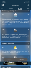
Looks like I bottomed out at 21.6, but that's about 30ft off the ground. I would imagine it was closer to 20 or less at 2 meters. https://tempestwx.com/station/20679/graph/69429/temp/2
-
Hello, please take a minute to check out our awesome content, contributed by the wonderful members of our community. We hope you'll add your own thoughts and opinions by making a free account!
You are using an out of date browser. It may not display this or other websites correctly.
You should upgrade or use an alternative browser.
You should upgrade or use an alternative browser.
Pattern Januworry
- Thread starter SD
- Start date
Oof this one got you booted. Guess I fixed itFied
Snownut
Member
Not sure what you are looking at or if you knowFied
Sent from my SM-A526U using Tapatalk
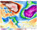
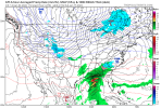
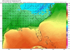
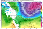
We don’t need a 50/50 low to get big snow. January 2000 had a ridge in the exact same place. The only difference is that that there was a trough that dug down over MN that supplied the cold air.That’s a nice pattern for Miller A cyclones, only problem is there’s no 50/50 but a WAR View attachment 101749View attachment 101751View attachment 101750
NoSnowATL
Member
I think it all depends on your location. Deep South needs more then NC/ upper AL and TN.We don’t need a 50/50 low to get big snow. January 2000 had a ridge in the exact same place. The only difference is that that there was a trough that dug down over MN that supplied the cold air.
Only 36F at 10:30
- Joined
- Jan 5, 2017
- Messages
- 3,779
- Reaction score
- 5,990
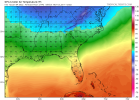
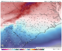
Icon has north Georgia in the forties for highs next week. A lot of mid to upper twenties for lows. More rain on Sunday and I wouldn't be surprised if that wedge holds longer, further south, than shown, even if it's in situ at the end.
SnowNiner
Member
We don’t need a 50/50 low to get big snow. January 2000 had a ridge in the exact same place. The only difference is that that there was a trough that dug down over MN that supplied the cold air.
WAR is not ideal, hurts keeping storms south and makes the nw trend worse imo. That said when we score, it's usually in spite of it because we have a big tall western ridge that helps keep energy south. So the modeled pattern ahead could certainly work imo. Would be great if we could keep a split flow during this time to get southern energy involved. If not we're depending on northern stream energy digging waaaaay south. So, not perfect but pretty good and workable I believe, and the usual way we score the last 10 years.
RGEM has a little ZL or light ZR around here tonight. Probably warms enough to not be an issue but if light precip returns quick enough after some good cooling, could see a very light glaze (seen it before).
I like how the GSP disc ends this morning.
Very dry and cold conditions may develop behind the cold
front by day 7 as model guidance continue to slide an Arctic High
(~1040+ mb) from Canada into the Midwest region by hour 180 of the
forecast with lots of cold air pumping into the region. A lot more
questions than answers at this time, but the January air should
remain in place through much of the extended and potentially beyond.
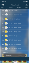
We had our lowest temp of the season so far this morning, -5.7 C (21.7 F). I'm looking forward to a more seasonable month of weather, hopefully.
NBAcentel
Member
D
Deleted member 609
Guest
um I'll take that lookStrange look here
View attachment 101784
Haven't seen a Gulf low in forever.Strange look here
View attachment 101784
D
Deleted member 609
Guest
Switch that L above Michigan with an H and we are good.Haven't seen a Gulf low in forever.
Oh my 


NBAcentel
Member
Y’all have soooooo many opportunities on 12 z gfs, it’s loaded with potential
Welp, buckle up. Just like that, were back to Winter. Lot's of opportunities coming up i think. Consistent Winter storms North of the SE might help us down the road if we can keep a decent pattern in place.
I could see a January’11 type storm out of this pattern
Still have frost on the roof at noon
Stephenb888
Member
Who all was included in that storm?I could see a January’11 type storm out of this pattern
Most of the Southeast. I-20 to I-40.Who all was included in that storm?
- Joined
- Jan 23, 2021
- Messages
- 4,603
- Reaction score
- 15,199
- Location
- Lebanon Township, Durham County NC
Storm5
Member
We can work with this

P
Sent from my iPhone using Tapatalk

P
Sent from my iPhone using Tapatalk
We just now hit 40F imby.
Who all was included in that storm?

Who all was included in that storm?
iGRXY
Member
That is the exact storm I thought of yesterday after watching the pattern being modeled. That was a true storm. Ended up with around 7.5" with a good glaze of freezing rain over top at the end of the storm. I remember the snow sticking around most of the week as it got pretty cold afterwards as well.I could see a January’11 type storm out of this pattern
NoSnowATL
Member
That was a good one.
#LakesLowStrange look here
View attachment 101784
90% of this board. My favorite snow in the last decade. Hands downWho all was included in that storm?
and look at that Baja bowling ball undercutting that ridge ?We can work with this
P
Sent from my iPhone using Tapatalk
iGRXY
Member
This is actually a great potential. That low is going to trend NW at some point, they always do. Right now every model has deep cold air during this time frame. I think oddly enough the I85 and south crew could trend this into a potential storm.View attachment 101788
I think there is potential here as well, i mentioned this yesterday that we just need the trough axis to tend further west to allow some energy to ride underneath it. The trend continued today. Better chance for eastern areas, of course.
Best ratios I’ve ever seen around here. I could scoop it up in the palm of my hand and blow every grain of snow out of it. My old shep here 11 years ago. We had an epic Jeb walk that morning.That is the exact storm I thought of yesterday after watching the pattern being modeled. That was a true storm. Ended up with around 7.5" with a good glaze of freezing rain over top at the end of the storm. I remember the snow sticking around most of the week as it got pretty cold afterwards as well.

First time Bausch and Lomb ever closed for snow and I had been there 11 years! Closed 2 days, think it was a Monday and Tuesday! Storm hit Sunday night, if I recallBest ratios I’ve ever seen around here. I could scoop it up in the palm of my hand and blow every grain of snow out of it. My old shep here 11 years ago. We had an epic Jeb walk that morning.View attachment 101789

