Insane, Charlotte really needs to reel one in.
-
Hello, please take a minute to check out our awesome content, contributed by the wonderful members of our community. We hope you'll add your own thoughts and opinions by making a free account!
You are using an out of date browser. It may not display this or other websites correctly.
You should upgrade or use an alternative browser.
You should upgrade or use an alternative browser.
Pattern Januworry
- Thread starter SD
- Start date
Insane, Charlotte really needs to reel one in.
You aren’t kidding. Going to go ape**** on here the next time I see enough to cover my grass. It’s sad really.
NoSnowATL
Member
Insane, Charlotte really needs to reel one in.
You would think with the look we have the next 3-4 weeks we have to score something worth talking about.
Jessy89
Member
Gfs that storm on 15th has my attention. No it’s not really showing anything. But boy it’s close to phasing
Sent from my iPhone using Tapatalk
Sent from my iPhone using Tapatalk
A bit out in fantasy land thoughGfs that storm on 15th has my attention. No it’s not really showing anything. But boy it’s close to phasing
Sent from my iPhone using Tapatalk
Just in time for when he goes back out west! So typical! A BAM lookalike
Jessy89
Member
A bit out in fantasy land though
Yeah that’s why I’m optimistic. Don’t want a perfect look. I’d rather have a signal and a good pattern and I think we have those two things.
Sent from my iPhone using Tapatalk
NoSnowATL
Member
-NAO will save our fab February!
-NAO will save our fab February!
Possibly late January too.
Sent from my iPhone using Tapatalk
accu35
Member
Did you steal Brent’s avatar? If not y’all are twinsDamn L needs to be a H
View attachment 101859
NBAcentel
Member
Not really encouraging to have a deeply -SCAND when we attempt to wavebreak over the next couple of weeks, more likely to see a SE Canada ridge/strong anticyclone SE of Greenland-NAO will save our fab February!
Also this...if we can hold pattern we’re going to have something to track mid January. She’s ripe, boys. Need a steep +PNA preferably with some split flow imo, energy diving out of Canada (common during Niña) and a wave entering Baja at our latitude. That’s the recipe for bigly success here. Always has been. Always will be.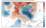

pcbjr
Member
and within range of some reality ... amazing ... ?This is how you do it. Big dog Baja vort. Kick you pig ? View attachment 101866
In the meantime, we have 3 glorious weeks of normal winter weather during the coldest month of the year climowise with this period averaging slightly BN temps and pretty close to normal precip. along with hints of Gulf activity. Compare this to where we were one month ago, when we were facing 4 weeks of mainly anywhere from solid AN to torch domination. Regardless of what does or doesn't happen after January 25th, I'm enjoying these last 2 days and am looking forward to the next 3 weeks, when 3-4 Arctic highs are likely to have a big influence.
If that jet keeps diving in and out as modeled, we’re as golden as we’ll ever be. It would be great if we could lock it in for an extended period but that may be asking too much. We can certainly time a big one up in this type of pattern.and within range of some reality ... amazing ... ?
pcbjr
Member
Time to try ...If that jet keeps diving in and out as modeled, we’re as golden as we’ll ever be. It would be great if we could lock it in for an extended period but that may be asking too much. We can certainly time a big one up in this type of pattern.
Gotta have the northern piece come down the stovepipe of IdahoAlso this...if we can hold pattern we’re going to have something to track mid January. She’s ripe, boys. Need a steep +PNA preferably with some split flow imo, energy diving out of Canada (common during Niña) and a wave entering Baja at our latitude. That’s the recipe for bigly success here. Always has been. Always will be.View attachment 101867
Well this tells me we got about 6 week window. Lol. Was able to get a nice snow out of a pattern that was supposed to never happen this winter.
Steep western ridge and that’s literally the only place she can go!Gotta have the northern piece come down the stovepipe of Idaho
dsaur
Member
It's that hint of gulf activity around mid month that has my attention. Take the cold placement of the 18Z with the low placement, but a bit further south, of the 12z and we've got something, lol. Or, or, it could just get some bitter cold in place and bring the gom low up into it, and cut out the suspenseIn the meantime, we have 3 glorious weeks of normal winter weather during the coldest month of the year climowise with this period averaging slightly BN temps and pretty close to normal precip. along with hints of Gulf activity. Compare this to where we were one month ago, when we were facing 4 weeks of mainly anywhere from solid AN to torch domination. Regardless of what does or doesn't happen after January 25th, I'm enjoying these last 2 days and am looking forward to the next 3 weeks, when 3-4 Arctic highs are likely to have a big influence.
It is admittedly a very small sample and thus of almost no statistical credibility, but fwiw I found two similarly strengthed La Nina winters (1933-4 and 1971-2) that had mild Decembers each followed by a significant cooldown to a little above normal in January that had one very cold plunge mid to late month. Both of these winters ended up having a cold to very cold February along with quite a bit of wintry precip. (including lots of ZR in some areas), which went totally against La Nina climo. So, you never know.
Edit: One of those two Febs (Feb of 1934) even gave significant wintry precip down to north FL not far from @pcbjr 2/10-11.
Edit: One of those two Febs (Feb of 1934) even gave significant wintry precip down to north FL not far from @pcbjr 2/10-11.
Last edited:
NBAcentel
Member
Stephenb888
Member
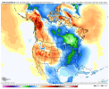
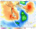
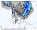
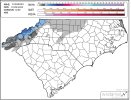
That snow mean sucks.The look ???
View attachment 101876View attachment 101877View attachment 101878The snow mean ??View attachment 101879
NoSnowATL
Member
Thankfully snow means have a accurate score of 2%.That snow mean sucks.
I like itThe look ???
View attachment 101876View attachment 101877View attachment 101878The snow mean ??View attachment 101879
NBAcentel
Member
Don’t get me wrong I love the H5 pattern myself, but typically good patterns produce good snow means and I honestly have no explanation why it sucks with that look at H5, feel like we saw that last winter as wellI like it
NBAcentel
Member
Feel like theres 2 opportunities to score the next couple of weeks, first off with the trough over the SE/that Miller A look with the tall western ridge as the retrogression begins, then when we retrograde the ridge off the west coast and get a trough in the west but still have some sort of GL vortex/SE Canada vortex to act as confluence/CAA in the east before we retrograde to a shitter, then feb goes up in flames, then March becomes interesting
Looking at the mslp maps I think it's clipper dominated/late blooming. I would like to see at least one or 2 wild members in there but then again how many times have we had good means only to go to crap?Don’t get me wrong I love the H5 pattern myself, but typically good patterns produce good snow means and I honestly have no explanation why it sucks with that look at H5, feel like we saw that last winter as well
Over 9,000.Looking at the mslp maps I think it's clipper dominated/late blooming. I would like to see at least one or 2 wild members in there but then again how many times have we had good means only to go to crap?
NoSnowATL
Member
Dude must be trolling me. I hate being so damn smart.
NBAcentel
Member
Everyone wants to talk about a La Niña Feb and it’s torch, but those La Niña March setups have had some notable winter storms/ULLs, esp 2018
Mega March otwEveryone wants to talk about a La Niña Feb and it’s torch, but those La Niña March setups have had some notable winter storms/ULLs, esp 2018
I think you're a little on the minimal side for the triad. PTI reported 2 inches.Final accumulations form the storm on 01/02/22 across the Carolinas. (Learning from webber)View attachment 101883
We haven't had any clippers this year have we? True Alberta Clippers?

