I think you're a little on the minimal side for the triad. PTI reported 2 inches.
-
Hello, please take a minute to check out our awesome content, contributed by the wonderful members of our community. We hope you'll add your own thoughts and opinions by making a free account!
You are using an out of date browser. It may not display this or other websites correctly.
You should upgrade or use an alternative browser.
You should upgrade or use an alternative browser.
Pattern Januworry
- Thread starter SD
- Start date
I know a lot of folks reported over 2 inches in NC. You should talk to Webber about his process. That might help you there.I used
CoCoRaHS they didnt have any reports?
I hope they don't measure on patio tables..?I know a lot of folks reported over 2 inches in NC. You should talk to Webber about his process. That might help you there.
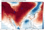
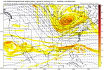
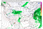
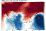
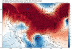
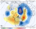
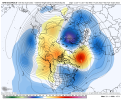
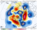
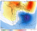
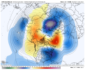
From the looks of it, ensembles and operationals have the trough axis too far to the east, so cold and dry. In my experience, far out in time they tend to retrograde as we get closer, so I kind of like the look at this point. And as you mentioned , we don’t do well with good snow means, LOL!Looking at the mslp maps I think it's clipper dominated/late blooming. I would like to see at least one or 2 wild members in there but then again how many times have we had good means only to go to crap?
Heelyes
Member
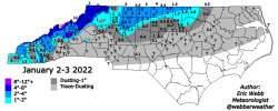
I feel left out, my mulch turned white!Final accumulations form the storm on 01/02/22 across the Carolinas. (Learning from webber)View attachment 101883
Also need to expand east along the NC/VA border, Warrenton in Warren Co. officially had 1.6, Littleton in Halifax Co appeared by pics I saw to have around an inch, I had .5 here. Good looking map thoughI hope they don't measure on patio tables..?
If you all could point me to peer reviewed resource. I would appreciate that. I tried the famous NC State winter storm database. Just went by CoCoRaHS. I didn’t mean to leave anyone out. Luckily, I saved the file.I feel left out, my mulch turned white!
Heelyes
Member
I had a dusting for about 5 mins. The map is fine for my areaIf you all could point me to peer reviewed resource. I would appreciate that. I tried the famous NC State winter storm database. Just went by CoCoRaHS. I didn’t mean to leave anyone out. Luckily, I saved the file.
I think our observations are just as important as the observations of CoCoRaHS.If you all could point me to peer reviewed resource. I would appreciate that. I tried the famous NC State winter storm database. Just went by CoCoRaHS. I didn’t mean to leave anyone out. Luckily, I saved the file.
No one is upset you "left them out", just passing along info to assist, we're all here to learn and contribute. Again the map looked professional good work.If you all could point me to peer reviewed resource. I would appreciate that. I tried the famous NC State winter storm database. Just went by CoCoRaHS. I didn’t mean to leave anyone out. Luckily, I saved the file.
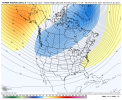
Yeah it's a pattern that supports fairly fast movers and late developing systems, like you said. The north-Atlantic ridge won't help suppress and slow the flow, so we're having to rely on the PV, which often squashes waves. The position of the PV will make it hard for HP to lock into a favorable damming position.Looking at the mslp maps I think it's clipper dominated/late blooming. I would like to see at least one or 2 wild members in there but then again how many times have we had good means only to go to crap?
That said, it's a decent pattern for timing something out. The model just isn't excited about any particular opportunity yet. But I bet if it continues to show this pattern shaping up, we'll see some nice fantasy systems and snow means on future runs.
Thank youNo one is upset you "left them out", just passing along info to assist, we're all here to learn and contribute. Again the map looked professional good work.
Forecast low of 30, already down to 28.6 with moisture return commencing. Temps will warm once clouds roll in but RGEM still showing light freezing rain or drizzle. Only model though, we shall see.... should I start my own thread ?
ATLwxfan
Member
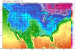
Temps really look seasonable on the GFS which may not be a bad thing for wintery mischief.
At least that’s what I’m telling myself.
Too many times we have gotten burned by the PV shredder.
Sent from my iPhone using Tapatalk
At least that’s what I’m telling myself.
Too many times we have gotten burned by the PV shredder.
Sent from my iPhone using Tapatalk
We have energy flying around. We have op runs with energy cut off around Baja. Some modeling has the trough too far east and broad, some models have it just right. Most importantly cold appears to be there. All the pieces are there. There are things I don't like, like ridging in the 50/50 region, +NAO etc. But no pattern is perfect and this one is workable. If we had to have a phase 8 MJO, a +PNA coupled to a -EPO, -AO, -NAO and a 50/50 low all together we'd never snow.Yeah it's a pattern that supports fairly fast movers and late developing systems, like you said. The north-Atlantic ridge won't help suppress and slow the flow, so we're having to rely on the PV, which often squashes waves. The position of the PV will make it hard for HP to lock into a favorable damming position.
That said, it's a decent pattern for timing something out. The model just isn't excited about any particular opportunity yet. But I bet if it continues to show this pattern shaping up, we'll see some nice fantasy systems and snow means on future runs.
End of that gfs run was a beauty
Brent
Member
It'll be congrats Chicago by verification probably ??
Webberweather53
Meteorologist
Webberweather53
Meteorologist
Wow, how did I miss this. Tornado in Harnett Co before the snow moved in...
HurricaneSolomon
Member
- Joined
- Dec 6, 2021
- Messages
- 154
- Reaction score
- 276
Wow, how did I miss this. Tornado in Harnett Co before the snow moved in...
A coworker in Granville Co. said he heard what sounded like a train before work Monday morning. I never followed up to see if a potential tornado had touched down but I can definitely see where some tornados might have formed.
Sent from my iPad using Tapatalk
Dang just one member ?0Z EPS has what appears to be a massive snowstorm for much of E NC very late in the run from a member with a coastal low.
Clem282340
Member
Did it show anything for the rest of the southeast0Z EPS has what appears to be a massive snowstorm for much of E NC very late in the run from a member with a coastal low.
Webberweather53
Meteorologist
Did it show anything for the rest of the southeast
No
Webberweather53
Meteorologist
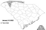
Here's my preliminary snow map for NC for the winter storm that hit parts of the SE US & the southern mid-Atlantic earlier this past week.
View attachment 101924
Haven't forgot about my friends in SC. Thanks @Jimmy Hypocracy for your ground-truth of IP in Greenville
Webberweather53
Meteorologist
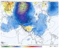
Something I already alluded to yesterday on twitter, but Decent looking negative E Asia Mtn torque here around mid-month. Should pull the Pacific Jet back during the following week or two and yield a GOA-Aleutian ridge + -PNA + SE ridge combo by the time we reach the last week of January. Ultimately, setting us up for a prototypical warm Nina Feb

NBAcentel
Member
kstrickland0823
Member
Here's my preliminary snow map for NC for the winter storm that hit parts of the SE US & the southern mid-Atlantic earlier this past week.
View attachment 101924
Looks perfect for my area! Watched the snow fall for a few hours but never stuck! Our mulch turnt white for about 10 mins! Great work on the map!


Sent from my iPhone using Tapatalk
Ole JB saying:
"Winter will remember December." Hopefully we can score January. Only other long shot would be some off the wall rogue March storm. But I think the Feb La Nina lag usually carries into March as well. Webber, what say you? Question have is I beleive I read, saw somewhere that La nina was gonna fade away late winter. Any truth to that? I honestly rely on Gawx and webb post to get vibe for Pacific seasonal forecast. They both follow them the most, have knowledge.
"Winter will remember December." Hopefully we can score January. Only other long shot would be some off the wall rogue March storm. But I think the Feb La Nina lag usually carries into March as well. Webber, what say you? Question have is I beleive I read, saw somewhere that La nina was gonna fade away late winter. Any truth to that? I honestly rely on Gawx and webb post to get vibe for Pacific seasonal forecast. They both follow them the most, have knowledge.
tennessee storm
Member
Think Eric said pretty much La Niña be gone by late spring completelyOle JB saying:
"Winter will remember December." Hopefully we can score January. Only other long shot would be some off the wall rogue March storm. But I think the Feb La Nina lag usually carries into March as well. Webber, what say you? Question have is I beleive I read, saw somewhere that La nina was gonna fade away late winter. Any truth to that? I honestly rely on Gawx and webb post to get vibe for Pacific seasonal forecast. They both follow them the most, have knowledge.
NBAcentel
Member
NBAcentel
Member


