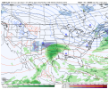
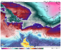
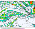
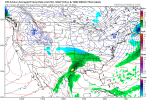
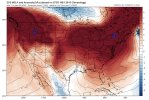
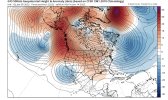
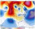
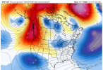
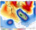
Gfs now showing something similar, looks warmer thoI like the confluence moving in ahead of the wave. Wish the cold core was a little closer, but we'll see. Either squash city or winter storm.
High pressure should be moving in just ahead of or in tandem with the southern low....at least until 18z lol
View attachment 101960
-
Hello, please take a minute to check out our awesome content, contributed by the wonderful members of our community. We hope you'll add your own thoughts and opinions by making a free account!
You are using an out of date browser. It may not display this or other websites correctly.
You should upgrade or use an alternative browser.
You should upgrade or use an alternative browser.
Pattern Januworry
- Thread starter SD
- Start date
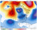
Interesting to see the AO looking to go negative and the NAO right about neutral at that 15th-17th timeframe that we’ve been talking about.
Yeah, the -AO returning mid month per todays GEFS is interesting to say the least. That’s never a bad thing. Hoping it is real.
NBAcentel
Member
Also will be key how strong that arctic front is that delivers cold air to the region .. looks fairly stout but maybe a bit shallow which allows cold air to retreat a little quicker than we would like for this coming down the pipeI like the confluence moving in ahead of the wave. Wish the cold core was a little closer, but we'll see. Either squash city or winter storm.
High pressure should be moving in just ahead of or in tandem with the southern low....at least until 18z lol
View attachment 101960
D
Deleted member 609
Guest
Need that high to win the race east
Yeah I don’t really have much hope that we could get good west based -NAO in the next couple weeks. I am more interested that the AO could go back negative.The NAO, while handsomely sporting a value of negative is more east-based in nature, based on the 500 mb charts. That's often not as helpful to us as we would want. Hopefully, it will migrate westward somewhat. That north Atlantic thumb ridge is not my favorite.
D
Deleted member 609
Guest
I would like to live in a CAD location with this look
With the amount of snow pack that is being put down in the coming days over the mid-Atlantic and NE, any CAD set up has a great chance to overperform… definitely a change from the anemic CAD set ups we’ve seen the last several yearsI would like to live in a CAD location with this look
iGRXY
Member
Almost a 1040 high sliding out ahead. With CAD building in. Very interesting look.
NBAcentel
Member
Probably gonna get sheared but this look reminds me of early December 2018 with split flow/active subtropical jet stream/active southern stream, really something to watch as the icon shows something similar, only thing that could be fixed is the confluence more SW but slightly quicker and or a quicker SS wave 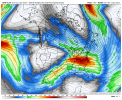

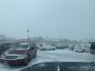
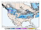
LeConte got 10”, probably safe to infer other spots in the Smokies are in the 8-12”.Here's my preliminary snow map for NC for the winter storm that hit parts of the SE US & the southern mid-Atlantic earlier this past week.
View attachment 101924
- Joined
- Jan 23, 2021
- Messages
- 4,603
- Reaction score
- 15,199
- Location
- Lebanon Township, Durham County NC
Man that was frustrating. Looked like for all the world it was on its way.
I like the pieces being on the table but a storm NOT showing up more than likely if you get a storm to show up 180-240 and you’re in the thick of it you’re probably not going to be in the thick of it at hour 80-120 .. we like to trend things better as we enter the medium range most of the time with our successful winter storms .. 2010 being an exception obviously lol and maybe 2018 tooProbably gonna get sheared but this look reminds me of early December 2018 with split flow/active subtropical jet stream/active southern stream, really something to watch as the icon shows something similar, only thing that could be fixed is the confluence more SW but slightly quicker and or a quicker SS wave View attachment 101970
I like the pieces being on the table but a storm NOT showing up more than likely if you get a storm to show up 180-240 and you’re in the thick of it you’re probably not going to be in the thick of it at hour 80-120 .. we like to trend things better as we enter the medium range most of the time with our successful winter storms .. 2010 being an exception obviously lol and maybe 2018 too
What does “in the thick of it” mean? Are you saying it’s better to have a storm up to 80-120 or 180-240?
Sent from my iPhone using Tapatalk
The key right now is that pieces continue to be there in that time frame. There is just a lot of pieces of energy flying around and it will be hard for these models to latch onto them.Man that was frustrating. Looked like for all the world it was on its way.
NBAcentel
Member
I know the 15th-20th time frame is our best shot but man you have pieces here around this time frame, you have troughing in the NE US clipping us acting as confluence with high pressure following behind, and a active Subtropical jet stream, could easily sneak a legitimate wintry CAD/Miller B setup with this look 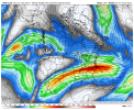
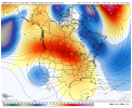


NBAcentel
Member
iGRXY
Member
80-120. Better to have the pattern in the long range. After the pattern established you want to get the players on the field in the medium range which is what we have right now. High pressure sliding out of Canada ahead of a SW. It's pretty strong and slides east to really lock in the cold air. You want to start seeing a storm materialize usually around day 5 or 6 and start showing up on globals and then let the short range models take it from there. This look is a textbook look for the southeast to get some kind of winter storm.What does “in the thick of it” mean? Are you saying it’s better to have a storm up to 80-120 or 180-240?
Sent from my iPhone using Tapatalk
iGRXY
Member
NBAcentel
Member
I look at that and can’t help but think… what is all that blue out over the Atlantic?? It seems like we’ve seen nothing but tall ridges in January out there for so longWhere’s the lotion View attachment 101976
- Joined
- Jan 23, 2021
- Messages
- 4,603
- Reaction score
- 15,199
- Location
- Lebanon Township, Durham County NC
Canadian is trying to throw show some zr in some of the favored areas on sunday morning.
NBAcentel
Member
D
Deleted member 1449
Guest
packfan98
Moderator
Wow!


iGRXY
Member
SW in the southwest finally ejects with a 1040 high coming down. Probably about to be a board wide hit.
Gfs isn’t working on TT or cod
iGRXY
Member
Ice storm on the GFS but I actually think a lot more of the frontend stuff is snow before a quick switch over to either sleet or ZR for a good portion of NC and the upstate.
D
Deleted member 609
Guest
You know the drill … IS THIS A GOOD LOOKWhere’s the lotion View attachment 101976
Stephenb888
Member
What would it take to be all snow. Why is it so difficult.Ice storm on the GFS but I actually think a lot more of the frontend stuff is snow before a quick switch over to either sleet or ZR for a good portion of NC and the upstate.
D
Deleted member 609
Guest
You live in South Carolina...What would it take to be all snow. Why is it so difficult.
iGRXY
Member
The SW in Baja to eject sooner when the real cold is around.What would it take to be all snow. Why is it so difficult.
Love that lakes cutter look! ??Southeast power in shambles.
iGRXY
Member
It would be fantastic rates as temps hover in the low to mid 20's for most of the storm. But if it does end up as freezing rain you can bet your bottom dollar it will freeze at those temperatures.

