packfan98
Moderator
What are your thoughts this morning on where we stand? Widespread SE event, Coastal special, or nothingburger?NAM coming in further west with the energy
What are your thoughts this morning on where we stand? Widespread SE event, Coastal special, or nothingburger?NAM coming in further west with the energy
The run-to-run changes with the TPV orientation in SE Canada are wild.Depends on where you are. With it inching west with the SW but also with the big low about the Great Lakes as well. Plus the big ULL exiting faster stage right over the far NE. The trend should be more tilt/amplification.
Almost a benchmark for our good winter storms. The big question mark is the other energy kinks and how they interact with our digging energy making it turn negative (or not).
Still hard to say - probably a I95 event right right now. But man the NW trending is fast. Saw someone mention this but in setups that lack blocking on top, with any amplification to the upstream pattern, this thing can come further NW. each tick west, the western Atlantic ridge noses in more. And on top of that, each amplified trend is driving in more WAA, which models already struggle onWhat are your thoughts this morning on where we stand? Widespread SE event, Coastal special, or nothingburger?
Yeah, we aren't far off from getting most of us in on the good stuff. Could potentially hit the coastal areas up north too. Interesting to follow nonetheless. Thanks!Still hard to say - probably a I95 event right right now. But man the NW trending is fast. Saw someone mention this but in setups that lack blocking on top, with any amplification to the upstream pattern, this thing can come further NW. each tick west, the western Atlantic ridge noses in more. And on top of that, each amplified trend is driving in more WAA, which models already struggle on
the ukie was a really interesting run. unsure if it will verify there's typically a warm outlier at this point that dials back as we approach hour zero. but i think it oulines the obvious risks of too much amplification for the southeastern fringe. Which I think is fine... augusta/upstate/clt are more than dueYep... I'm just skimming through stuff and the Ukie tries to really bomb this. Which for us down east is concerning haha. Someone getting a nice surprise Sunday I do believe


12z nam yesterday vs 12z today View attachment 183227
Somebody about to get rained onNAM is winding this one up, no doubt. Good separation here. It's going to tilt.


Can already see difference in appearence of moisture in TN on 12z NAM compared to 06zSomebody about to get rained on


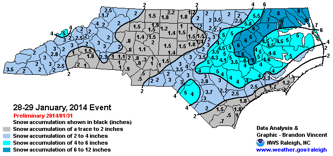
This one?Very Jan 2014-esque wave pattern here, which makes sense given the superposition of the West Pac MJO onto the eastward shifting indo pacific warm pool
View attachment 183231
View attachment 183232
No precip response on the NAM through 84 hours.
Looks like the shape of a high pressure ridgeIt lost that flat suppressive look here. Thoughts?First time I’ve seen that feature modeled. It appears cocked and ready to fire View attachment 183235
you won't see that until the 18z or 00z probably, its just not quite go time yet for the namNo precip response on the NAM through 84 hours.
This one?
Maybe for east of 95 folks. Don't think it was going to cut it for western areasAt 500mb it was on its way to a pretty big storm I think.
Sent from my iPhone using Tapatalk
Precip was about to explode. It's just delayed b/c it's slowed and dug so much.No precip response on the NAM through 84 hours.
The base was all the way near New Mexico… that’s why it hadn’t fired anything off yet. This is actually further west then the EC/GFSMaybe for east of 95 folks. Don't think it was going to cut it for western areas

That's what's driving the Saturday morning snow chances for North GA/NC mountains. I don't think it has a big impact on the main wave, either way.It lost that flat suppressive look here. Thoughts?First time I’ve seen that feature modeled. It appears cocked and ready to fire View attachment 183235
Once we get the synoptic details pinned down this thing is probably going to shift north and west, and possibly a good bit at that, even down to the 0 hour.
Overrunning events are basically driven by a large-scale warm front aloft “overrunning” a cold low level Arctic air mass. Models just plain suck with warm advection
I was in Greensboro back then and I remember that was one of those rare storms in the upper teens at the surface. Wasn’t a lot of snow, but the cold ones are always fun.Haha yep. That looked like a nothingburger except for the coast about 4-5 days out and trended north down to the 0 hour. I remember Fayetteville was supposed to get drilled with snow but the warm nose aloft was much stronger than forecast and changed us over to sleet
that's fine with me as long as I don't get a sleet stormOnce we get the synoptic details pinned down this thing is probably going to shift north and west, and possibly a good bit at that, even down to the 0 hour.
Overrunning events are basically driven by a large-scale warm front aloft “overrunning” a cold low level Arctic air mass. Models just plain suck with warm advection


Much better than that image of extremely dry air you shared last night from the NAM.Folks, that was a great NAM run for many. Very similar to the 6Z EURO but poised to bring precip much further west IMO. Here, you can see the 700Mb moisture pooling and is about to overspread much of the SE. We're very close to getting overrunning precip before the pivot on both the NAM and 6Z Euro.View attachment 183238View attachment 183239
Even though I am happy with the trends that the models have been showing during the past 48 hours, I am afraid that the northwest shift you mention will happen and this may become an event for folks in the Western Piedmont and points west in North and South Carolina. I've got my fingers crossed that this shift will not be dramatic and turn Sunday's storm into a App cutter. We are still around 96 hours away from ground zero and a lot can happen between now and then. Here's to hoping my negativity is totally unfounded.Once we get the synoptic details pinned down this thing is probably going to shift north and west, and possibly a good bit at that, even down to the 0 hour.
Overrunning events are basically driven by a large-scale warm front aloft “overrunning” a cold low level Arctic air mass. Models just plain suck with warm advection
Indeed. And, while I didn't post it, thermals are quite supportive of mostly snow, assuming adequate precip early on and later as CAA spills into Alabama and Georgia.Much better than that image of extremely dry air you shared last night from the NAM.
