Once we get the synoptic details pinned down this thing is probably going to shift north and west, and possibly a good bit at that, even down to the 0 hour.
Overrunning events are basically driven by a large-scale warm front aloft “overrunning” a cold low level Arctic air mass. Models just plain suck with warm advection
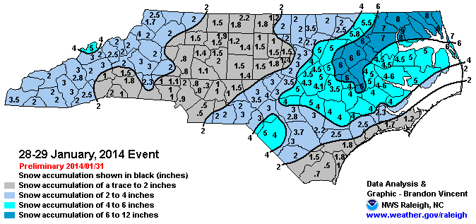
I'm already sweating the warm nose. Are you thinking this could possibly shift to a snow to cold rain scenario or a snow to ice scenario for the Eastern areas? Just wondering because there is so much cold air available with this system.