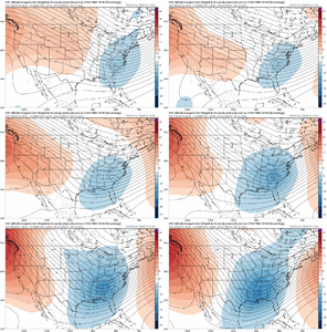
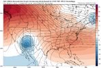
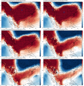
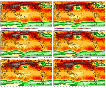
GFS about to dump that cutoff in the SW again here
-
Hello, please take a minute to check out our awesome content, contributed by the wonderful members of our community. We hope you'll add your own thoughts and opinions by making a free account!
You are using an out of date browser. It may not display this or other websites correctly.
You should upgrade or use an alternative browser.
You should upgrade or use an alternative browser.
Pattern January Joke
- Thread starter SD
- Start date
bncho
Member
MichaelAndrews
Member
Yeh it this could move to the weekend, I’d book a cabin in Gatlinburg
LOL same, got my Land Rover ready to get lost in some mountain somewhere. Hopefully this event doesn't rugpull
Buzzkill hour.
NCWeatherNow
Member
trackersacker
Member
At 00z the Euro will have a blizzard in Las VegasAnd now the downtrend starts.

That EPS run gave me pause as to where we are headed. It looks like a very possible scenario which we have seen already recently, namely the cold is bottled up North and cuts us off from the temps needed to give us wintry weather. I realize we are a ways out to make definitive statements, but it does not make me feel good to see it contradict the other modeling, hopefully it will go towards the other models rather than them going towards it.
Where is the EPS contradicting the other modeling?
We found that out last year with 4” on MLK. Bummer was we were in a hotel and all the restaurants started closing when the snow got heavy. We found one open and had one of the worst Italian meals of my life. We’re going back this year so maybe the luck will hold.Already have 10 cabins saved for the wife to review for MLK weekend. Historically been money for snow up there the last 10 years for our family.
Anywhere off ski mountain road, preferably closer to ober Gatlinburg. It’s wild the difference in the top and the bottom of the mountain. I target 2800-3000 feet in elevation. Never fails me.
Great thing about Gatlinburg is they keep the roads maintained as well.
Lol come on man.And now the downtrend starts.

I will say, normally one set of bad runs sets off a chain reaction. So I wouldn’t be surprised if they sucked again overnight then perked right back up in 24 hours. Figuring out a trend has to be looked at broadly timeframe wise. What is the trajectory over a few days span for example.
nooob post, but can someone "just tell me if I'm gonna get more than .023481" of snow IMBY in the next 10-14 daze plz, kthx"
NCWeatherNow
Member
I wouldn't be shocked to see western troughs by 00zLol come on man.
I will say, normally one set of bad runs sets off a chain reaction. So I wouldn’t be surprised if they sucked again overnight then perked right back up in 24 hours. Figuring out a trend has to be looked at broadly timeframe wise. What is the trajectory over a few days span for example.
rburrel2
Member
18z Euro ai has a weak but cold overrunning event at hr264. So signal not completely lost.
CNCsnwfan1210
Member
18z Euro ai has a weak but cold overrunning event at hr264. So signal not completely lost.

Sent from my iPhone using Tapatalk
Trends have been good for Jan 15. That wave is trending deeper and slower, exactly what we want for a big storm. Regardless, we need to play our cards perfectly for snow across the general region or it'll be a rain/slop storm unless you live in W
Trad 18Z GFS was a few pixels away from turning that trough negative, not sure what all the negativity is for.
John1122
Member
The GFS has had the issue with moving those blue blobs west/sw all season. It's been moving many from Canada down across Oregon too. It hasn't actually verified yet.
Webberweather53
Meteorologist
Did you ever think that we would see the LaNina die out so quickly and then possibly go straight into an El Niño?
I noted this was a possibility all the way back in early November actually.
Between then and now and a stretch around mid December or so where I had some truly awful takes (lol), it took me until a few weeks ago to fully bite on this idea of a rapid enough collapse to impact late winter. At least way back in early Nov, I told you how it would have to happen if we were to deviate from the Nina script in Feb this year.
Imho, tho we've had some good stretches here and there, I would say that December as a whole this year is probably about as favorable as it has looked at this range in a very long time.
January could be intriguing and I wouldn't be shocked if there are at least occasional favorable opportunities intermixed with stretches of SE ridging.
Imho, our best (& possibly only) shot to come away with a good February this winter is if the eastern edge of the Indo-Pacific Warm Pool advances more quickly than expected, which would invigorate convective heating closer to the Central Pacific & possibly help dislodge the Aleutian-Gulf of Alaska ridge eastward/closer to the US West Coast. This is something we've occasionally seen play out in heavy +TNH/-EPO winters like 2013-14 & 2014-15.
La Niña is living on borrowed time.
The only reason the extreme -IOD event we're currently seeing is going to collapse is because all of the warm water is about to get flushed into the tropical west pacific at depth over the next month or two in this MJO event's westerly wind burst. Another solid subsequent MJO burst over the West Pacific later in the winter would lead to rapid onset of El Nino conditions this spring.
A more rapid shift towards El Niño is probably the one wild card we could play that would have the potential to significantly alter the outcome of the latter part of this winter/February in our favor (though even then it wouldn't be a guarantee that things would shift favorably even in that scenario).
View attachment 176055
rburrel2
Member
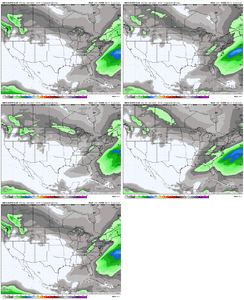
Big uptick across the board on the 18z gefs snow mean.
Tsappfrog20
Member
Big uptick across the board on the 18z gefs snow mean.
Would you share those?
Sent from my iPhone using Tapatalk
CNCsnwfan1210
Member
Yeah there was a few cad/overunning members.
Sent from my iPhone using Tapatalk
Sent from my iPhone using Tapatalk
Webberweather53
Meteorologist
Our best bet is to let the first system go by & then score a southern slider/overrunning type event around MLK Day after the big vortex drops in.
Stormlover
Member
packfan98
Moderator
Joe Bastardi seems to be of the mindset that after our next cold snap that the pattern may not have sustained staying power. He thinks that by the time the mjo gets to phase 8 that we will have lost the wpo teleconnection and that our source region will be flooded with warm air.
packfan98
Moderator
I can see that. I get cold sweats when i hear the word el nino. Last few have absoloutely drowned Canada with pacific Air. And it doesnt move,just re loads continously.Joe Bastardi seems to be of the mindset that after our next cold snap that the pattern may not have sustained staying power. He thinks that by the time the mjo gets to phase 8 that we will have lost the wpo teleconnection and that our source region will be flooded with warm air.
Anxiously awaiting southern skies update. Havent had one in 3 days.
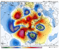
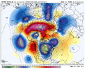
Of the 3 18z operational runs, 2 of them (GFS, AI Euro) renewed the western ridging after moving a piece of it NW across the Bering Sea. This was good to see as previous runs for both of those models (and others of course) were launching the western ridging into the Bering Sea and into NE Siberia.....but unless we see a noteworthy -EAMT event, bouts of renewed western ridging is more along the lines of what I would expect to see, with the Pac Jet maintaining its momentum east, in the final 10 days of January and first 10 days of February as the tropical convection signal / MJO works thru phase 7 and into phase 8, in concert with the eastward moving tropical Pacific warm pool.
Right or wrong, I'm as much a pattern nut as I am a find a storm nut as I'm of the ilk that if you build the pattern, the storms will come. We're not where we need to be with the pattern, but we're getting closer
Here's an image of the renewed ridging on the 2 model runs...
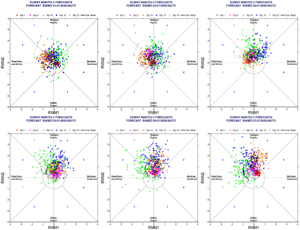
Last 7 runs of the Euro Wk MJO forecast
Right or wrong, I'm as much a pattern nut as I am a find a storm nut as I'm of the ilk that if you build the pattern, the storms will come. We're not where we need to be with the pattern, but we're getting closer
Here's an image of the renewed ridging on the 2 model runs...


Last 7 runs of the Euro Wk MJO forecast

SnowNiner
Member
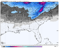
The 18z AI eps has one of the best means I’ve seen recently as well.
View attachment 181647
Better…but still paltry for southern piedmont south. Baby steps hopefully. My long range unscientific threshold is a 2 inch mean to my south into SC to be game on.
Best case scenario the western trough never materializes and the eastern trough just gets deeper and colder. Silver medal, we get some SE ridge, unideal pacific, but a nice -nao with a 50/50 low superwedging us into overrunning or a miller B.
SnowNiner
Member
Of the 3 18z operational runs, 2 of them (GFS, AI Euro) renewed the western ridging after moving a piece of it NW across the Bering Sea. This was good to see as previous runs for both of those models (and others of course) were launching the western ridging into the Bering Sea and into NE Siberia.....but unless we see a noteworthy -EAMT event, bouts of renewed western ridging is more along the lines of what I would expect to see, with the Pac Jet maintaining its momentum east, in the final 10 days of January and first 10 days of February as the tropical convection signal / MJO works thru phase 7 and into phase 8, in concert with the eastward moving tropical Pacific warm pool.
Right or wrong, I'm as much a pattern nut as I am a find a storm nut as I'm of the ilk that if you build the pattern, the storms will come. We're not where we need to be with the pattern, but we're getting closer
Here's an image of the renewed ridging on the 2 model runs...
View attachment 181648
View attachment 181649
Last 7 runs of the Euro Wk MJO forecast
View attachment 181650
Those h5 looks pretty good though to me. What are they missing that you’d like to see, to have a great pattern? Deeper tough to the south?
iGRXY
Member
1-2” means showing up when we are still 10-14 days away from any realistic opportunity isn’t paltryBetter…but still paltry for southern piedmont south. Baby steps hopefully. My long range unscientific threshold is a 2 inch mean to my south into SC to be game on.
Best case scenario the western trough never materializes and the eastern trough just gets deeper and colder. Silver medal, we get some SE ridge, unideal pacific, but a nice -nao with a 50/50 low superwedging us into overrunning or a miller B.
Yep, he's been saying that for a few days now. That will most likely be the only thing that can ruin this February, and you just know in the back of your mind it will probably happen. Phase 6 MJO stinks in January!Joe Bastardi seems to be of the mindset that after our next cold snap that the pattern may not have sustained staying power. He thinks that by the time the mjo gets to phase 8 that we will have lost the wpo teleconnection and that our source region will be flooded with warm air.
Last edited:
Bastardi is fun to read and listen to, but I don't know why anybody thinks anybody else actually knows how the weather is going to turn out 45 days from now, unless there's some overwhelming driver, which in this case, there's really not. Plus, he has been wrong (as have many others) several times this winter already.Yep, he's been saying that for a few days now. That will most likely be the only thing that can ruin this February, and you just know in the back of your mind it will probably happen.
wow
Member
Bastardi is fun to read and listen to, but I don't know why anybody thinks anybody else actually knows how the weather is going to turn out 45 days from now, unless there's some overwhelming driver, which in this case, there's really not. Plus, he has been wrong (as have many others) several times this winter already.
It's the only weather you got.. haven't watched his Long Ranger vids since they were free on Accuwx 20+ years ago. But who else remembers the trough east of HI = no SW trough!
I’ve heard lots folks mention that over the years but I’m honestly have looked to see if it holds any weight.It's the only weather you got.. haven't watched his Long Ranger vids since they were free on Accuwx 20+ years ago. But who else remembers the trough east of HI = no SW trough!
Oh yeah man I remember that!It's the only weather you got.. haven't watched his Long Ranger vids since they were free on Accuwx 20+ years ago. But who else remembers the trough east of HI = no SW trough!
I think it does...it's a wavelength thingI’ve heard lots folks mention that over the years but I’m honestly have looked to see if it holds any weight.
TriplePhaser
Member
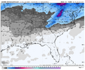
Trends have been good for Jan 15. That wave is trending deeper and slower, exactly what we want for a big storm. Regardless, we need to play our cards perfectly for snow across the general region or it'll be a rain/slop storm unless you live in WV.View attachment 181630
See that vortex east of James Bay? If that continues trending ese that'll lower hights along the east coast and prehaps act as a 50/50ish low.
NBAcentel
Member
CNCsnwfan1210
Member
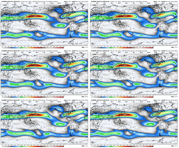
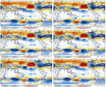
I like. In a +TNH regime you gotta take anything that can swing the fences more towards the SE instead of the western U.S., and getting the pacific jet just slightly more extended like this R2R sequence is showing is nice. Hopefully it continues View attachment 181661View attachment 181660View attachment 181659
Equatorward Pacific jet, spiking poleward PNA ridge, stronger subtropical jet too. Good things to see.
Sent from my iPhone using Tapatalk

