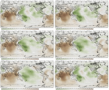
Agree 1000% "but I don't know where anybody said Bastardi claims to know the weather 45 days out." That was my comment, not Bastardi's. Not that I know anything. lol Sorry if I made it sound like his comment!!! But If you mention his name in anyway on here, he gets trashed, so I guess in the end it doesn't matter.Bastardi is fun to read and listen to, but I don't know why anybody thinks anybody else actually knows how the weather is going to turn out 45 days from now, unless there's some overwhelming driver, which in this case, there's really not. Plus, he has been wrong (as have many others) several times this winter already.
-
Hello, please take a minute to check out our awesome content, contributed by the wonderful members of our community. We hope you'll add your own thoughts and opinions by making a free account!
You are using an out of date browser. It may not display this or other websites correctly.
You should upgrade or use an alternative browser.
You should upgrade or use an alternative browser.
Pattern January Joke
- Thread starter SD
- Start date
What about, wherever a storm comes in on west coast, it exits on east coast. He use to reverberate a lot of what his dad,pioneers taught him from early satelite era. Hes the one I learned old EE Rule from watching. Ridge Bridge,Ridge over troubled waters, December likes to Remeber etc etc etc. To many to count rehashI think it does...it's a wavelength thing
NBAcentel
Member
Tsappfrog20
Member
I don’t really know what I’m looking at but I know it’s a good thing so I liked the post lol
Sent from my iPhone using Tapatalk
CNCsnwfan1210
Member
I don’t really know what I’m looking at but I know it’s a good thing so I liked the post lol
Sent from my iPhone using Tapatalk
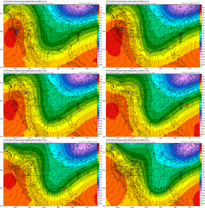
I think that’s pretty much saying the EPS is moving the MJO into phase 8 (or close to it) during the timeframe of interest from what I’m seeing.
Sent from my iPhone using Tapatalk
- Joined
- Nov 29, 2021
- Messages
- 42
- Reaction score
- 144
What models or data are suggesting no more negative WPO? I get the idea of the south being flooded with warm air (the southern ridge we are seeing now) and there are almost always ways to flood the southern US with warm air. Most in this forum have seen no snow while we’ve had the -WPO so far. I get ideally we want a negative WPO and I agree, but to say our chances will diminish because the WPO will become positive right as we enter phase 8 seems pessimistic and possibly incorrect. Even with the -WPO the past month we’ve found other ways to avoid snow, and I don’t see it going away at least on the models through Feb.Joe Bastardi seems to be of the mindset that after our next cold snap that the pattern may not have sustained staying power. He thinks that by the time the mjo gets to phase 8 that we will have lost the wpo teleconnection and that our source region will be flooded with warm air.
NBAcentel
Member
Yeah it’s clearly heading that way. Coherent phase 7 MJO at the end of that loop, but headed towards phase 8 with subsidence entering the MC and rising heading towards the AmericasI think that’s pretty much saying the EPS is moving the MJO into phase 8 (or close to it) during the timeframe of interest from what I’m seeing.
Sent from my iPhone using Tapatalk
Oh I'm not bashing JB. I like him fine. I'm just saying, all the time you hear people getting encouraged or discouraged based on what someone with name recognition says. Not talking about you at all.Agree 1000% "but I don't know where anybody said Bastardi claims to know the weather 45 days out." That was my comment, not Bastardi's. Not that I know anything. lol Sorry if I made it sound like his comment!!! But If you mention his name in anyway on here, he gets trashed, so I guess in the end it doesn't matter.
Pretty funny, he does give his ideas months in advance and generally turns out to be a decent forecast. Perfect? Absolutely not, but neither are others. Anyone can sit there and watch model run after model run and change the forecast and eventually get it right. He seems to do pretty well with hurricanes except this year, but everyone missed this year.Agree 1000% "but I don't know where anybody said Bastardi claims to know the weather 45 days out." That was my comment, not Bastardi's. Not that I know anything. lol Sorry if I made it sound like his comment!!! But If you mention his name in anyway on here, he gets trashed, so I guess in the end it doesn't matter.
Should keep records of everyone's so-called forecast and see who has the best percentage of being right. I would bet the highest would be 30% accurate. Nobody can predict the weather its all a guess as models are not accurate unless a few days out. Love watching locals give a 7 day forecast and watch it change throughout the week lol.
Great post Frost!!
- Joined
- Nov 29, 2021
- Messages
- 42
- Reaction score
- 144
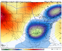
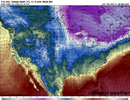
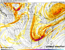
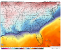
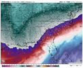
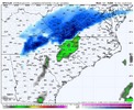
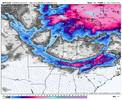
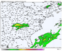
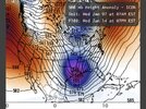
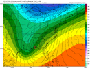
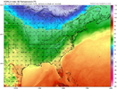
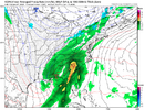
Also, why the heck is it January 15th (perfect climo), the trough looks like it does below, we have 532 thickness lines wrapping down to northern Louisiana with a surface FL panhandle low literally in the *perfect* position and the best we can do at 7 pm ET are balmy 40s and 50s (not even upper 30s) and RAIN for literally *everyone* except Erie PA and Mt. Mitchell, NC?


Last edited:
One thing I’ll always give JB credit for is completely nailing the January 1987 storm. Back in those days, Accuweather did the forecasting for WBT radio and WBTV in Charlotte. I remember hearing JB on the radio the afternoon before that storm while riding home from school with my mom. He was adamant that the CLT area was in for a significant snowstorm while local mets and the NWS was forecasting rain. He and Accuweather were correct of coursePretty funny, he does give his ideas months in advance and generally turns out to be a decent forecast. Perfect? Absolutely not, but neither are others. Anyone can sit there and watch model run after model run and change the forecast and eventually get it right. He seems to do pretty well with hurricanes except this year, but everyone missed this year.
Should keep records of everyone's so-called forecast and see who has the best percentage of being right. I would bet the highest would be 30% accurate. Nobody can predict the weather its all a guess as models are not accurate unless a few days out. Love watching locals give a 7 day forecast and watch it change throughout the week lol.
Great post Frost!!
UniclimateAlso, why the hell is it January 15th (perfect climo), the trough looks like it does below, we have 532 thickness lines wrapping down to northern Louisiana with a surface FL panhandle low literally in the *perfect* position and the best we can do at 7 pm ET are balmy 40s and 50s (not even upper 30s) and RAIN for literally *everyone* except Erie PA and Mt. Mitchell, NC?
View attachment 181668View attachment 181667View attachment 181666View attachment 181665
wow
Member
No 50/50 low = nothing to stop WAA to surge northAlso, why the hell is it January 15th (perfect climo), the trough looks like it does below, we have 532 thickness lines wrapping down to northern Louisiana with a surface FL panhandle low literally in the *perfect* position and the best we can do at 7 pm ET are balmy 40s and 50s (not even upper 30s) and RAIN for literally *everyone* except Erie PA and Mt. Mitchell, NC?
LukeBarrette
im north of 90% of people on here so yeah
Meteorology Student
Member
2024 Supporter
2017-2023 Supporter
No cold air before the system. It’s been warmAlso, why the hell is it January 15th (perfect climo), the trough looks like it does below, we have 532 thickness lines wrapping down to northern Louisiana with a surface FL panhandle low literally in the *perfect* position and the best we can do at 7 pm ET are balmy 40s and 50s (not even upper 30s) and RAIN for literally *everyone* except Erie PA and Mt. Mitchell, NC?
View attachment 181668View attachment 181667View attachment 181666View attachment 181665
Also, why the hell is it January 15th (perfect climo), the trough looks like it does below, we have 532 thickness lines wrapping down to northern Louisiana with a surface FL panhandle low literally in the *perfect* position and the best we can do at 7 pm ET are balmy 40s and 50s (not even upper 30s) and RAIN for literally *everyone* except Erie PA and Mt. Mitchell, NC?
View attachment 181668View attachment 181667View attachment 181666View attachment 181665
Ethan,
The simple answer is that we don’t live at 500 mb. They don’t always correlate well. There’s no low level cold air connection. The closest Conus sfc high is a measly 1025 mb and it’s way up at the Canadian border.
- Joined
- Nov 29, 2021
- Messages
- 42
- Reaction score
- 144
I wonder at what point will greater than half of setups that could traditionally bring significant southern snow just bring rain now.Uniclimate
My fav is +ENSO / Nino with heavy —AO / —NAO (2009-2010, 1935-1936)Those h5 looks pretty good though to me. What are they missing that you’d like to see, to have a great pattern? Deeper tough to the south?
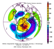
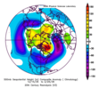
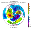
Here are all Cool Neutral / La Nina January's at Greensboro with at least 5 inches of snow since 1980 (average monthly snowfall for the selected years was 9.3)
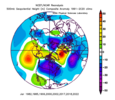
Here are all Cool Neutral / La Nina February's at Greensboro with at least 4 inches of snow since 1980 (average monthly snowfall for the selected years was 9.0)
Last edited:
trackersacker
Member
Compliments of a scoured out cold source to our north. The seesaw is tipping in our direction, but there isn’t much cold to send down into the trough. We’ll eventually bring colder air back into the picture, but next week is gonna have to really wind up to pull in enough cold air for a wet snow event in our neck of the woods. Maybe doable, but still low probability for now.Also, why the hell is it January 15th (perfect climo), the trough looks like it does below, we have 532 thickness lines wrapping down to northern Louisiana with a surface FL panhandle low literally in the *perfect* position and the best we can do at 7 pm ET are balmy 40s and 50s (not even upper 30s) and RAIN for literally *everyone* except Erie PA and Mt. Mitchell, NC?
View attachment 181668View attachment 181667View attachment 181666View attachment 181665
- Joined
- Nov 29, 2021
- Messages
- 42
- Reaction score
- 144
That’s definitely true. I guess the deeper question is: does the 540 thickness line mean the same today as it did 50-75 years ago, in that more variables have to fall in place now for it to be the (relatively) true rain/snow changeover line because of how average 500 mb heights for, say 40° north, over North America during DJF have steadily risen overall since the 1960s for all of mid latitude CONUS. In other words, what used to be the upper air norm is not normal now.Ethan,
The simple answer is that we don’t live at 500 mb. They don’t always correlate well. There’s no low level cold air connection. The closest Conus sfc high is a measly 1025 mb and it’s way up at the Canadian border.
Iceagewhereartthou
Member
December 1st 2019.I wonder at what point will greater than half of setups that could traditionally bring significant southern snow just bring rain now.
LukeBarrette
im north of 90% of people on here so yeah
Meteorology Student
Member
2024 Supporter
2017-2023 Supporter
Could be setting up nicely with a developing CAD once the SE LP exits and the next shortwave dives in from the PAC NW. The 12th begins the transition to cold for a time.
View attachment 181673View attachment 181672
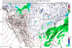
Just terrible sfc temps killing this
It seems like everything that ever happens on the ICON that is any good always seems to happen at 192 hrs.
Yep. That's why I'm more interested in the period just beyond this. Although if it wound up strong enough, I suppose NC and Virginia could trend cold enough.View attachment 181674
Just terrible sfc temps killing this
bncho
Member
Probably should be focusing on this winter, but I was kinda bored and decided to look at next year. I will say I am cautiously optimistic for 2026-27.
La Niña is definitely east based. This does leave the door open for a Modoki El Niño next year, especially with these impressive WWBs and the similarities to the 2014-15 transition to El Nino.
We also have history on our side for at least an El Nino event. The weakening -PDO combined with the La Nina strength as of Dec 31 in Nino 3.4 says we would see an El Nino somewhere in the 0.5-1.2°C range next winter. It should also be able to couple with the atmosphere compared the 2018-19 event. Obviously a lot can change, but the background state looks more favorable than recent transitions like 22-23 into 23-24.
The proof is in the MSLP pudding. If you don’t see sprawling high pressure to the north and or northeast you can forget about it. Always looking for that high pressure dominated pattern to emerge. Then you’ve got something to make frozen precipitation withUniclimate
Yup, that is one of the main Cold Rain keys to success.The proof is in the MSLP pudding. If you don’t see sprawling high pressure to the north and or northeast you can forget about it. Always looking for that high pressure dominated pattern to emerge. Then you’ve got something to make frozen precipitation with
NBAcentel
Member
trackersacker
Member
John1122
Member
Gives me 10 or so. No way it happens but it would be incredible.Brother who scores 13” from a clipperView attachment 181680
@LukeBarrette can get 13” from a derechoBrother who scores 13” from a clipperView attachment 181680
HailCore
Member
Should that happen it’s gotta be a snow record, no way a sole clipper could do that, right? Probably some enhancement somewhere along there.Brother who scores 13” from a clipperView attachment 181680
Should that happen it’s gotta be a snow record, no way a sole clipper could do that, right? Probably some enhancement somewhere along there.
Unless the water to snow ratios are extremely high??
LukeBarrette
im north of 90% of people on here so yeah
Meteorology Student
Member
2024 Supporter
2017-2023 Supporter
chilllllll I have not had a 4+ inch snowstorm since 2022 I believe@LukeBarrette can get 13” from a derecho
Such a weird hybrid clipper
That thing is a thin mintchilllllll I have not had a 4+ inch snowstorm since 2022 I believe
Such a weird hybrid clipper
LukeBarrette
im north of 90% of people on here so yeah
Meteorology Student
Member
2024 Supporter
2017-2023 Supporter
HailCore
Member
I agree, but the crazy thing is that the majority of this thing falls while sfc temps are around or above freezing with the backside only reaching upper 20s. The amount of moisture in there is absurd.Unless the water to snow ratios are extremely high??

