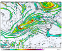
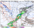
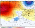
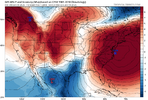
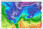
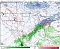
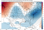
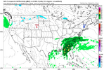
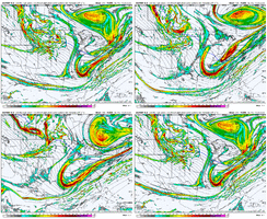
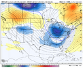
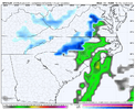
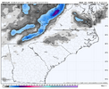
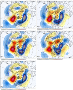
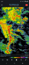
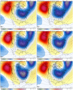
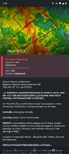
Cutoff doesn’t appear as stranded this run. Now that I said that watch it retrograde 2k miles back to the SW off the coast of Cabo
-
Hello, please take a minute to check out our awesome content, contributed by the wonderful members of our community. We hope you'll add your own thoughts and opinions by making a free account!
You are using an out of date browser. It may not display this or other websites correctly.
You should upgrade or use an alternative browser.
You should upgrade or use an alternative browser.
Pattern January Joke
- Thread starter SD
- Start date
LukeBarrette
im north of 90% of people on here so yeah
Meteorology Student
Member
2024 Supporter
2017-2023 Supporter
LukeBarrette
im north of 90% of people on here so yeah
Meteorology Student
Member
2024 Supporter
2017-2023 Supporter
NBAcentel
Member
LukeBarrette
im north of 90% of people on here so yeah
Meteorology Student
Member
2024 Supporter
2017-2023 Supporter
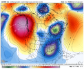
Hmm, yk if we can get that TPV more involved then next weeks deal can become something more then a rain bomb View attachment 181685
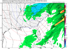
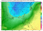
No problem with cold air aloft, just sfc issues
LukeBarrette
im north of 90% of people on here so yeah
Meteorology Student
Member
2024 Supporter
2017-2023 Supporter
Classic in-betweener look here. Push that ridge back off the SE coast a hair and we are in trouble there. Overrunning air out ahead. Single digit dews east of the mountains
HailCore
Member
I like that a lot better than most setups where WAA ruins any chance of something mixing in at lower elevations. I would think it’s a bit easier to cool the surface off or trend a few degrees colder in this case versus working with a cooler surface and major warm nose which seems to be a lot more common.
NBAcentel
Member
accu35
Member
Euro was a good run. Not there yet for the 15th system but very close to something special
NBAcentel
Member
NBAcentel
Member
Morning latest CFS Update: Great trends continue/ even better.
LOL hits the VA/NC border counties 5 separate times with frozen before end of January.
I'll post this image today, last frame , just to show one of the many cold dives. The trend is deeper and wider as you roll through 1st week of February. Good to see model being consistent showing a late Jan early Fab Feb. Todays image is all the way out to Feb 9th.
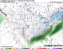

All the ops are on the cusp to doing something for Jan 15th. I' interested to watch next few cycles. Got about a 50% chance to rope something frozen in. Maybe we can pull a rabbit out of the hat.Euro was a good run. Not there yet for the 15th system but very close to something special
Euro should be closer here for the 15-16th
View attachment 181696
I'm grabbing that look and the ICON's and running like a stole it. I don't care what the models are trying to be too warm at the surface.
CNCsnwfan1210
Member
I’m still interested in the 19-22 timeframe with the location of that TPV and upstream western ridge. Models may not show much now, but things can change so quickly with that especially with the cutoff business/STJ and trough over the east. I could be wrong, but I like that period FWIW.
Sent from my iPhone using Tapatalk
Sent from my iPhone using Tapatalk
packfan98
Moderator
CNCsnwfan1210
Member
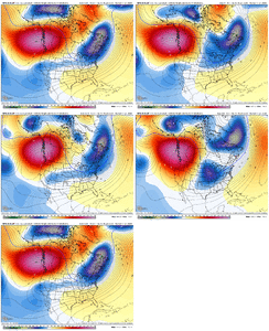
Ugh. Not a fan of this trend. We are losing our cold air and favorable trough position. Bye bye -NAO block. Hopefully we can get some better looks over the next couple of days.
View attachment 181705

00z EPS for comparison
Sent from my iPhone using Tapatalk
Webberweather53
Meteorologist
Ugh. Not a fan of this trend. We are losing our cold air and favorable trough position. Bye bye -NAO block. Hopefully we can get some better looks over the next couple of days.
View attachment 181705
Models likely are not properly handling the wave reflection that usually comes with these North Pacific blocking patterns
Webberweather53
Meteorologist
Models are having a hard time sniffing out the wave reflection that usually comes with these North Pacific blocking (-EPO/-WPO) patterns. That plus the east QBO/high solar base state, and the re-strengthening polar vortex aloft following our early-winter stratospheric warming event usually favor +NAM/AO
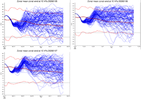

GiantBear
Member
So we may see a +NAO signal return in a few days?
Webberweather53
Meteorologist
Things have been setup well for a strong +NAM/AO in Feb-Mar this winter
Late winter-early spring +NAM is very typical of El Niño onset years. High solar/east qbo base state makes this more likely, which we talked about months ago
Late winter-early spring +NAM is very typical of El Niño onset years. High solar/east qbo base state makes this more likely, which we talked about months ago
Brent
Member
Ugh. Not a fan of this trend. We are losing our cold air and favorable trough position. Bye bye -NAO block. Hopefully we can get some better looks over the next couple of days.
View attachment 181705
I see the rising NAO trend you’re showing on the last few AI GEFS. But on the regular GEFS mean, the NAO has been favored to go essentially neutral for a good number of days of runs (even further back than this gif goes back). So, on that ensemble mean, it’s really nothing new/surprising:
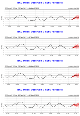
I’m not gonna pretend I know what this means. I just want it to snow in the South.Things have been setup well for a strong +NAM/AO in Feb-Mar this winter
Late winter-early spring +NAM is very typical of El Niño onset years. High solar/east qbo base state makes this more likely, which we talked about months ago
NCWeatherNow
Member
Models are having a hard time sniffing out the wave reflection that usually comes with these North Pacific blocking (-EPO/-WPO) patterns. That plus the east QBO/high solar base state, and the re-strengthening polar vortex aloft following our early-winter stratospheric warming event usually favor +NAM/AO
View attachment 181707
Do you think this would be good or bad for wintry weather in the SE?
I think it means send the pizza to @LukeBarretteI’m not gonna pretend I know what this means. I just want it to snow in the South.
rburrel2
Member
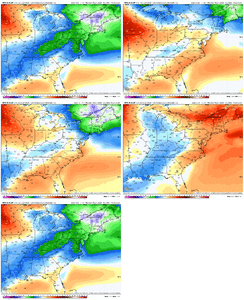
The overrunning threat has started to consolidate on the models to more of a weak/fizzling frontal look unfortunately. But there’s still some potential there. First trough that plunges down on day 7/8 delivers cold/dry air and the 06z gfs capitalizes on that with a decent burst of snow over north ga/western nc/ even down to my house in SC when the frontal precip comes through.
Euro was more robust with precip, but too warm, ai models are too weak.
Maybe the trends will be more favorable today.
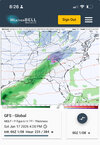
Euro was more robust with precip, but too warm, ai models are too weak.
Maybe the trends will be more favorable today.

It looks like, for the first time this winter, the MJO is poised to venture far outside of the COD before settling into a lower amplitude 7-8-1 progression into early February. I'd like to think this will help to shake things up in our favor for the last gasp at winter before my unofficial end of winter, February 20th.
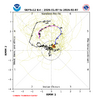
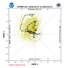


It looks like, for the first time this winter, the MJO is poised to venture far outside of the COD before settling into a lower amplitude 7-8-1 progression into early February. I'd like to think this will help to shake things up in our favor for the last gasp at winter before my unofficial end of winter, February 20th.
View attachment 181719
View attachment 181720
Thanks for posting those. Here’s something I hope you find interesting:
# of days per phase Jans 2011-25 (465 total days)/% of Jan days per phase
1: 17 (only 4%)
2: 26 (only 6%)
3: 67 (14%)
4: 51 (11%)
5: 57 (12%)
6: 101 (a whopping 22%)
7: 104 (a whopping 22%)
8: 42 (9%)
So, since 2011, each of Jan phase 6 and 7 days has been more than twice as common as phase 8 days and a whopping FOUR TO FIVE times as frequent as each of Jan phase 1-2 days!
So, the progs that you showed with a lot of days in 6 and/or 7 (especially GEFS) would fit well with the Jan trend of the last 15 years. I’m suspecting CC is a factor.
Brent
Member
Interesting research! Do you have data to compare with the much colder 70s and 80s?Thanks for posting those. Here’s something I hope you find interesting:
# of days per phase Jans 2011-25 (465 total days)/% of Jan days per phase
1: 17 (only 4%)
2: 26 (only 6%)
3: 67 (14%)
4: 51 (11%)
5: 57 (12%)
6: 101 (a whopping 22%)
7: 104 (a whopping 22%)
8: 42 (9%)
So, since 2011, each of Jan phase 6 and 7 days has been more than twice as common as phase 8 days and a whopping FOUR TO FIVE times as frequent as each of Jan phase 1-2 days!
So, the progs that you showed with a lot of days in 6 and/or 7 (especially GEFS) would fit well with the Jan trend of the last 15 years. I’m suspecting CC is a factor.
CNCsnwfan1210
Member
Besides stating the obvious, increasing lower heights in the east Pacific could help enhance the subtropical jet.
Sent from my iPhone using Tapatalk
Interesting research! Do you have data to compare with the much colder 70s and 80s?
Great question! This will probably be my next homework assignment. I’m curious enough, myself, to count the days of each phase for Jan 1975-89.
I think next Thursday could turn into something. Need that baby to dig a little more. We got our cold coming in. Several systems have potential and we're in prime climo. I remember January 2017 was looking grim and then we got that storm around Martin Luther King Day. I believe good times are ahead.

