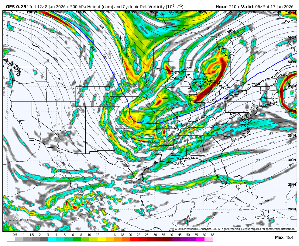
It’s close to an all out bomb. A little more energy on the backside of that trough, it go boomoh wow, it's doing it. View attachment 181743
-
Hello, please take a minute to check out our awesome content, contributed by the wonderful members of our community. We hope you'll add your own thoughts and opinions by making a free account!
You are using an out of date browser. It may not display this or other websites correctly.
You should upgrade or use an alternative browser.
You should upgrade or use an alternative browser.
Pattern January Joke
- Thread starter SD
- Start date
LukeBarrette
im north of 90% of people on here so yeah
Meteorology Student
Member
2024 Supporter
2017-2023 Supporter
Synoptically not the same. GFS is almost entirely northern stream based as it digs and then tilts. ICON is a phase of the twoLook again...
Yeah, this is hour 189. Big bomb potential...It’s close to an all out bomb. A little more energy on the backside of that trough, it go boom

packfan98
Moderator
Round 2 coming I think.
EDIT - Fizzles out, but it's a good look
EDIT - Fizzles out, but it's a good look
Last edited:
MEET ME AT THE ROOF MY GUY
Secondary look again?Round 2 coming I think

LukeBarrette
im north of 90% of people on here so yeah
Meteorology Student
Member
2024 Supporter
2017-2023 Supporter

No 2018 was good too but I got my dates mixed up on the 2017 storm. It was the 6th and 7th.I think he meant Jan 2018
Oh, so close.
I’ll take my chances on a favorable track if this is what we’re working with 
LukeBarrette
im north of 90% of people on here so yeah
Meteorology Student
Member
2024 Supporter
2017-2023 Supporter


Extremely fast flow was the reason that second look did not work
The next storm is the Southernwx mountain special. We will meet Friday evening. I'll order the pizza.
LongRanger
Member
Now you know that will always move NW and end up a I85 specialAhhh alee nah!!!
View attachment 181747
Lil inbetweener but we were troughed up with no ridge in sight so I’m ok with it for nowView attachment 181749
Odd look here
Tsappfrog20
Member
A good start by the GFS hope the GEFS follows then of course King EURO!
Sent from my iPhone using Tapatalk
Sent from my iPhone using Tapatalk
rburrel2
Member
We’ve got two bullets in the chamber inside of day 10. Maybe one of them will work out. I’m definitely more intrigued about that first trough after the last few model runs. Very close to something big. And I feel like the ai models typically are too broad/rounded/washed out with troughs at this lead time, so not a huge cause for concern there.
rburrel2
Member
Mega wedge incoming? We got our nao blocking back!

Yeah that’s the main thing - fairly sharp western ridge trying to dig energy sharply into the SE (La Niña style like it or not)Lil inbetweener but we were troughed up with no ridge in sight so I’m ok with it for now
GFS has a cold core pressing in later

I really do like when that happens 
1050 high over the lakes on the GFS

FoothillsWX
Member
NW of I-85 hasn’t scored a good storm in years. Asheville and most of the foothills are in a historic snow drought. Last time warning criteria was met — Jan 2022.Now you know that will always move NW and end up a I85 special
LukeBarrette
im north of 90% of people on here so yeah
Meteorology Student
Member
2024 Supporter
2017-2023 Supporter
Very icy solution incoming
gfs is the worst model in the world and sucks and should be left out in a field to die and is a synecdoche for american deterioration until it shows a good snow
LukeBarrette
im north of 90% of people on here so yeah
Meteorology Student
Member
2024 Supporter
2017-2023 Supporter
Very icy solution incoming

Stupid idiot shortwave out west ruined the final look with SW flow. Ehh who cares
I love a good 900hr fail proof look1050 high over the lakes on the GFS

But you can’t have it all working at the same time unfortunately

LukeBarrette
im north of 90% of people on here so yeah
Meteorology Student
Member
2024 Supporter
2017-2023 Supporter

rburrel2
Member
Pretty dramatic change in the long range on the gfs ai mean at 850mb. Love to see it.

UKMET. Last frame. to positively tilted

Agreed hell the coast and areas down east have gotten more in the last few years than we have. Next Thursday could be interesting we just need that baby to dig and connect the northern and southern streams and we might be cooking. I know it's the icon but it did show us the path to Glory.NW of I-85 hasn’t scored a good storm in years. Asheville and most of the foothills are in a historic snow drought. Last time warning criteria was met — Jan 2022.
Iceagewhereartthou
Member
Good thing this is the GFS. If that were to actually happen I would cry in the fetal position for 24 hours and give up on weather. Throw all my weather pics and calenders and books and thermometers away and quit.
mx3gsr92
Member
Book your hotels in Moyock ASAP.
rburrel2
Member
Hmm… best look yet on the gfs ai mean.


A good start by the GFS hope the GEFS follows then of course King EURO!
Sent from my iPhone using Tapatalk
Unfortunately though not surprisingly, the 12Z GEFS says the op. is a major outlier:


I am fully expecting the 12Z Euro to be real close to the 12z GFS and Icon. Split difference to a degree, but more so toward the GFS. The 0Z Euro last night was already where these two are at today. To be fair 0z Icon was honking a little last night on the 5H maps.
When I say close, I'm talking 500mb vort maps, not surface maps
When I say close, I'm talking 500mb vort maps, not surface maps
tennessee storm
Member
Just not cold enough still …. Hopefully we get better changes soonWe’ve got two bullets in the chamber inside of day 10. Maybe one of them will work out. I’m definitely more intrigued about that first trough after the last few model runs. Very close to something big. And I feel like the ai models typically are too broad/rounded/washed out with troughs at this lead time, so not a huge cause for concern there.
12z Euro AI is a cold run but not a lot of moisture.
Can't really worry very much about moisture at this range. Give me all these maps to verify and let's see what we can do in the medium range. Wouldn't take much to pick up that southern piece of energy12z Euro AI is a cold run but not a lot of moisture.


The amount of effort that it is even taking to get precipitation around here is just monumental. I get La Nina and all. But we just keep jumping from one pattern variation to another that all produce the same result.
As long as we have a low-topped ridge or a NW-SE oriented ridge and no STJ, it's a clipper fest.
As long as we have a low-topped ridge or a NW-SE oriented ridge and no STJ, it's a clipper fest.