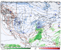
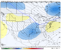
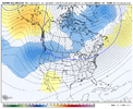
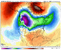
I don’t see a cutoff stranded in the SW from the euro so that’s a good sign I thinkA brisk trough
View attachment 181586
-
Hello, please take a minute to check out our awesome content, contributed by the wonderful members of our community. We hope you'll add your own thoughts and opinions by making a free account!
You are using an out of date browser. It may not display this or other websites correctly.
You should upgrade or use an alternative browser.
You should upgrade or use an alternative browser.
Pattern January Joke
- Thread starter SD
- Start date
CNCsnwfan1210
Member
LukeBarrette
im north of 90% of people on here so yeah
Meteorology Student
Member
2024 Supporter
2017-2023 Supporter
LukeBarrette
im north of 90% of people on here so yeah
Meteorology Student
Member
2024 Supporter
2017-2023 Supporter
Euro has so much energy flying around it kinda cooks the whole thing
LukeBarrette
im north of 90% of people on here so yeah
Meteorology Student
Member
2024 Supporter
2017-2023 Supporter
Nashville stole our snowstorm this run. Good for them. They never get snow.
CNCsnwfan1210
Member
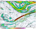
View attachment 181594
Not a bad look here just doesn't quite happen
There’s some SW flow on that southern branch though I think.
Sent from my iPhone using Tapatalk
LukeBarrette
im north of 90% of people on here so yeah
Meteorology Student
Member
2024 Supporter
2017-2023 Supporter
#natgas
Lol! But seriously, NG moves relatively little on op runs because they’re so unstable and thus aren’t very telling. So, instead it usually cares mainly about the more credible GEFS and EPS means, especially in week 2, and forecasts of mets of course put much more weight on those.
CNCsnwfan1210
Member

Favorable trends here for the first wave late next week, trend with the western ridge helping out with that scenario.
Sent from my iPhone using Tapatalk
LukeBarrette
im north of 90% of people on here so yeah
Meteorology Student
Member
2024 Supporter
2017-2023 Supporter
accu35
Member
I still feel like this first wave has good potential with it. Good times ahead
Favorable trends here for the first wave late next week, trend with the western ridge helping out with that scenario.
Sent from my iPhone using Tapatalk
CNCsnwfan1210
Member
I still feel like this first wave has good potential with it. Good times ahead
Yep, keep spiking that ridge to allow the shortwave to take full advantage of the trough downstream, you could def get a decent size storm out of it.
Sent from my iPhone using Tapatalk
A nice block in east Canada would go a long way here.Yep, keep spiking that ridge to allow the shortwave to take full advantage of the trough downstream, you could def get a decent size storm out of it.
Sent from my iPhone using Tapatalk
The mean smooths out the details. Op shows a kicker.
CNCsnwfan1210
Member
A nice block in east Canada would go a long way here.
The mean smooths out the details. Op shows a kicker.
Failed to mention the NAO block would help the flow slow down and provide cold air at the same time.
Sent from my iPhone using Tapatalk
LukeBarrette
im north of 90% of people on here so yeah
Meteorology Student
Member
2024 Supporter
2017-2023 Supporter
Sorta thing that pops up in medium range out of nowhere. Lots of time for thatA nice block in east Canada would go a long way here.
The mean smooths out the details. Op shows a kicker.
Yeah we're a looooong way out. Certainly don't want it picture perfect at this range. And no need to sweat the details rn as long as the big picture looks decent. That is a huge blessing in an of itself!Sorta thing that pops up in medium range out of nowhere. Lots of time for that
Thank you, Everybody, for a great and respectful discussion the last couple of days. It's nice to log in and not see a bunch of arguing and insulting and derailing. Really appreciate that!
That kinda gives me some February 2014 vibes. The first system produces a light to moderate overrunning event then you get a gulf low developing on the back side producing a major storm
Webberweather53
Meteorologist
CNCsnwfan1210
Member
That kinda gives me some February 2014 vibes. The first system produces a light to moderate overrunning event then you get a gulf low developing on the back side producing a major storm
There’s quite a few characteristics from Jan-FEB 2014 that are similar to the upcoming pattern. Although, Jan 2014 cold hit early than this year, we’re a little behind on that, but hopefully we’ll make up for it later.
Sent from my iPhone using Tapatalk
CNCsnwfan1210
Member
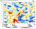
This is just insane to see.
Absolute monster westerly wind burst in the tropical West Pacific
View attachment 181598
Sent from my iPhone using Tapatalk
Did you ever think that we would see the LaNina die out so quickly and then possibly go straight into an El Niño?This is just insane to see.
Absolute monster westerly wind burst in the tropical West Pacific
View attachment 181598
SnowNiner
Member
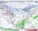
12z EPS falls apart late in the run though. I can't see the rest of the hemisphere, but yuck.
View attachment 181599
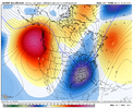
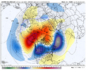
Strong -PNA:
LukeBarrette
im north of 90% of people on here so yeah
Meteorology Student
Member
2024 Supporter
2017-2023 Supporter
SnowNiner
Member
Thanks. Looks like the jet retracted. And that dumb tilted bent over w ridge. Lot's of time for that to reverse and head back east like it's always been doing this year.
Lots of blocking up top though, with a decent -NAO for super wedges.
NCWeatherNow
Member
Im raging so hard
broken025
Member
Just give it a day or two for the models to go to ---- and we will be ready to kill each other again.Thank you, Everybody, for a great and respectful discussion the last couple of days. It's nice to log in and not see a bunch of arguing and insulting and derailing. Really appreciate that!
NCWeatherNow
Member
When yall expect it to downtrendJust give it a day or two for the models to go to ---- and we will be ready to kill each other again.
EPS snow mean is still just pitiful. I know not to put much stock into it but I’d sure like to see more then 6-7 members showing more then a trace of snow 
NCWeatherNow
Member
Im still skepticalEPS snow mean is still just pitiful. I know not to put much stock into it but I’d sure like to see more then 6-7 members showing more then a trace of snow
Could be a rugpull
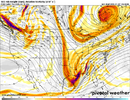
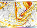
ICON was setting up for glory at 180, EC has just enough stream separation to hamper a GOM low forming. I'm cool though with a weak suppressed track at this range. Pretty much all guidance though is showing a anomalously deep trough over the Eastern US next week, question is do we get a storm out of it.


Last edited:
Iceagewhereartthou
Member
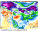
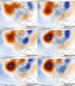
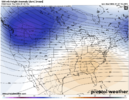
This is just a snap shot of course, but this is an amazing depiction of what has been happening the past 4 years in potential winter weather scenarios. Notice the blues over the foothills/piedmont. This is the exact area that we were discussing has been so behind in snowfall. Whatever has been happening with the orientation and progression of cold has not allowed for sufficient cooling for those areas. Yet, historically; those were the best areas with a chance outside the mountains. Not sure what has changed so drastically but I wish it would change back.
rburrel2
Member
Right where we want it at this timeframe, if you go off seasonal biases12z EPS falls apart late in the run though. I can't see the rest of the hemisphere, but yuck.
View attachment 181599
Off the 12Z Eps: After this Sunday Greensboro never gets higher than the mid 40's for highs throughout the entire run. Only exception is wed 1/14 high of 50-51.
As things stand now: I put the odds of Greensboro hitting/ exceeding it's normal annual snowfall accum before Easter Sunday at 99%. Caveat is gonna be qpf rather than Cold
As things stand now: I put the odds of Greensboro hitting/ exceeding it's normal annual snowfall accum before Easter Sunday at 99%. Caveat is gonna be qpf rather than Cold
CNCsnwfan1210
Member
Right where we want it at this timeframe, if you go off seasonal biases
Yeah models want to steer toward a La Niña pattern in the long range, but it auto corrects toward a western ridge/east trough ( for the past 2 months) at least.
Sent from my iPhone using Tapatalk

