trackersacker
Member
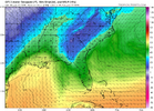
Lol I jinxed it. It slipped up. Not gonna be as crazy as 12zI don’t wanna jinx it , but I feel like we’re already trending towards a quicker and further west phase on the 18z GFS than we had on 12z
Lol I jinxed it. It slipped up. Not gonna be as crazy as 12zI don’t wanna jinx it , but I feel like we’re already trending towards a quicker and further west phase on the 18z GFS than we had on 12z
Posted a couple of weeks ago that, for some reason, La Nina...and this pattern is frustrating. West of the apps...rain, rain, rain. East? We can't seem to get ANY rain. Couple that with the incredibly frustrating H pressures that miss time the moisture feed.We’ve received 0.0 here in Columbia.
I still think it’s gonna bounce back on 00z. For the past day and a half, the 00z/12z runs have been better while the 06z/18z runs have been worse. The next day or two, I expect both to come to a consensus, and hopefully it’s more of an 00z/12z solution.Lol I jinxed it. It slipped up. Not gonna be as crazy as 12z
Aka not a soul on this boardGood hit for the mid-Atlantic crew on the gfs
Yeah it’s gonna bounce around for sureI still think it’s gonna bounce back on 00z. For the past day and a half, the 00z/12z runs have been better while the 06z/18z runs have been worse. The next day or two, I expect both to come to a consensus, and hopefully it’s more of an 00z/12z solution.
I liked the GFSAka not a soul on this board
Pretty to see, but unless we form some kind of secondary this will 100% never verify here. The mountains won’t allow it. Idc if it’s a 1070 high on top of Pigeon Forge. It just can’t do it
Would be so much of a better system if it wasn’t a sheared wave pushing the system quickly throughHere we go. Looks like we got a fresh injection of something going into the 2nd storm. View attachment 182284View attachment 182285
It won't verify like that clown map I bet my house on it. If toccoa Ga gets snow then I get snow...thats how it is.SC is basically left OUT outside of the mountains. Parts of GA and NC get a good hit.
Well this did kind of happened in the Mid January 2018 storm. Columbia got completely shafted in a two week span from the North & to the South. But anyways! Nice run from the GFS for many on the board!!Pretty to see, but unless we form some kind of secondary this will 100% never verify here. The mountains won’t allow it. Idc if it’s a 1070 high on top of Pigeon Forge. It just can’t do it
the triad can do it successfully. Atlanta can do it no problem. We cannot
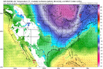
This will verify don’t worryOddly skips over SC but hey it’s another run showing something for a lot of the board View attachment 182296
Broader trough like the Euro instead of another useless sharp trough. For us east of the apps folks, we need HP in both the northeast and in the Ohio valley to get a storm (banana high)That looked more like EURO
This set up isn’t a death sentence for us bc the air in place ahead of it is pretty cold and dry as well. A slight shift south with the boundary on this run and we’re all snow, start to finish.Pretty to see, but unless we form some kind of secondary this will 100% never verify here. The mountains won’t allow it. Idc if it’s a 1070 high on top of Pigeon Forge. It just can’t do it
the triad can do it successfully. Atlanta can do it no problem. We cannot
I’m looking at it and I just don’t see a scenario where we snow. I mean I know there are scenarios where travelers rest can score in late arriving cold setups but this is certainly not South Carolinas bread and butter setup. As it stands At least. It’s just brutal living on the immediate Lee side. Until you get a wedge but that never even happens any moreThis set up isn’t a death sentence for us bc the air in place ahead of it is pretty cold and dry as well. A slight shift south with the boundary on this run and we’re all snow, start to finish.

What about the Triad area in ur opinionI’m looking at it and I just don’t see a scenario where we snow. I mean I know there are scenarios where travelers rest can score in late arriving cold setups but this is certainly not South Carolinas bread and butter setup. As it stands At least. It’s just brutal living on the immediate Lee side. Until you get a wedge but that never even happens any more
I’m looking at it and I just don’t see a scenario where we snow. I mean I know there are scenarios where travelers rest can score in late arriving cold setups but this is certainly not South Carolinas bread and butter setup. As it stands At least. It’s just brutal living on the immediate Lee side. Until you get a wedge but that never even happens any more

We’re not roasting out ahead of it. No need to panic yet. Hi-res models would have dumped on us with this depiction.I’m looking at it and I just don’t see a scenario where we snow. I mean I know there are scenarios where travelers rest can score in late arriving cold setups but this is certainly not South Carolinas bread and butter setup. As it stands At least. It’s just brutal living on the immediate Lee side. Until you get a wedge but that never even happens any more

I agree with thos 100%. Luckily it's the gfs and over a week away. More changes to come.View attachment 182298
Unless that L in southern Canada gets replaced by one of those Hs, nobody east of the Apps are getting snow, not just the Lee side folks. If this trends more like the Euro then we have a chance
If this happened tomorrow the triad would see snowWhat about the Triad area in ur opinion
You’ve got to get that cold bleeding south prior to precip. There’s got to be some sort of gap between front and rain. Need cold air sagging in some way shape or fashion prior or you can forget aboutWe’re not roasting out ahead of it. No need to panic yet. Hi-res models would have dumped on us with this depiction.
View attachment 182300
