• Hello, please take a minute to check out our awesome content, contributed by the wonderful members of our community. We hope you'll add your own thoughts and opinions by making a free account!

Pattern January Joke

i can name at least 4 winter storms here in the last 30 years that had no high pressure to the north. It does happen. And what’s being depicted next Saturday is how it can happen(but needs to remain weak).
Yea its a delicate situation for us in NW SC for sure. But all this thing needs to do is dig a little more and/or slow down which are both very possible. Now if the euro starts losing it around Tuesday I'll tee up the can.
 
The models remain 100% in agreement on predicting a very lengthy phase 6 that covers the upcoming 1/15-19 SE winter storm dual threat period.

During the 15 Jan phase 6 La Nina periods when SE temperatures were MB, B or NN in the aggregate for the phase 6 period, they were often productive for measurable wintry precip in 1+ of ATL, GSP, GSO, and RDU:

-1976 MB RDU 0.4”
-1999 NN GSP 0.7”
-2000 B GSO 6.8”, RDU 5.4”
-2011 MB ATL 4.4”, GSP 6.5”, GSO 1.4”, RDU 0.3”
-2017 MB GSP 1.9”, GSO 6.0”, RDU 0.5”
-2018 NN GSO 0.5”
-2021 NN GSO 0.4”, RDU 1.6”
-2022 B GSO 1.1”, RDU 1.5”
-2022 MB GSO 1.8”, RDU 0.4”

So, 9 of these 15 periods (60%) had measurable wintry precip in at least one of these 4 cities.
 
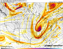
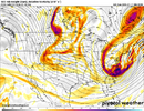
could still be fools gold. i definitely wrote it off at first as 'pie in the sky'. but becoming more and more interested in how the the 1st shortwave behaves and folds negatively as it approaches the coast. i think there's still plenty of opportunity to get more folks involved (if we trend the right direction). this can be the type of storm that amplifies and sharpens as the short range models get a hold of it.
 
@hr78, more vorticity consolidated on the south end of the longwave trough. ridge out west is a smidge weaker. overall still liking what i'm seeing

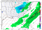
edit: @hr90 pretty significant shift southwest with the most vigorous portion of the shortwave.. i think this could be a fun run for someone...
 
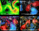
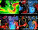
0Z ICON similarly to the 12Z run has historically low H5 hts over N GA of ~520 dm at the N border. Going back to 1948, the only two cases I’ve so far been able to find with lower H5 hts at the N GA border are these:

-~512 dm 1/27/1986 7AM: Asheville plunged to -2 F next day with mid single digits ATL-RDU; this was also during MJO phase 6 and +PNA; it was during cold neutral ENSO, -AO, +NAO, -EPO, and neutral WPO
H5 in upper right panel:
IMG_6884.gif

-~516 dm 3/13/1993 7PM backside of the superstorm, which brought record cold, too; this was during MJO phase 4 and a weak -PNA; warm neutral ENSO, +AO, +NAO, -EPO, -WPO
IMG_6899.gif
 
d8065ef474fa890bd5c4c89e9fae26c0.gif

Not a bad look so far


Sent from my iPhone using Tapatalk
 
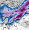
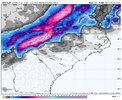
I like what I’m seeing on the GFS for the mountains of north GA. We have had success with the mountains enhancing snow under the vortmax
 
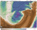
yeah. solid run though. i don't think the gfs or any global is going to nail cyclogenesis with this. canadian also looking like a wholesale shift west with our trough


Although this setup is extremely unlikely to succeed for the southeast. If you get GFS but just slightly deeper you would maybe be talking potential blizzard conditions. Obviously this would take an extremely extremely unlikely scenario. But it's one to watch nonetheless even if it's a minor event.
 
2nd storm is still an unknown entity to me. i still think it's an uncommon method for us to score (glorified frontal passage) but i think there's more moving parts to sort out. also think incumbent environment it's coming into is cold and favorable. lots still on the table with that.
 
Although this setup is extremely unlikely to succeed for the southeast. If you get GFS but just slightly deeper you would maybe be talking potential blizzard conditions. Obviously this would take an extremely extremely unlikely scenario. But it's one to watch nonetheless even if it's a minor event.
there's a lot of potential here. it reminds me a lot of the jan 4 2018 storm which had a lot of trepidation over digging, storm strength etc in the medium range before coming into form in the last 72 hours
 
2nd storm is still an unknown entity to me. i still think it's an uncommon method for us to score (glorified frontal passage) but i think there's more moving parts to sort out. also think incumbent environment it's coming into is cold and favorable. lots still on the table with that.
Last time I can think of an overrunner succeding was 8 years ago in 12/8/17
 
Back
Top