LukeBarrette
im north of 90% of people on here so yeah
Meteorology Student
Member
2024 Supporter
2017-2023 Supporter
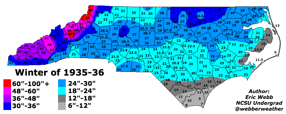
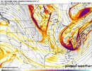
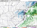
At this juncture, if you are planning on heading to the Apps for a snow chase. Be ready for really good ratios and very heavy snow in banding


.png")
.png")

