-
Hello, please take a minute to check out our awesome content, contributed by the wonderful members of our community. We hope you'll add your own thoughts and opinions by making a free account!
You are using an out of date browser. It may not display this or other websites correctly.
You should upgrade or use an alternative browser.
You should upgrade or use an alternative browser.
Pattern January Joke
- Thread starter SD
- Start date
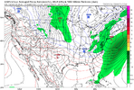
I know there is a lot of talk about multiple potential systems here. I have learned in the past, however, that it is important to remember how much the first system impacts system #2 down the road. It is almost fruitless to even guess what will happen when models aren’t even close to resolving the first one, which would have enormous implications for the next down the road. If we get a bombing storm or just a frontal passage for storm #1, then storm #2 will be much different.I know people are worried about boundary layer issues with both systems, and rightfully so, but for the 2nd system… we will actually have an extremely cold and dry airmass in place out ahead of it. That leaves a lot of room for things to trend colder at the surface.
For example: the gfs has GSP at 28/1 Saturday morning. Won’t shock my if the boundary isn’t that big of a problem with the 2nd storm.
NCWeatherNow
Member
Very low
The 2nd one is most likely to go away in about 2 runs.I know there is a lot of talk about multiple potential systems here. I have learned in the past, however, that it is important to remember how much the first system impacts system #2 down the road. It is almost fruitless to even guess what will happen when models aren’t even close to resolving the first one, which would have enormous implications for the next down the road. If we get a bombing storm or just a frontal passage for storm #1, then storm #2 will be much different.
- Joined
- Jan 23, 2021
- Messages
- 4,602
- Reaction score
- 15,197
- Location
- Lebanon Township, Durham County NC
i get it's nice to have things to track and see pretty colors on a map but going through the thread pages i slept through frankly i saw way more hand wringing than i expected for a storm 11 days out on the gfs
Brent
Member
i get it's nice to have things to track and see pretty colors on a map but going through the thread pages i slept through frankly i saw way more hand wringing than i expected for a storm 11 days out on the gfs
Seriously and just to add the same GFS that totally failed with the strongest Atlantic hurricane landfall in 90 years just 2 and a half months ago haha
Drizzle set in early today. Messed up a lot of outdoor work and Golf today Im sure.
LukeBarrette
im north of 90% of people on here so yeah
Meteorology Student
Member
2024 Supporter
2017-2023 Supporter
Had an off day Tuesday and shot a +3 74. It was real nice last few days for VADrizzle set in early today. Messed up a lot of outdoor work and Golf today Im sure.
True, but do you not see any potential for this first storm, especially in Richmond? These type of bombing Miller As never show up at the surface initially, which is why I am more intrigued than if the models were showing a foot of snow.i get it's nice to have things to track and see pretty colors on a map but going through the thread pages i slept through frankly i saw way more hand wringing than i expected for a storm 11 days out on the gfs
Remember that with warm ground temps, 50% of that is melting on contact if it falls.
Let me tell you of a miraculous day in the grand year of 2017 where snow was predicted to fall, a slushy, melting inch or two because of warm ground and marginal Temps. Instead weather laughed at forecasts and 9-15" crushed trees, power lines and blacksmith shops across the glorious land of dixie.
Downeastnc
Member
s on the pond. Potential for the big
still there. We're solidly in the game, and that's all we need at this point.
Its just nice that the models are finally settling down on the back and forth. I love looking at model runs showing snow when its pushing 80 outside lol.
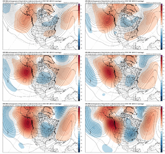
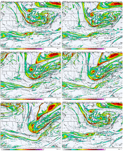
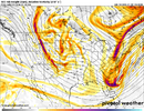
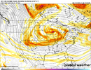
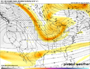
it's interesting and it's close. haven't seen a storm whose parent shortwave digs north to south like this while. amplified flow and by virtue of having a longer wavelength there's more potential here. however, our boogeyman last couple of winters is shortwaves losing their oomph, getting more sheared, losing negative tilt this range. wonder if that holds. obviously a few adjustments west to the entire wave train would be helpful hereTrue, but do you not see any potential for this first storm, especially in Richmond? These type of bombing Miller As never show up at the surface initially, which is why I am more intrigued than if the models were showing a foot of snow.
edit- also moisture is limited. the deal you take with the shortwave coming in from the dakotas. if the 12z suite keeps the general thought/structure and marginally improves, you may see robust surface low pressures off the coast. you may think, that's wrong. there should be more qpf there. but until we get more warm air advection involved as a forcing mechanism and better moisture sourcing, the drier than you think storm is a feature not a bug
Last edited:
LukeBarrette
im north of 90% of people on here so yeah
Meteorology Student
Member
2024 Supporter
2017-2023 Supporter
LukeBarrette
im north of 90% of people on here so yeah
Meteorology Student
Member
2024 Supporter
2017-2023 Supporter
LukeBarrette
im north of 90% of people on here so yeah
Meteorology Student
Member
2024 Supporter
2017-2023 Supporter
Its scooping up the southern energy again. Look out here!
Tsappfrog20
Member
Its scooping up the southern energy again. Look out here!

Looks really good here will see what it puts out
Sent from my iPhone using Tapatalk
LukeBarrette
im north of 90% of people on here so yeah
Meteorology Student
Member
2024 Supporter
2017-2023 Supporter
Worried that its too late with the energy in western Canada diving down to boot it outIt's going to phase:
LukeBarrette
im north of 90% of people on here so yeah
Meteorology Student
Member
2024 Supporter
2017-2023 Supporter
I think we need to sacrifice that first one. I can’t stomach another 14” in Moyock
NCWeatherNow
Member
How do we know that a 2nd one can even happen in this setupI think we need to sacrifice that first one. I can’t stomach another 14” in Moyock
SnowNiner
Member
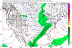
View attachment 181954
Just too late to happen. If we did not have a crashing shortwave in the West it would have time to amplify and then tilt itself for coastal folks.
Seems a little east coming into the conus too, very positive tilt at the Mississippi. Needs to back up for the first one overall imo.
LukeBarrette
im north of 90% of people on here so yeah
Meteorology Student
Member
2024 Supporter
2017-2023 Supporter
We just need better wave timing across the board. Some greenland blocking would really help us but we don't have a lot of that.
Also AIGFS is not running hmmmm
Also AIGFS is not running hmmmm
WolfpackHomer91
Member
Im excited to see the ensemble means.... im more interested to see them start increasing than decreasing in that 5-7 day range. If those continue to increase I think were really honing in on something instead of just having fun but not seriously tracking. Although I do think if this is still here tomm eve the "Nothing" will begin to leave the table
LukeBarrette
im north of 90% of people on here so yeah
Meteorology Student
Member
2024 Supporter
2017-2023 Supporter
NBAcentel
Member
Yeah the AIGFS just looks like a flizzard for some and that’s about it
LukeBarrette
im north of 90% of people on here so yeah
Meteorology Student
Member
2024 Supporter
2017-2023 Supporter
If the energy doesn't merge until it reaches the Apps, then it's too far east. Need to shift the LW axis left OR delete the kicker OR edit the height field and paint in some blocking. Take whichever option you want and fix it, and you'll have a storm. Plenty of time to trend either way.
WolfpackHomer91
Member
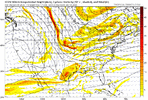
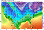
Rates will overcome ...........View attachment 181962
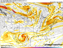
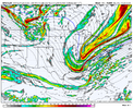
View attachment 181963Second system coming in an interesting manner however. Surface temps likely an issue for many here
I always was taught/ thought, you need the SS in front or parallell with NS coming down, to get the Boom. half tick behind wrecks it.
AIGFS is too far east with both troughs. We toss.
FoothillsWX
Member
We’re still in the “players on the field range” imo. That’s all we need to focus on for now. Clowns are fun but the pieces are there. It’s a complex interaction as always.
This energy is digging in to SEC country, so there’s always a shot the players on the field aren’t good enough though.
This energy is digging in to SEC country, so there’s always a shot the players on the field aren’t good enough though.
accu35
Member
NBAcentel
Member

