-
Hello, please take a minute to check out our awesome content, contributed by the wonderful members of our community. We hope you'll add your own thoughts and opinions by making a free account!
You are using an out of date browser. It may not display this or other websites correctly.
You should upgrade or use an alternative browser.
You should upgrade or use an alternative browser.
Pattern January Joke
- Thread starter SD
- Start date
iGRXY
Member
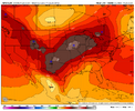
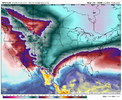
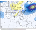
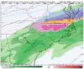
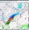
Regardless of what the surface shows, this to me would be very close to big ice in the CAD areas. Your HP is working in tandem and that’s still very cold air all concentrated in eastern Canada and along the Great Lakes. Definitely not a snow look by any means because the S/W dug too far west pumping the heights out ahead. But it’s still a look I think could produce
accu35
Member
trackersacker
Member
iGRXY
Member
trackersacker
Member
iGRXY
Member
Another run/another outcome. Going to have to get this weekend storm out to see how the table is set then.View attachment 181887Left overs
accu35
Member
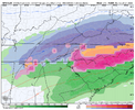
much colder run for that system. So close to a board wide winter storm.
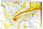
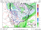
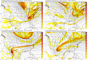
That energy coming down the stovepipe just needs to move along with the flow of the pattern and interact with the southern stream wave. The ridge up in western Canada just sort of rolls over on it at the last second causing it to hang back then gets cranking flooding us with that warm air out of the SW that we love so much.
But it’s better than a few days ago when it was completely cutting it off and retrograding it back into Cabo. So maybe we’re getting somewhere
But it’s better than a few days ago when it was completely cutting it off and retrograding it back into Cabo. So maybe we’re getting somewhere
LukeBarrette
im north of 90% of people on here so yeah
Meteorology Student
Member
2024 Supporter
2017-2023 Supporter
trackersacker
Member
I personally don’t even buy the GFS solution of digging the shortwave way out into the southwest like that.
trackersacker
Member
I traded my tomatoes for rocks
Blue_Ridge_Escarpment
Member
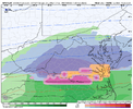
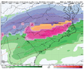
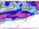
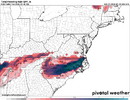
Mercy…actually gets Morganton down to 20 degrees. 2.1 inches of snow, 1.3 inches of sleet and 0.20 of freezing rain. Skating rink.
Tsappfrog20
Member
Not a horrible run by the gfs all right time for bed and I will see what the euro does in the morning night y’all
Sent from my iPhone using Tapatalk
Sent from my iPhone using Tapatalk
LukeBarrette
im north of 90% of people on here so yeah
Meteorology Student
Member
2024 Supporter
2017-2023 Supporter
Not to be that guy but when a ridge that steep happens the steering flow for the shortwave is straight south or east but very weak. Gotta have steering to move it east or you need to make sure the shortwave doesn’t get too far underneath the ridge.I personally don’t even buy the GFS solution of digging the shortwave way out into the southwest like that.
They put us in the winter battle zone for a reasonView attachment 181892We actually get what I would’ve expected even with the initial wave
CMC tried hard with wave 2, but it has the opposite problem of digging the wave too far east. So take a blend there and not bad
The overrunning setup is the one I’m most interested in, but all setups are hard to hit onIt honestly looked really good up until this point. Had that saggy cold zonal overrunning look. View attachment 181897
trackersacker
Member
No you’re rightNot to be that guy but when a ridge that steep happens the steering flow for the shortwave is straight south or east but very weak. Gotta have steering to move it east or you need to make sure the shortwave doesn’t get too far underneath the ridge.
Going to probably have some good hitting GEFS members in a few. Let’s see what happens.
LukeBarrette
im north of 90% of people on here so yeah
Meteorology Student
Member
2024 Supporter
2017-2023 Supporter
Real talk! The first threat has my eyes wide open for someone along the coast knowing how NW trends tend to work with coastal storms…
I would keep your eyes peeled if you live on or just inside the coast!
I would keep your eyes peeled if you live on or just inside the coast!
trackersacker
Member
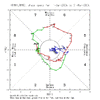
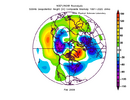
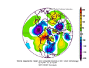
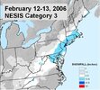 While not a perfect match, 2005-2006 analog was in my package for this winter as I know I’ve already stated and while there are certainly large differences with this year from that year I have picked up on some similarities. One is, that one of the quickest ends to the La Niña during the winter season comparable to this upcoming one was in 05-06. Notice how we went into phase 8 in February. Then out of that came the NESIS Category 3 storm just before Valentines Day. I remember being a 9 year old and getting stranded in the mountains here in Tennessee with over a foot of snow.
accu35
Member
Starting to get them membersGoing to probably have some good hitting GEFS members in a few. Let’s see what happens.
NBAcentel
Member
Euro AI is way better for both systems tbh
trackersacker
Member
trackersacker
Member
Oh man. Is the Euro bombing?
I would take this! And run with it for ATLImprovement for many. View attachment 181913
NBAcentel
Member
1 more of these and we cook. 50/50 low would be super helpful hereLooks mainly for the mountains at the moment. Might not be seeing something you can see. View attachment 181914
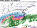
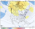
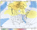
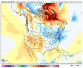
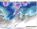
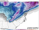
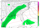
Also if you take a look at the 540 map it makes you think “dang it is looking good!” But surface temps is killing us here.
View attachment 181915View attachment 181916View attachment 181917
