Webberweather53
Meteorologist
Is it a 50/50 shot? Or would you still lean more towards warm because, well, why not lolNo ensemble-derived snowfall mean or probability product will tell you how a minor tweak to this pattern will be the difference between being bitterly cold with snow/ice or an all blowtorch.
There is very little room for anything in between here
View attachment 181422
Is it a 50/50 shot? Or would you still lean more towards warm because, well, why not lol
Raleigh having their temp sensor inside a pot of boiling water and still BN for the month is impressiveMonthly anomalies before the next several warm days:
KATL: +7.9
KFYY: +4.7
KFCC: +3.9
KAVL: +4
KGSP: +4.4
KCLT: +5
KRDU: -.2
KBHM: +4.4
From Charlotte west its a pretty consistent 4 to 5 degrees above average so far during this first week, and this first ten day stretch of January might be one of the warmest on record. The +7.9 for KATL is obviously bogus.
I thought BAM always said the cold would be post 1/15.
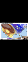
Bamwx backtracking today for the medium range:
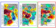
Ha the 12z EPS Clusters for Day 15 show the razors edge wellNo ensemble-derived snowfall mean or probability product will tell you how a minor tweak to this pattern will be the difference between being bitterly cold with snow/ice or an all blowtorch.
There is very little room for anything in between here
View attachment 181422
Northern Coastal Plain, really Hwy 64 north in NC has had a very good start to winter. Minus a few warm days at Christmas/ that got muted due to NE winds. And the next 4 days , before we flip back to winter. Could easily turn into a banter winter, especially if we stay on the good side of the razor thin margin that's coming up/ webber described. That NW to SE angled cutoff line has been good to Virginia and NE NC so farRaleigh having their temp sensor inside a pot of boiling water and still BN for the month is impressive
Not sure if I would say damage control. The models didn't go like they thought. I would rather they admit it than to change every time the models run, as most do.It started yesterday! Damage control
The more they do this, the more credibility they lose, in my opinion. Kind of like JB
Not sure if I would say damage control. The models didn't go like they thought. I would rather they admit it than to change every time the models run, as most do.
Never was supposed to be a great winter and most of the time it never is in the south east so nothing is surprising anymore. Just part of living here.
I get it’s highly variable, everyone has laid that out well. It’s way out there in the forecast period anyways. Just saying I would like to see some movement towards said tweak/snowier solutions over the next few days to make me feel like the colder possibilities of the mid-Jan period are becoming more of a reality.No ensemble-derived snowfall mean or probability product will tell you how a minor tweak to this pattern will be the difference between being bitterly cold with snow/ice or an all blowtorch.
There is very little room for anything in between here
View attachment 181422
I get it’s highly variable, everyone has laid that out well. It’s way out there in the forecast period anyways. Just saying I would like to see some movement towards said tweak/snowier solutions over the next few days to make me feel like the colder possibilities of the mid-Jan period are becoming more of a reality.
I’m still more of a learner than most of the long timers on this board as I am sure yall are aware. As far as long-range stuff goes, my two cents probably aren’t worth a cow pie yet.
I remember the ensemble means being completely useless for Winter Storm Izzy more than around 5 days out, it really only showed up good in the medium range.It’s honestly pointless in this kind of pattern to get hung up by the ensemble mean snowfall derived output.
Sure it could verify, but a subtle shift in the pattern can take you from nothing to a whole lot of something in a few cycles and these ensemble suites are rarely (if ever) properly dispersed to handle unforeseen shifts in the synoptic details.
It’s honestly pointless in this kind of pattern to get hung up by the ensemble mean snowfall derived output.
Sure it could verify, but a subtle shift in the pattern can take you from nothing to a whole lot of something in a few cycles and these ensemble suites are rarely (if ever) properly dispersed to handle unforeseen shifts in the synoptic details.
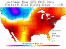
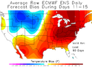
You can see that dominoes itself later on, way taller ridge nosing into AK. Also not far from getting stream separation with that look either with that wave entering MontanaBig fan of this trend, the more we get this to back off early on, the less likely we are to get a chopped/midget western ridge View attachment 181429
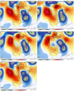
Beautiful fantasy run on it as well View attachment 181431View attachment 181432View attachment 181433View attachment 181434
MLK period.. something always happens for someone in the South.Beautiful fantasy run on it as well View attachment 181431View attachment 181432View attachment 181433View attachment 181434
Like you and webb and grit have eluded to. Same "general" look showing but minor adjustments mean a huge difference in winter weather outcome. Gonna be a roller coaster for sure and we may fall flat on our faces, but by gosh it's very capable of multiple winter storms just as well. And we could be due again for a February freak show as well. Seems like they show up every 5 years.
that’s a crazy alt timeline I wanna live inMy money is on a massive snow storm on the 25th when the Panthers are hosting the Packers for the NFC championship.
Like you and webb and grit have eluded to. Same "general" look showing but minor adjustments mean a huge difference in winter weather outcome. Gonna be a roller coaster for sure and we may fall flat on our faces, but by gosh it's very capable of multiple winter storms just as well. And we could be due again for a February freak show as well. Seems like they show up every 5 years.
