• Hello, please take a minute to check out our awesome content, contributed by the wonderful members of our community. We hope you'll add your own thoughts and opinions by making a free account!

Pattern January Joke

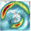
These mid-late winter -EPO/+TNH patterns are usually big roller coaster rides in the SE US.

We usually flip-flop between a torch and extreme cold, with very little room for anything in between.

A subtle shift here or there to minute details in the pattern is often the difference between those 2 extreme outcomes. The lack of long range threats (day 7+) honestly doesn’t mean 💩 in this pattern because of how razor thin the margins are between being bitterly cold or blowtorch warm.

You’re very rarely going to sniff out overrunning type winter storm threats (which are the hallmark of this pattern) outside the medium range, because the background flow is fast and your waves are usually getting shredded to bits as they encounter the Hudson Bay Vortex.

Everyone just needs to take a deep breath and relax 😌

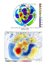
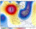
View attachment 181371

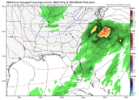
View attachment 181372
If I'm going to take a swing at something epic (multiple inch snow followed by extended cold) I'm taking my shot with a big NW Canada/AK ridge over any other option.
No need for anyone to @ me about the NAO
 
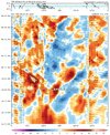
Yes, looks at this 7 day torch to end the 06z gefs/euro ai mean, Awful. January, cancelled. Next!

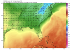
View attachment 181364
View attachment 181366

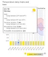
To be fair, verbatim, I don't think that's cold enough for a winter storm in my back yard in the SE. I'm just not a fan of any SE ridging like the ensembles are showing out in time. The temps Kylo showed in his post are not very cold at all sadly. With that said, perhaps the models continue to correct out in time to more western ridge, less SE ridge like they have been. That's still my hope.

0z GEFS though looked really good their for a while. LOL, whiplash overnight discussion.
 
These mid-late winter -EPO/+TNH patterns are usually big roller coaster rides in the SE US.

We usually flip-flop between a torch and extreme cold, with very little room for anything in between.

A subtle shift here or there to minute details in the pattern is often the difference between those 2 extreme outcomes. The lack of long range threats (day 7+) honestly doesn’t mean 💩 in this pattern because of how razor thin the margins are between being bitterly cold or blowtorch warm.

You’re very rarely going to sniff out overrunning type winter storm threats (which are the hallmark of this pattern) outside the medium range, because the background flow is fast and your waves are usually getting shredded to bits as they encounter the Hudson Bay Vortex.

Everyone just needs to take a deep breath and relax 😌

View attachment 181371

View attachment 181372
Why do those type of storms not show up on modeling this far out?

I remember Winter Storm Diego was on models nearly 300 hours out and it locked in
 
Why do those type of storms not show up on modeling this far out?

I remember Winter Storm Diego was on models nearly 300 hours out and it locked in

Super fast flow with weak waves and a tight temperature gradient. Good luck forecasting that with any skill outside day 5-7
 
Super fast flow with weak waves and a tight temperature gradient. Good luck forecasting that with any skill outside day 5-7

Now on top of that, throw things like warm advection into the mix and it’s a recipe for last minute threats to show up out of the blue.
 
looking at the EPS box and whisker we are starting to get the 30-45 degree spreads which since I have had access to them typically means something dramatic is coming. This is one of the few patterns where I would be weary and skeptical of the mean out past day 7 or so until the members get more in agreement. A smoothed mean right now is probably going to pump out near normal temps and slightly AN heights since it's averaging out the 2 extremes. The reality is likely to be either big EC trough or some form of SER.
 
c998971dcb36b3e957a3a57c966eca87.jpg

36e61f3e06edffe49a40f39648ef2a97.jpg

-EPO starts setting up around day 9 or so.


Sent from my iPhone using Tapatalk
 
If you look at the upper air pattern, you can see how just a few minor tweaks take you from highs in the 60s to highs in the 30s just like that. As long as deep, bitterly cold air is building up in Canada, which looks to continue, this will be the case. You can see evidence of this in just the last 2 cycles of model runs.
 
Alright back to the real world for real today for me, so I guess I'm back on here too.

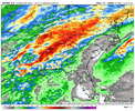
Mild week huh? But how bout the QPF showing up for this weekend deal in the MS/TN valleys! Feels like it's been awhile since I've seen a MRGL/SLGT excessive rainfall outlook in the southeast. Nice WAA driving precip before the sfc LP adds a little more sauce to it Sat AM.

1767709238436.png

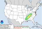
Pick your favorite ensemble, they all seem to agree on the rough axis of heaviest precip and the WPC has responded in kind:

1767709295577.png

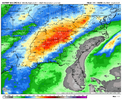
Some 2-2.5"+ EPS means in there:

1767709334115.png

Personally looking forward to the front that clears most of this out, it's a solid ~48hr swing at H5

ecmwf_z500a_us_fh90-138.gif

Wouldn't be shocked if that TN valley rain trended up some more in the next couple of days, what with it being a WAA-forced event for the most part. There's a few 4-6" members in there already for Huntsville.

Edit: My apologies to everyone who clicked their notification button hoping for snow in this post. I also hope it snows, but I think everyone else has that covered rather extensively right now
 
You all are hitting the high points well in here me thinks. Increased loading of cold air to our N and NW - knife's edge with the ridge / trough pattern over the SE

Summary:
1) EAMT - we've had a moderate level +EAMT to kick off the new year. Looks like we'll get a bit more +EAMT in the Jan 10-11 timeframe. In the Jan 18-20 timeframe, it looks like we may transition to a -EAMT event.
2) Strong La Nina > El Nino transition encouraging +TNH pattern at times in 2nd half of winter
3) MJO waking up and supplementing #2 as it works out of Phase 6 mid-Jan and into Phase 7 late-Jan

So, we should have solid Pac Jet extension support up to ~Jan 20 from the +EAMT activity, supporting the active western ridging. The potential -EAMT event would want to retract the jet....but as this is occurring, the MJO push into Phase 7 may counterbalance - i.e. potentially some good timing there for us. Also, as rburrel mentioned, no sign of the high latitudes flipping to +AO/+NAO. In fact, Scandi ridging should be encouraged given the +EAMT / MJO Phase 6-7 combo - and again, watch for potential Scandi ridge > retrograde to Greenland block transition in late Jan as the -EAMT kicks in

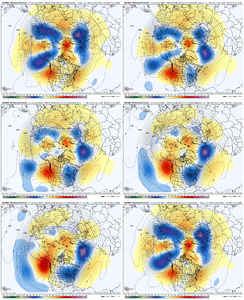
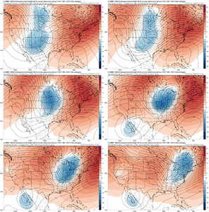
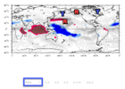
Phase 7 (1st image) is straight up +TNH / -EPO ridging by the way. T is trough / low pressure in upper atmosphere. R is ridge / high pressure in upper atmosphere. Red shading is reduced convection. Blue shading is enhanced convection.

Phase 7.png


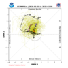
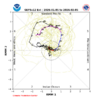
I'd go with a blend between these 2 on amplitude into Phase 7

Jan 6 MJO EPS.png

Jan 6 MJO GEFS.png
 
Last edited:
The NG market, which is heavily influenced by reputable objective professional mets who are influenced by model trends, didn’t like what it saw overnight and this morning as it is down another 5% from yesterday. As a reminder, this market in winter typically likes to see colder E US prospects (where the higher pop centers and thus NG users are) in the 2-3 week forecast to get it to jump. Without that, it’s subject to drop. In that way, it’s an excellent barometer of the overall E US wx picture.

I’m hoping to see a big turnaround later today due to colder 12Z models for week 2 into early week 3 as opposed to, say, significant SER influence late in the runs like the 0Z EPS mean suggests. I’m still hoping the -PNA biases of the ensemble means and analogs suggesting a +PNA Jan following a -PNA Dec for -ENSO mean we’ll see a resumption of good news soon. The beauty of this market is that it will almost always let us know!

IMG_6811.png
 
Last edited:
The NG market, which is heavily influenced by reputable objective professional mets who are influenced by model trends, didn’t like what it saw overnight and this morning as it is down another 5% from yesterday. As a reminder, this market in winter typically likes to see colder E US prospects (where the higher pop centers and thus NG users are) in the 2-3 week forecast to get it to jump. Without that, it’s subject to drop. In that way, it’s an excellent barometer of the overall E US wx picture.

I’m hoping to see a big turnaround later today due to colder 12Z models for week 2 into early week 3 as opposed to, say, significant SER influence late in the runs like the 0Z EPS mean suggests. I’m still hoping the -PNA biases of the ensemble means and analogs suggesting a +PNA Jan following a -PNA Dec for -ENSO mean we’ll see a resumption of good news soon. The Beaty of this market is that it will almost always let us know!

View attachment 181387
What I have gathered from this information is they flip with whatever the models are showing for the most part. Which just seems like a guessing game.
 
What I have gathered from this information is they flip with whatever the models are showing for the most part. Which just seems like a guessing game.

Yes, that’s generally the case and it’s mainly for typically more volatile week 2 and beyond. They’re looking at the model changes just like we do. Operational runs generally have little influence in week 2+ for them. Instead the ens means are what count the most, which makes perfect sense.

One thing they’re not heavily influenced by are forecasters who tend to be influenced too much by either cold or warm biases or are just trying to get more clicks/hits/likes. They’re too smart/knowiedgeable to fall for the influence of strongly biased mets. That’s one reason I love following this market.
 
Yes, that’s generally the case and it’s mainly for typically more volatile week 2 and beyond. They’re looking at the model changes just like we do. But one thing they’re not heavily influenced by are forecasters who tend to be influenced too much by either cold or warm biases They’re too smart for that.

Yeah, the market usually knows more than we know. But doesn't mean that NG can't rip higher in a week or two.
 
Yeah, the market usually knows more than we know. But doesn't mean that NG can't rip higher in a week or two.

Not only that, the current sharply down day doesn’t mean that it can’t rip higher the rest of this week. Actually, as you know from being an experienced short term equities trader, big down/up days often set up traders for better short term opportunities awaiting in the opposite direction should the tide change.
 
Yes, that’s generally the case and it’s mainly for typically more volatile week 2 and beyond. They’re looking at the model changes just like we do. Operational runs generally have little influence in week 2+ for them. Instead the ens means are what count the most, which makes perfect sense.

One thing they’re not heavily influenced by are forecasters who tend to be influenced too much by either cold or warm biases or are just trying to get more clicks/hits/likes. They’re too smart/knowiedgeable to fall for the influence of strongly biased mets. That’s one reason I love following this market.
I agree 1000x
 
So it sounds like the main take-away is the the price action in the NG market is most useful in determining the price of NG.

The daily price action of NG is often an excellent barometer of the changes from prior/recent runs of GEFS and EPS means of the E US pattern especially for days 8+.
 
The daily price action of NG is often an excellent barometer of the changes from prior/recent runs of GEFS and EPS means of the E US pattern especially for days 8+.
What I'm confused about is how it helps us assess the pattern when we can just look directly at the GEFS and EPS data for ourselves. It's like me looking at the data and posting it here and then me telling you and then you posting here what I just told you that I already posted here. I don't see how it helps us since it's not anything we haven't already observed and assessed in the data.

If the data begins to trend cold in the medium/long range, which we're watching every day, NG prices will go up, and vice versa.
The only way the info would help is if the forecasters who are advising the natgas traders have demonstrated skill at beating the modeled forecasts. But yeah, if they are just reacting to model runs, agree
 
What I'm confused about is how it helps us assess the pattern when we can just look directly at the GEFS and EPS data for ourselves. It's like me looking at the data and posting it here and then me telling you and then you posting here what I just told you that I already posted here. I don't see how it helps us since it's not anything we haven't already observed and assessed in the data.

If the data begins to trend cold in the medium/long range, which we're watching every day, NG prices will go up, and vice versa.
Im with ya on the nat. gas pricing(no offense Larry). Its a trickle/ripple down effect as most resources tend to do. When it favors a price increase (like a day 10-15 arctic blast being modeled) then prices generally increase to meet demand and make as much money as possible. Even knowing that the long range forecast is likely wrong its their excuse to raise subtly until theres consensus that that arctic blast moderates 5 days out. Then prices lower a little and its a win win for them. Def not a forecasting tool for me...just my opinion tho
Now lets get this EPS and its AI to go wild today!
 
What I'm confused about is how it helps us assess the pattern when we can just look directly at the GEFS and EPS data for ourselves. It's like me looking at the data and posting it here and then me telling you and then you posting here what I just told you that I already posted here. I don't see how it helps us since it's not anything we haven't already observed and assessed in the data.

If the data begins to trend cold in the medium/long range, which we're watching every day, NG prices will go up, and vice versa.
All about demand
 
Back
Top